Starting point: Zettersfeld (1860 m)
| Lat/Lon: | 46,8678°N 12,78353°E |
| |
Time of walking: 3 h 30 min
Difficulty: partly demanding marked way
Altitude difference: 1045 m
Altitude difference po putu: 1060 m
Map:
Recommended equipment (summer):
Recommended equipment (winter): ice axe, crampons
Views: 3.023
 | 2 people like this post |
Access to the starting point:
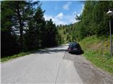
Drive through the Karavanke Tunnel into Austria, then continue to Spittal and on to Lienz (the motorway ends a little after Spittal). We continue along a relatively nice and wide road through the Drava Valley. In the centre of Lienz, at the roundabout, turn right towards Matrei. After a few hundred metres, after a roundabout, take a sharp right and then a left over a bridge towards Thurn. Continue following the green signs "Zettersfeld Zentrum". Shortly before the ski centre, as the road starts to descend, you will see a dirt road on the left hand side of the road leading to the ski resort, which is closed to traffic. There are also yellow mountain signs along the road. Park in one of the smaller car parks nearby. There is also a much larger car park a little further along the main road.
Path description:
From the starting point, take the macadam road (route 9b) after the "Steinermandl" signs. The road, which is closed to traffic, climbs eastwards and leads to a ski slope where you soon reach a crossroads.
We continue to the left after the "Steinermandl" signs and continue for some time under the chair lift leading to the top of Steinermandl. The road then turns left and climbs slightly steeper. The road then becomes more sloping and leads past a large artificial lake, which is used for artificial snowmaking. Here the road turns slightly to the right and leads to a marked crossroads.
The road continues towards the top of Steinermandl and the upper station of the chairlift. We continue left up the footpath, which starts to climb up the grassy slope. The higher the slope becomes, the flatter it becomes.
A path joins us from the upper chairlift station on the right, a path leads straight ahead along the north side of the Goiselemandl summit (Goiselemandlweg Nord), and we continue left along path 913 after the "Goiselemandl, Schleinitz" markers. The trail continues north-westwards and leads to the foot of the slopes of Goiselemandl. Here we come to a crossroads where the path to Goiselemandl branches off to the right. We continue straight ahead and cross the slightly steeper western slopes of the summit. When we reach the north side of the summit, the path continues to cross the slopes on the left side of the ridge, and in a short section we are also helped by a couple of small rocks. The path then leads to the right (north-east) side of the ridge and begins to climb gently. This path then leads us to a gentle grassy slope which soon leads to a marked crossroads.
To the right the path leads to lake Neualplseen, which can already be seen from the path, and we continue left towards the top of Schleinitz. From the crossroads we continue to climb gently up the grassy slopes from which we have a fine view of lakes Neualplseen and the ridge from Sattelkopf to Schleinitza. The grassy slopes are slowly replaced by rocks and the path leads us under the slightly steeper slopes of an unnamed peak. The path turns left here and skirts the steep slopes on the left (south) side. A short section of the path is also helped by a steel cable. The path then turns right and climbs slightly steeper. After the ascent, the path leads to the flatter slopes below the Schleinitz peak, which are strewn with rocks and boulders. Here, the initially gentle path leads below the eastern slopes of peak Schleinitz, before turning left and ascending towards the ridge. When you reach the ridge, continue right and then climb up to the cross, which is located at a crossroads just below the summit. At the crossroads where the path joins the Alkuser See lake on the left, continue slightly right along the ridge. Shortly afterwards, a climbing path joins from the right and there is only a short climb to the summit.

Pictures:
 1
1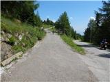 2
2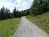 3
3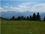 4
4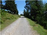 5
5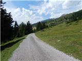 6
6 7
7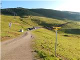 8
8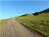 9
9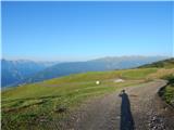 10
10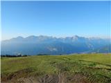 11
11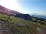 12
12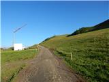 13
13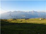 14
14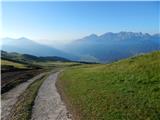 15
15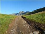 16
16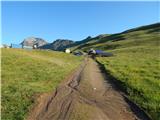 17
17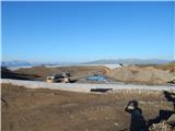 18
18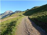 19
19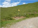 20
20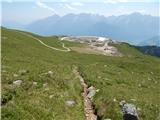 21
21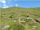 22
22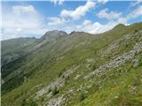 23
23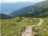 24
24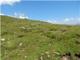 25
25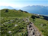 26
26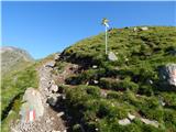 27
27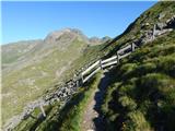 28
28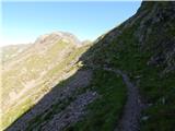 29
29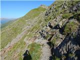 30
30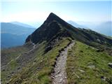 31
31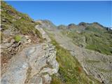 32
32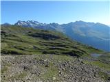 33
33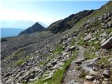 34
34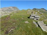 35
35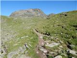 36
36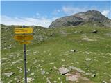 37
37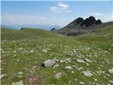 38
38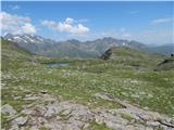 39
39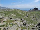 40
40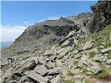 41
41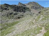 42
42 43
43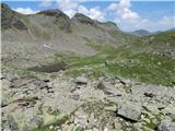 44
44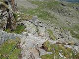 45
45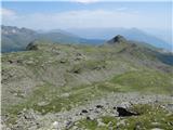 46
46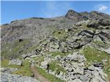 47
47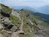 48
48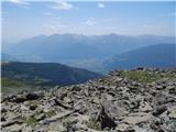 49
49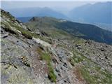 50
50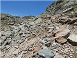 51
51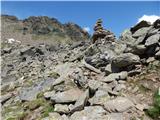 52
52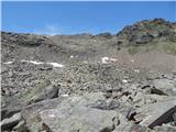 53
53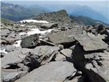 54
54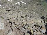 55
55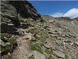 56
56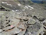 57
57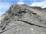 58
58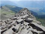 59
59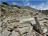 60
60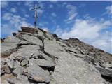 61
61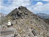 62
62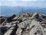 63
63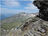 64
64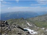 65
65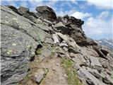 66
66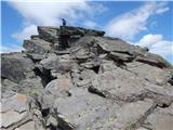 67
67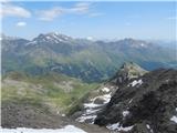 68
68
Discussion about the trail Zettersfeld - Schleinitz
|
| bboris25. 06. 2017 |
Pred leti. Cesta je placljiva, sama pot je lahka.
|
|
|