Starting point: Briše (375 m)
| Lat/Lon: | 46,0542°N 14,3033°E |
| |
Time of walking: 1 h 5 min
Difficulty: easy unmarked way
Altitude difference: 333 m
Altitude difference po putu: 360 m
Map: Škofjeloško in Cerkljansko hribovje 1:50.000
Recommended equipment (summer):
Recommended equipment (winter):
Views: 5.171
 | 1 person likes this post |
Access to the starting point:
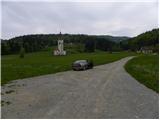
From Horjul or Dobrova, drive to Polhov Gradec, then continue to Gorenjska vas. Just after Polhovi Gradec, at the end of the village of Briše, you will see the Church of the Holy Three Kings by the roadside and just a few metres before it, signs for the Briše Spa, which will direct you left onto a macadam road, which you will then follow for about 100 metres to the parking lot in front of the Briše Spa natural baths.
Path description:
From the parking lot at the Briše Spa, return to the main road, cross it carefully, and then continue along the asphalted road in the direction of St Martin. Continue along the gently sloping road, which leads you along a small stream. After a few minutes' walk, the road splits into two, and we follow it to the left, continuing our ascent in the direction of Setnik and St Martin. The road loses its asphalt coating and starts to climb steeply. Higher up, we emerge from the forest and the road leads us to a few isolated houses. We continue to climb along the edge of the forest, and the increasingly scenic road leads us past a sign - a cross - into the lane of the forest, beyond which we reach the last house in the village. The road ends further on, and we continue along the wide cart track, after which we reach St Martin's Church in a few 10 steps of further walking.
From St Martin's, continue right in the direction of the TD Briše cycle path and follow cart track, which turns into a forest and climbs steeply for a short distance. Higher up, the cart track gradually flattens out, and the path leads to a waterworks, where it joins the marked path from the village of Praproče.
Continue left and ascend the often rather muddy cart track, which you follow to the top grassy slope of Malý vrh. Once out of the forest, the summit is only a short walk away along an increasingly scenic path.

Pictures:
 1
1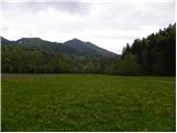 2
2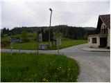 3
3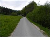 4
4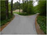 5
5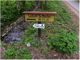 6
6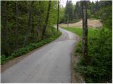 7
7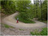 8
8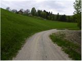 9
9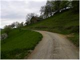 10
10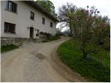 11
11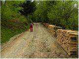 12
12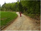 13
13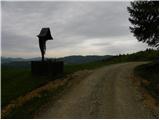 14
14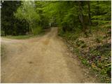 15
15 16
16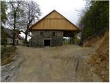 17
17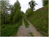 18
18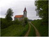 19
19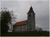 20
20 21
21 22
22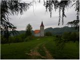 23
23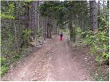 24
24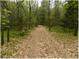 25
25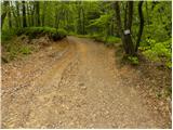 26
26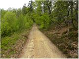 27
27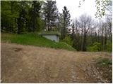 28
28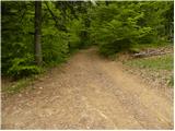 29
29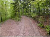 30
30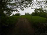 31
31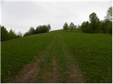 32
32 33
33 34
34
Discussion about the trail Briše - Mali vrh
|
| Lj25. 03. 2011 |
Lep popoldanski izlet za ujet vsaj delček teh čudovitih pomladnih dnevov ta teden. Smo šle po temle opisu gor, še pred razcepom na 5. sliki je bil odcep na levo in glede na opis smo tja tudi zavile. Pozneje smo ugotovile, da smo prehitro zavile levo, vendar se je naša varianta izkazala za idealno, saj smo se izognile hoji po cesti in smo se opisani smeri priključile nad kmetijo na 17. sliki t.j. tik pod Sv. Martinom. Včasih moraš imeti tudi malo sreče. Sestopile smo v Praproče in od tam po cesti nazaj v Briše. Prav lep krog, Mali vrh pa je velik po širnih razgledih. 
|
|
|