Ponikva/Hotunje - Sveta Uršula above Dramlje
Starting point: Ponikva/Hotunje (275 m)
| Lat/Lon: | 46,2497°N 15,4306°E |
| |
Time of walking: 1 h 30 min
Difficulty: easy marked way
Altitude difference: 189 m
Altitude difference po putu: 280 m
Map: Posavsko hribovje Boč - Bohor 1:50.000
Recommended equipment (summer):
Recommended equipment (winter):
Views: 3.507
 | 2 people like this post |
Access to the starting point:
a) By train. . . Ponikva railway station.
b) By car. . . Leave the motorway at exit Dramlje and continue towards Šentjur. After three kilometres at the Dole roundabout, continue in the direction of Ponikva and after a total of approximately seven kilometres reach the railway line. You can park safely in front of the level crossing. The railway station is on the other side of the line and a little further to the right.
Path description:
Follow the asphalt road along the stream towards the settlement of Zagaja pri Ponikvi. After one and a half kilometres, the asphalt surface turns to macadam and you follow it through the forest. Soon you will reach a small settlement of houses and, if well marked, continue through the yard of one of the homesteads onto a meadow path. The grass path becomes a forest path and then leads along several ponds and through the forest to a chapel. From the chapel, continue through Razbor, to the left, and shortly under the road viaduct, where you cross a small watercourse, cross over to the other side of the motorway. Continue across the meadow, through the farmyard of the homestead and by the wooden horse corral reach the more concrete Vodulee. From the flat part of Vodul, there is a climb along an asphalt road and then along narrower paths surrounded by vineyards/walled houses. Higher up, you reach a crossroads and after a good hundred metres go right and soon you will see the Church of St Ursula and the home of the Dramlje mountaineers in the former forestry.
The total length of the route from Ponikva/Hotunj is 5100 metres, 280 positive vertical metres and 90 negative vertical metres.

Pictures:
 1
1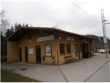 2
2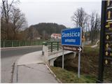 3
3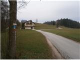 4
4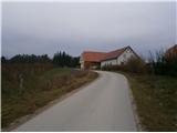 5
5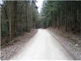 6
6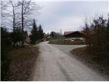 7
7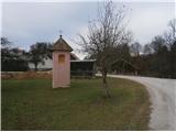 8
8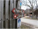 9
9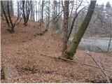 10
10 11
11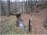 12
12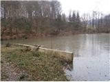 13
13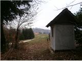 14
14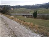 15
15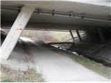 16
16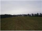 17
17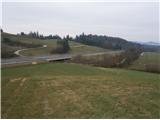 18
18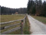 19
19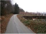 20
20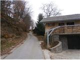 21
21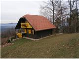 22
22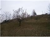 23
23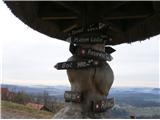 24
24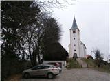 25
25
Discussion about the trail Ponikva/Hotunje - Sveta Uršula above Dramlje
|
| bruny27. 01. 2015 |
Danes,27.01.2015 v večerni pohodniški aktivnosti po opisani poti...tja in nazaj, bilo je še nekaj dodatka in morda, kaj več!? v razmerah...Hladno je pa  bilo...Lp
|
|
|
|
| bruny12. 02. 2016 |
Po opisani poti do slike št. 16 in povratek nazaj v Hotunje v četrtek 11.02.2016 popoldan. Kratka pohodniška aktivnost v prostoru med železniško progo in avtocesto Maribor - Celje. Za Uršulo žal ni bilo časa. Razborški ribniki v več funkcijah v tem prostoru, tudi kot naravni zadrževalniki vode, mesto za rekreacijo, ribolov in še kaj... Vir - Pešpoti in Strava Lp
|
|
|