Sant'Uberto - Cascata di Fanes (Via Ferrata Giovanni Barbara)
Starting point: Sant'Uberto (1421 m)
| Lat/Lon: | 46,60229°N 12,1072°E |
| |
Name of path: Via Ferrata Giovanni Barbara
Time of walking: 1 h 10 min
Difficulty: very difficult marked way
Ferata: B
Altitude difference: 46 m
Altitude difference po putu: 200 m
Map: Tabacco 03 1:25.000
Recommended equipment (summer): helmet, self belay set
Recommended equipment (winter): helmet, self belay set, ice axe, crampons
Views: 3.642
 | 4 people like this post |
Access to the starting point:
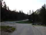
Via Border crossing Rateče, take the road to Trbiž / Tarvisio, where you take the motorway towards Udine. Leave the motorway at the exit for Tolmezzo and follow the road to the above-mentioned place. From Tolmezzo, continue in the direction of Ampezzo and the Passo della Mauria mountain pass. The road then begins to descend and leads into the Cadore valley, where you continue to the right (Belluno and Cortina d'Ampezzo on the left) in the direction of Auronzo. After a few more km of driving, you reach the next major crossroads, where you turn right towards Misurina (left Tre Croci Pass). From here, follow the road down to a major crossroads, where you turn left towards Cortina d'Ampezzo (right Austria). From this crossroads, you continue for about 10 km towards Cortina d'Ampezzo, and then, at a sharp left turn, you turn right onto the road towards the Rifugio Ra Stua hut. Park in the parking lot at the very beginning of the road.
Path description:
From the parking lot, turn left onto cart track, following the signs for "Valle di Fanes" (route No 10). Cart track starts descending from the parking lot and quickly leads to a marked crossroads. At the crossroads, turn right onto the footpath, following the signs for "Valle di Fanes". From the crossroads, the path descends through the forest and leads to a tarmac road.
Continue right along the road and cross the bridge over the Rio di Fanes stream. The road along the stream then leads to a crossroads.
To the right is a path called Sentiero dei Canyons, which we will return to later, but now turn left (route 10) onto a road which is still tarmac for a short distance and then becomes gravel. The road continues to climb gently through the forest, with occasional views of the nearby peaks.
Later, a footpath branches off to the left towards the Posporcora saddle, and we continue on the dirt road. The road then turns slightly to the right and crosses the deep gorge of Gola di Fanes via a bridge. We continue along the road, which soon leads us back to a marked crossroads.
At the crossroads the road turns left, straight ahead is a path called Sentiero dei Canyons, and we turn right following the signs 'Sentiero Attrezzato alla Cascata'. Just after the crossroads there are tables and benches along the trail where you should equip yourself with a self-protection kit and a helmet. The sheltered Via Ferrata Giovanni Barbara first crosses the exposed slope above the gorge and leads to the Cascata di Fanes waterfall. The wall over which the waterfall falls is slightly overhanging, so that the path follows the waterfall.
The path then leads over a narrow notch to a ravine which continues down to the right. Then descend over a rock jump, which is well protected. We have a rope and crampons to help us. The gully then becomes less steep and leads to the mighty waterfall Cascata di Fanes di Sotto.
The sheltered path crosses a stream here but the bridge has been cut down. Because of the fallen bridge under the waterfall, we continue on the path to the left, which crosses the slope by the stream. Later the path turns left and climbs steeply in short switchbacks above the gorge. After a steep climb, the path leads us to a crossroads where the path becomes easy again. To the left is just a few metres to a viewpoint with a wonderful view of the waterfall and the gorge. To the right is a path descending to the starting point.
The descending path is easy and mostly passes through the forest.
The walk to the waterfall will take approximately 1h 10min, and the whole circular route will take approximately 3h.
The circular route can also be walked in the opposite direction. Alternatively, you can extend the trip by following the Sentiero dei Canyons route to the upper waterfall.

Pictures:
 1
1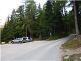 2
2 3
3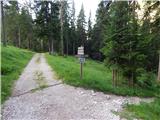 4
4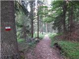 5
5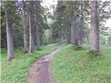 6
6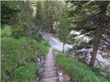 7
7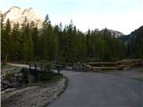 8
8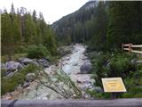 9
9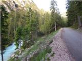 10
10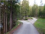 11
11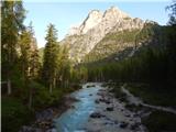 12
12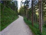 13
13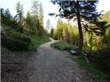 14
14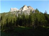 15
15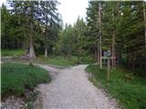 16
16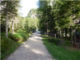 17
17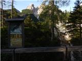 18
18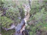 19
19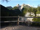 20
20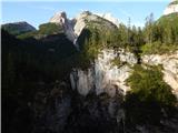 21
21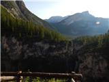 22
22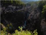 23
23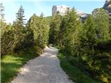 24
24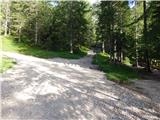 25
25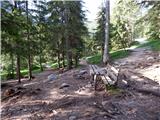 26
26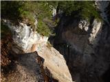 27
27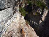 28
28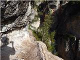 29
29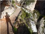 30
30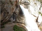 31
31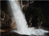 32
32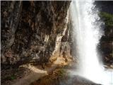 33
33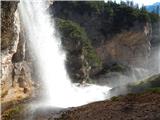 34
34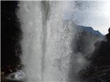 35
35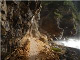 36
36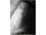 37
37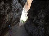 38
38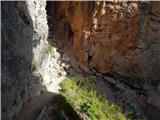 39
39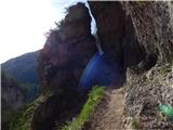 40
40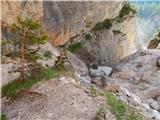 41
41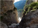 42
42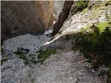 43
43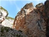 44
44 45
45 46
46 47
47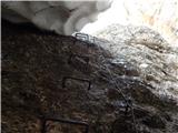 48
48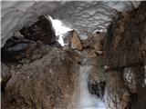 49
49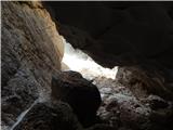 50
50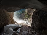 51
51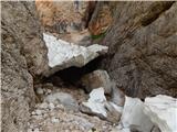 52
52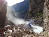 53
53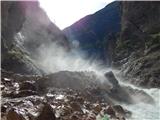 54
54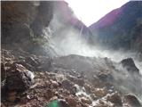 55
55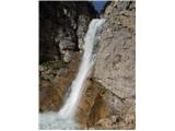 56
56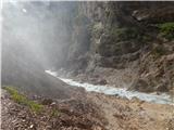 57
57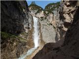 58
58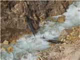 59
59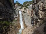 60
60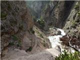 61
61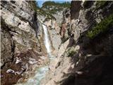 62
62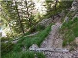 63
63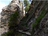 64
64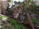 65
65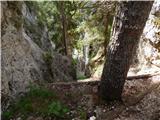 66
66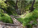 67
67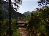 68
68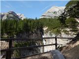 69
69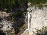 70
70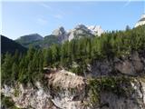 71
71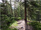 72
72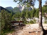 73
73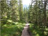 74
74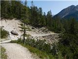 75
75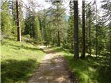 76
76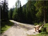 77
77
Discussion about the trail Sant'Uberto - Cascata di Fanes (Via Ferrata Giovanni Barbara)
|
| robi1430. 05. 2015 |
Letos imam načrt obiskati to dolino in se sprehoditi tudi med slapovi.
Z nami bo tudi fantič star dve leti, ki ga bom nosil v nahrbtniku. Zanima kakšna je vaša realna ocena težavnosti te ferrate?
Če se bo dalo, bi prehodili pot Sentiero dei Canyons v celoti, nato pa nadaljevali pot proti GrossFanes Hutte.
Lizika, si mogoče ti prehodila vso pot ali samo prvi del (prvi slap)?
Hvala za odgovor in lep dan,
robi
|
|
|
|
| VanSims7. 09. 2020 |
Huh, tukaj je dve tretjini poti spuščene. Tisti most je na novo postavljen, brez njega sicer ne vem kako bi prišel na drugo stran reke in do tistega razgledišča, razen seveda naokoli čez most nižje. Zgornjega dostopa nisem našel, oz. sem omenjeno rampo in začetek poti našel šele ob odhodu ko sem peljal s parkirišča (je tik ob njegovem začetku na levi) in verjetno se po njem pride na tisti asfalt, ki pripelja na razpotje na slik 11. Sicer pa uraden smerokaz za pot (Cascata, Canyons) kaže po makadamu, ki se spusti nekoliko levo od asfaltirane ceste za kočo Sennes. Po tem pristopu se spustimo po tem makadamu do prvega mostička, od koder vidimo na desni sotesko, po kateri pa teče le pritok do glavne reke s slapovi. Malo po mostu (odcep za Malga Ra Stua) je smerokaz na katerem ni označena pot, a nadaljujemo še par sto metrov naravnost, ko se nam odpre travnik imenovan 'Pian Di Loa'. Gremo do konca travnika tam pa lahko seveda naravnost in pridemo do križišča s slike 11, a če želimo narediti tisti res strm in zoprn cik cak s slike št. 64 v spustu, gremo na koncu travnika desno in v le rahlem vzponu prav tako pridemo na razgledno točko (sta celo dve) in potem po tistem cikcaku dol, tam pa se že začne ferata na eno ali drugo stran. Po levi pridemo do tistih klopi iz opisa, po desni pa do feratice za dostop do slapa oz. za njim torej pod tekočo vodo.  Od tistih klopi iz opisa se lahko naprej po makadamski cssti dvignemo še do zgornjega slapa (kake dobre po ure hoje navkreber). Pri naslednjem križišču od klopi, z makadama zavijemo v gozd (smerokaz za Sentiero dei Canyons) in ob strugi potoka nadaljujemo vzpon. Ob poti sta še dva manjša slapova. Pri zgornjem večjem je ravno tako krožna feratica (Chengia di Mattia), ki nas ravno tako popelje pod oz. za hrumeči slap. Sestopimo po makadamu in spet pridemo do omenjenih klopi Opis celotne poti je na bergsteigen.com sicer v nemščini: https://www.bergsteigen.com/touren/klettersteig/sentiero-dei-canyons-e-delle-cascate/ a slika https://www.bergsteigen.com/fileadmin/userdaten/import/topos/sentiero_dei_canyons_e_delle_cascate_topo.pdf pove več kot tisoč besed. 
|
|
|
|
| VanSims7. 09. 2020 |
Aha, zdajle šele vidim, opisana je zgornja pot, ki vodi pod slapom. Ja most je popravljen in gremo lahko direktno po spodnji feratici nazaj do klopi in naprej do zgornjega slapa. Na levo pa potem res pridemo po cik caku do razgledišč.
Še @lizika: Oznaka 'zelo zahtevna' je glede na klasifikacijo tega portala (oz. tisto kar se na njem označuje s to oznako) popolnoma primerna. Feratno gledano pa gre res za lahko ferato nad katero bo izkušeni feratar razočaran a point pri obisku slapov ni v feratarskih užitkih ampak bolj v sami lepoti narave, soteske in slapov
|
|
|