Kraljev dol - Planjava (via Srebrno sedlo)
Starting point: Kraljev dol (1400 m)
| Lat/Lon: | 46,3389°N 14,6855°E |
| |
Name of path: via Srebrno sedlo
Time of walking: 4 h 30 min
Difficulty: difficult marked way
Altitude difference: 992 m
Altitude difference po putu: 1200 m
Map: Kamniške in Savinjske Alpe 1:50.000
Recommended equipment (summer): helmet
Recommended equipment (winter): helmet, ice axe, crampons
Views: 5.790
 | 1 person likes this post |
Access to the starting point:
a) First drive to Kamnik, then continue to Stahovica and the Črnivec Pass. A few 100 metres before the Črnivec Pass, leave the main road leading to Gornji Grad and drive sharp left in the direction of the Volovljek Pass (Kranjski Rak). From the above-mentioned pass, continue straight ahead (on the left the road leading to Velika planina, on the right the Štajerski Rak) and start descending towards Luce. Lower down, the road bends slightly and leads to the Podvolovljek valley. Continue past the road leading to the Lučka Bela valley, then past the bar at Gams. After the bar, pay attention, because just a few 100 metres further on, a road branches off to the left, leading to mountain pasture Podveža and Ravne and the Planinšek farm (at the point where you leave the main road, the road marking is approximately 11 km). Continue along the initially still asphalted road, which climbs further towards the Dleskovská plateau. Higher up, the road to Planinšek branches off to the right, and here we continue along the upper left road, which leads us a little further to the next crossroads, where we continue straight on in the direction of mountain pasture Ravne (on the left mountain pasture Podveža). After 9 km of driving from the main road (8 km of which are macadam), you will come to a sharp right turn in the middle of which a road branches off to the left, which is blocked by a grazing fence from the very beginning. Take the road and follow it to the turning point at the end of the road. Park in a suitable place at the end of the road.
b) First drive to Luce, then continue towards Kamnik. When you see a road sign by the side of the road indicating 10. 5 km, look out for the right fork, as just a little further on the road will branch off to the right towards mountain pasture Podveža and Ravne and the Planinšek farm. Continue along the initially still asphalted road, which climbs further towards the Dleskovški plateau. Higher up, the road to Planinšek branches off to the right, and here we continue along the upper left road, which leads us a little further to the next crossroads, where we continue straight on in the direction of mountain pasture Ravne (to the left mountain pasture Podveža). After 9 km of driving from the main road (8 km of which are macadam), you will come to a sharp right turn in the middle of which a road branches off to the left, which is blocked by a grazing fence from the very beginning. Take the road and follow it to the turning point at the end of the road. Park in a suitable place at the end of the road.
Path description:
From the end of the road, cross the fence and then, immediately after it, continue right along the fence steeply uphill. The path soon enters the woods, where it climbs steeply for a while before gradually descending. A few minutes' walk through increasingly sparse forest follows, and the relatively winding path quickly leads to a dilapidated shepherd's hut at mountain pasture Vodole.
From the ruined shepherd's hut, continue along the bottom of mountain pasture, following the path which leads past a small swamp. On the other side of mountain pasture the path begins to climb slightly and after a few minutes of further walking leads us to a boulder, on which we notice the already rather faded markings for Korošica, which direct us slightly to the right, on a path that goes into the forest and gradually begins to climb more steeply. The rather overgrown path, which passes through dwarf pines, joins a much wider path higher up, which comes from mountain pasture Podvežak.
Continue in the direction of Korošice, following the path which crosses the pasture fence and, after a few further steps, leads to Inkret's well, which is located just a few metres off the path.
There is only a slight ascent, and then the path is laid out again and leads us under the relatively steep and avalanche-prone slopes of Tolstego vrh. A little further on, a pleasant path leads us to a marked crossroads, where we continue slightly left in the direction of Korošice (slightly right, the chapel on Molička peč (mountain)). The path continues for some time crossing the slopes below Tolstim vrh, and then passes onto the plateau-like world of the Dleskovška plateau, which is interspersed with numerous potholes and caves. The path, which continues with a few short ascents and descents, then quickly leads us to a crossroads, where the path from Robanov Kot and mountain pasture Ravne joins us from the right.
Continue in the direction of Korošica along the path which ascends crosswise to the saddle between the lesser-known Koroška vrh on the left and Mala Ojstrica on the right. Continue straight down (Prag on the left, Ojstrica over Mala Ojstrica on the right) on the marked trail which begins to descend towards Korošica. After a few minutes of descending, you will reach the vast grassy slopes of Korošica, which you can then walk along in a few minutes to the mountain lodge. From Kocbek's home, continue in the direction of Planjava and Kamnik saddle. The way forward is initially slightly downhill, then a series of small valleys in a slight ascent leads us to a steeper part of the route. The path then climbs up along the ravine and only crosses it at a higher level. As we climb, more and more views open up and a natural window catches our eye. The path then switches from grassy to rocky slopes, where you quickly reach the sheltered part of the path. The well-protected and sometimes quite steep path then leads us to Srebrno sedlo, where a beautiful view of the Kamnik side opens up. Then cross the slopes to the west at a moderate incline. We then come to the next crossroads, where we continue to the right towards the top of Planjava (Kamniško sedlo on the left). The green meadows are finally bidding farewell to the increasingly scenic route, replaced by grey rock. Just below the summit, the paths from Klemenča jame and Kamnička sedlo join up. There is only a short climb up the top slope of the mountain.
Starting point - mountain pasture Vodole 30 minutes, mountain pasture Vodole - Kocbekov dom 2:00, Kocbekov dom - Planjava 2:00.

Pictures:
 1
1 2
2 3
3 4
4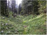 5
5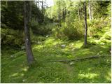 6
6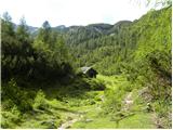 7
7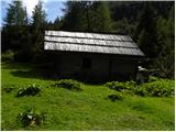 8
8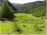 9
9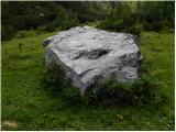 10
10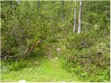 11
11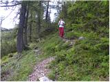 12
12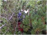 13
13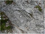 14
14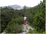 15
15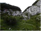 16
16 17
17 18
18 19
19 20
20 21
21 22
22 23
23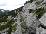 24
24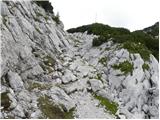 25
25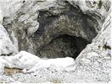 26
26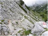 27
27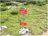 28
28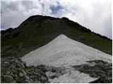 29
29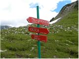 30
30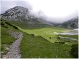 31
31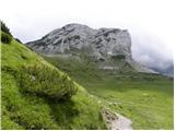 32
32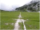 33
33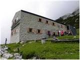 34
34 35
35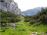 36
36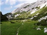 37
37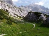 38
38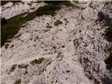 39
39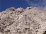 40
40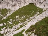 41
41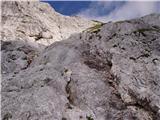 42
42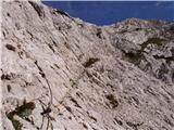 43
43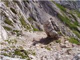 44
44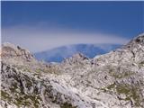 45
45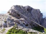 46
46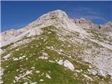 47
47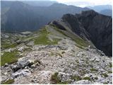 48
48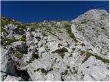 49
49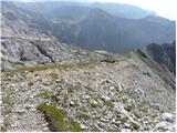 50
50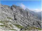 51
51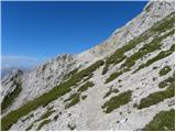 52
52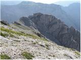 53
53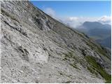 54
54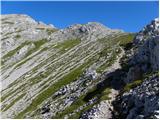 55
55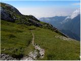 56
56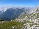 57
57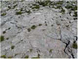 58
58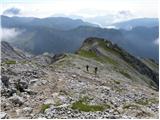 59
59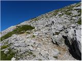 60
60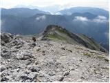 61
61 62
62
Discussion about the trail Kraljev dol - Planjava (via Srebrno sedlo)