Starting point: Podbreg (720 m)
| Lat/Lon: | 46,4198°N 14,6455°E |
| |
Time of walking: 3 h
Difficulty: easy unmarked way, easy marked way
Altitude difference: 1043 m
Altitude difference po putu: 1050 m
Map: Kamniške in Savinjske Alpe 1:50.000
Recommended equipment (summer):
Recommended equipment (winter): ice axe, crampons
Views: 3.050
 | 2 people like this post |
Access to the starting point:
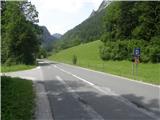
a) Drive to Luce, then continue on to the Logar Valley. After Solčava and 300 metres before the Logarska dolina Landscape Park, you will see signs for a parking area, which direct you to the left to the larger Podbreg parking area, where you park. The turnoff from the main road is near the 13. 5 km road marker.
b) From Črna na Koroškem, go over the Spodnje Sleme pass to Solčava, and from there continue to the right in the direction of the Logarska dolina. After Solčava and 300 metres before the Logarska dolina Landscape Park, you will see signs for a parking area, which direct you left to the larger Podbreg parking area, where you park. The turnoff from the main road is near the 13. 5 km road marker.
c) Cross the Pavličev Vrh pass into Slovenia, then continue driving towards the Logarska dolina. When you reach the junction where the road to the Logarska dolina Landscape Park turns off to the right, continue straight ahead, then after 300 metres turn right into a large caravan park, where you park.
Path description:
From the parking lot, continue along the main road towards the Logarska dolina valley, and then a few metres after crossing the Jezera stream over a bridge, turn left onto the macadam road. The dirt road quickly leads to another bridge, where after the Črna stream (the Črna stream is the second source of Savinjek) continue to the right, initially still on the dirt road, which quickly turns into a wide cart track. The way ahead leads along the steep cart track, which is followed at the crossroads in the route where the "main" cart track continues. Higher up, at a crossroads at an altitude of approximately 1200 metres, follow the right-hand cart track, which then crosses the slopes between Icmanikova and Logarska peč to the right. Cart track soon ends, and from the end of cart track we continue along a lesser track or track which continues in the same direction across the slopes. After less than 5 minutes of traversing, we reach another cart track (which can also be reached by the above-mentioned cart track), which climbs steeply along a kind of ridge in the last part, and which we reach near its end. From the end of cart track (the end of cart track is at an altitude of approximately 1350 to 1400 m), we follow a prominent path which crosses the slopes to the right, and soon the path joins an old waymarked path which ascends to a gully, where the abandoned waymarked path climbs steeply up alongside the gully. Climb steeply for a few minutes, then, when you leave the ravine, continue slightly right, where you see another faded marker, and the track ends here. Continue through the clearing to the nearby Icmanik's Tent, where you will reach the marked trail Plesnikova planina - Strelovec.
After the tent, take the newer cart track, from which the marked path soon branches off slightly to the right, and we continue on cart track, as the path is impassable in the upper part due to the branches that were deposited during the construction of the nearby forest road. The cart track ascends in a few minutes to Icmanikova planina, where there is a marked crossroads and from where a fine view opens up.
From the crossroads at mountain pasture continue right (left Logarska peč for 5 minutes, straight along the forest road to reach the Knez farm) to an undistinguished ridge, which continues the ascent. At first the climb parallels the newer road, which is right below us, then the path becomes steeper and steeper and gradually moves away from the road. The steep path leads us higher up to a less visible crossroads, located in a belt of lush vegetation, and we continue to the left, on a noticeably less well-beaten path, which climbs the Strelovec ridge north-east of the summit (the right path crosses the slopes to the right and reaches the Strelovec ridge to the south-west of the summit, the latter path is also about 15 minutes longer). When you reach the ridge, continue to the right and climb a few steps to the summit. Podbreg - Icmanikova planina 2:15, Icmanikova planina - Strelovec 45 minutes.

Pictures:
 1
1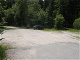 2
2 3
3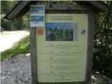 4
4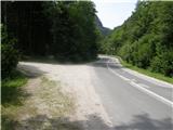 5
5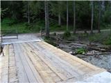 6
6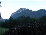 7
7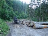 8
8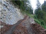 9
9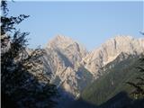 10
10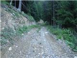 11
11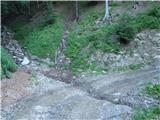 12
12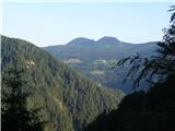 13
13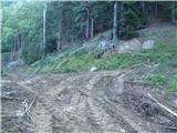 14
14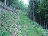 15
15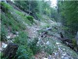 16
16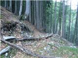 17
17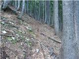 18
18 19
19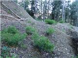 20
20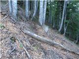 21
21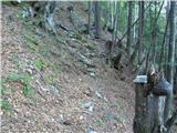 22
22 23
23 24
24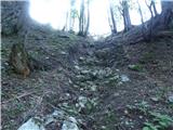 25
25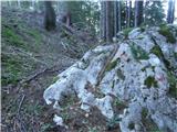 26
26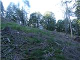 27
27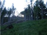 28
28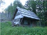 29
29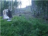 30
30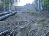 31
31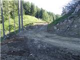 32
32 33
33 34
34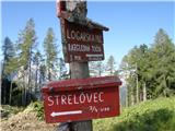 35
35 36
36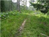 37
37 38
38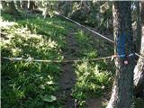 39
39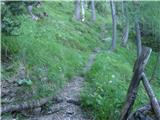 40
40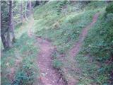 41
41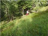 42
42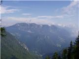 43
43 44
44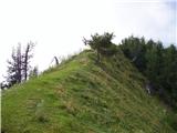 45
45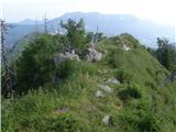 46
46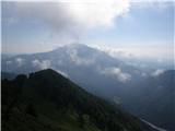 47
47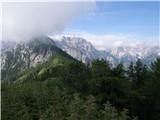 48
48
Discussion about the trail Podbreg - Strelovec
|
| pohodnik3820. 06. 2021 21:22:19 |
Opis te poti bo potrebno dopolniti saj je v tem koncu veliko novih gozdnih vlak ki se odcepijo na vse strani in na koncu če nisi pripravljen se lahko zaide.Vlake so sedaj že speljane čisto do Icmankove planine.Pot opravil 17.6. sicer sem obiskal še Podbrežnikovo planino.... SLIKE in osebni vtisi z poti Lp! Tone 
|
|
|