Mače - Planina Kališče (by road)
Starting point: Mače (600 m)
| Lat/Lon: | 46,3131°N 14,4187°E |
| |
Name of path: by road
Time of walking: 2 h 15 min
Difficulty: easy marked way
Altitude difference: 850 m
Altitude difference po putu: 850 m
Map: Karavanke - osrednji del 1:50.000
Recommended equipment (summer):
Recommended equipment (winter): ice axe, crampons
Views: 2.642
 | 2 people like this post |
Access to the starting point:
a) From the motorway Ljubljana - Jesenice, take the exit Kranj - East, then continue driving towards Jezersko. When you reach Preddvor, leave the main road and turn left towards the centre of the town, and from there follow the signs for Mače. When you arrive in Mače, continue right at the marked crossroads (left Bašelj, straight ahead St Nicholas Church (the church is not accessible by car)) and follow the narrow road above the village, where there is a large marked parking lot.
b) From the motorway Jesenice - Ljubljana, take the exit Kranj - West and continue left at the first junction. Continue through the underpass under the motorway and then to the roundabout, from where you continue in the direction of Golnik. The road continues through Mlaka pri Kranju, and at the end of the village we turn right in the direction of Srakovlje. We then drive through Srakovlje, Spodnja Bela, Srednja Bela to Zgornja Bela, where we turn right towards Preddvor. At Preddvor we see signs for Mače, which direct us left past the primary school onto the road that climbs up to Maca. When you arrive at Mače, continue right at the marked crossroads (left Bašelj, straight ahead St Nicholas Church (the church is not accessible by car)) and follow the narrow road above the village, where there is a large marked parking lot.
Path description:
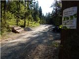
From the parking lot, return to the road from which you turned into the parking lot and continue your ascent in the direction of Kališča. At first we walk through the forest, but a few minutes higher the road approaches the stream Suha, which it crosses 2 more times. After about 20 minutes we arrive at a marked crossroads where the normal route towards Kišče continues to the left, and we continue to the right in the direction of Srednji vrh, Kališča via Kozjek and Zavetišče v Hudičevem borštu via Kozjek. The deteriorating road a little further on leads to a cargo cableway leading to Dom na Kališču, and at the first fork for the cargo cableway we continue on the left unmarked cart track (right Srednji vrh and Kališče via Kozjek). Continue along cart track or the wide logging trail, which at the crossroads is followed by the "main" cart track. A moderate climb takes a few minutes to reach the lane of the hemlock plantations and the lane of the sparse forest, from where some views open up. There is a short cross-climb and we join the normal route from Maca.
The marked path is reached at a small saddle north of Gora (994 m), and we follow it towards Kališča. We climb for a few minutes through a dense spruce forest before joining a less well-trodden road, which we follow for a few minutes. We leave the road when we see the continuation of the mountain path on the right (the branch is well marked). The path continues on to a steeper slope and climbs quite steeply in many bends. Higher up, the forest thins out and we get a nice view to the south. A wooden bench in a part of the sparse forest gives us a pleasant rest, and a little further on we are "surprised" by a working clock on a tree. Continue for a little longer, crossing to the right to reach the wooded southern ridge of Kališča. On the ridge, the path turns sharp left, then climbs in a few switchbacks to Spodnji Kališča, from where we get a beautiful view of Storžič.

Pictures:
 1
1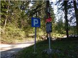 2
2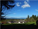 3
3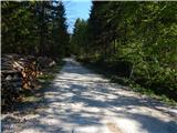 4
4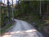 5
5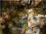 6
6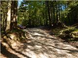 7
7 8
8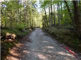 9
9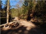 10
10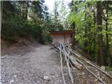 11
11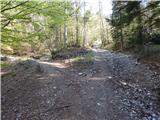 12
12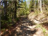 13
13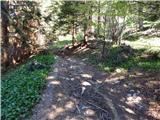 14
14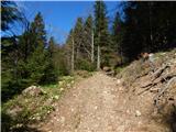 15
15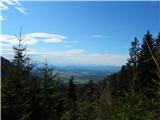 16
16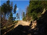 17
17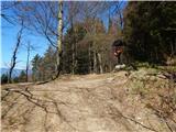 18
18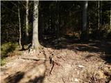 19
19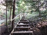 20
20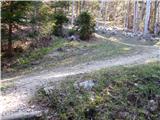 21
21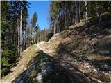 22
22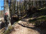 23
23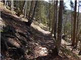 24
24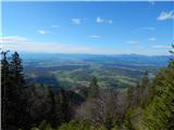 25
25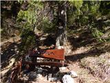 26
26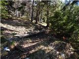 27
27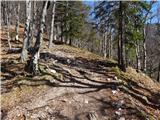 28
28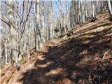 29
29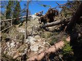 30
30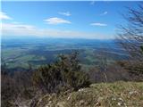 31
31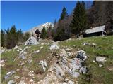 32
32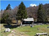 33
33
Discussion about the trail Mače - Planina Kališče (by road)