Planina Ravne - Veliki vrh (Veža) (via Zelene trate)
Starting point: Planina Ravne (1500 m)
| Lat/Lon: | 46,3493°N 14,6997°E |
| |
Name of path: via Zelene trate
Time of walking: 2 h 15 min
Difficulty: easy marked way
Altitude difference: 610 m
Altitude difference po putu: 650 m
Map: Kamniške in Savinjske Alpe 1:50.000
Recommended equipment (summer):
Recommended equipment (winter): ice axe, crampons
Views: 32.603
 | 1 person likes this post |
Access to the starting point:
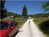
a) First drive to Kamnik, then continue to Stahovica and the Črnivec Pass. A few 100 metres before the Črnivec Pass, leave the main road leading to Gornji Grad and drive sharp left in the direction of the Volovljek Pass (Kranjski Rak). From the above-mentioned pass, continue straight ahead (on the left the road leading to Velika planina, on the right the Štajerski Rak) and start descending towards Luče. Lower down, the road bends slightly and leads to the Podvolovljek valley. In the following, you first pass the road branch leading to the Lučka Bela valley, and then the bar at Gams. After the bar, pay attention, because just a few 100 metres further on, a road branches off to the left, leading to mountain pasture Podveža and mountain pasture Ravne and the Planinšek farm (at the point where you leave the main road, the road marking is approximately 11 km). Continue along the initially still asphalted road, which climbs further towards the Dleskovská plateau. Higher up, the road to Planinšek branches off to the right, and here we continue along the upper left road, which a few 100 metres further on from the turnoff to the Planinšek farm becomes macadam, and this road leads us a little further on to the next crossroads, where we continue straight on in the direction of mountain pasture Ravne (to the left, mountain pasture Podveža). Continue on a slightly less favourable road, then follow to the start of mountain pasture Ravne, where you park in a suitable place on the roadside.
From the main road to mountain pasture Ravne is about 10 km, of which about 4 km are macadam.
b) First drive to Luce, then continue driving towards Kamnik. When you see the road sign by the side of the road indicating 10,5 km, pay attention to the right fork, as just a little further on the road will branch off to the right towards mountain pasture Podveža and Ravne and the Planinšek farm. Continue along the initially still asphalted road, which climbs further towards the Dleskovški plateau. Higher up, the road to Planinšek branches off to the right, and here we continue along the upper left road, which a few 100 metres further on from the turn-off to Planinšek Farm becomes macadam, and this road leads us a little further on to the next crossroads, where we continue straight on in the direction of mountain pasture Ravne (to the left of mountain pasture Podveža). The road to the right is the road to Planinšek Farm, and the road to Planinšek Farm becomes macadam. Continue on a slightly less favourable road, then follow to the start of mountain pasture Ravne, where you park at a suitable place on the roadside. From the main road to mountain pasture Ravne is about 10 km, of which about 4 km are macadam.
Path description:
From the starting point, walk via mountain pasture to the shepherd's hut, which you go around on the right by continuing in the direction of Molička mountain pasture and mountain pasture Polšak (the path on the left side of the hut leads across the Dolgo trata). After the hut the path is a bit harder to follow at first, but the markings help us, and a little further on we join the cart track, which branches off the road on the mountain pasture straight at a right-hand bend.
Once on cart track, continue left, initially walking without any significant change in elevation, and then starting a gentle to moderate climb. After a few minutes, you will reach a faint saddle between Dleskovec on the left and Smrekovec on the right. Here a path joins us from the end of the road on the right, and we continue straight ahead over a pasture fence. After the grazing fence there is a short crossing, and then we arrive at the next marked crossroads, where we continue to the left in the direction of Lučka hut, straight mountain pasture Polšak.
The way forward continues in a series of several small valleys, and then leads us to the NOB memorial, next to which there are two benches with a table. From here on, the path climbs slightly steeper, and slightly higher up, the first beautiful views towards Križevnik, Raduha and the surrounding mountains open up. Higher up, we climb moderately for a while through the dwarf pines bands, and then the trail lays down and leads us to Sedelce, where the trail over the Long Lawn joins us from the left.
Continue straight ahead here and for a short distance continue along the marked path towards Korošice and Molička mountain pasture, then continue right in the direction of the marked path to Velika vrh. The way ahead leads along an unmarked valley to the east, then north-east of Velika vrh. As the marked path to Velika summit turns left up the slope, a view opens to the right of a passage to Caving bivouac on Dleskovška planota, which is about 10 minutes' descent, and we continue along the above-mentioned marked path, which gradually changes to a steeper slope. We continue to climb up the steep and sometimes less well-trodden path, which leads us towards the saddle between Velika peak on the left and Velika Zelenica on the right. Before this saddle, the path becomes even steeper, then suddenly flattens out and leads to an expanse of grassy terrain. Here continue left towards the Velika peak (Velika Zelenica on the right), which you can already see in front of you and which takes a few minutes of moderate climbing to reach.

Pictures:
 1
1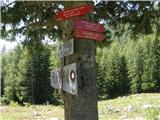 2
2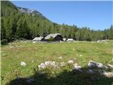 3
3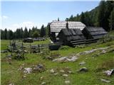 4
4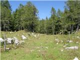 5
5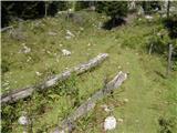 6
6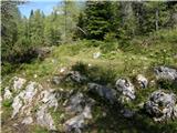 7
7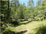 8
8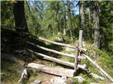 9
9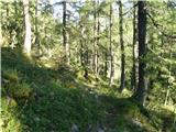 10
10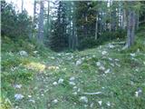 11
11 12
12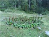 13
13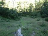 14
14 15
15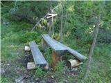 16
16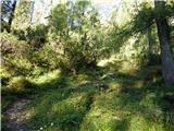 17
17 18
18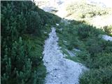 19
19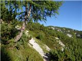 20
20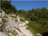 21
21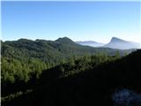 22
22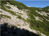 23
23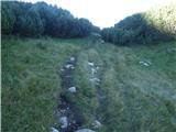 24
24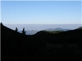 25
25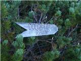 26
26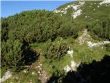 27
27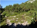 28
28 29
29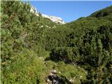 30
30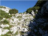 31
31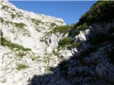 32
32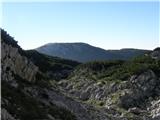 33
33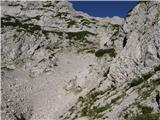 34
34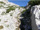 35
35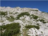 36
36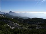 37
37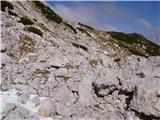 38
38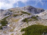 39
39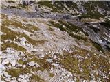 40
40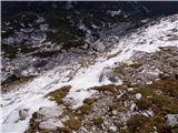 41
41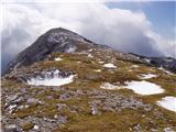 42
42 43
43
Discussion about the trail Planina Ravne - Veliki vrh (Veža) (via Zelene trate)
|
| klavdipo15. 07. 2008 |
Ali je v vpisni skrinjici poleg knjige tudi žig?
|
|
|
|
| fpetel115. 10. 2008 |
Danes je bila v skrinjici samo knjiga in dva kemična svinčnika. Prvega, ki sem ga poizkusil je pisal.
|
|
|
|
| EUGEN10. 09. 2009 |
Krasen izlet:
pl.Ravne,Polšakova planina,Križevnik, Poljske device,Veliki vrh,Dleskovec,pl.Ravne
|
|
|
|
| sla17. 12. 2009 |
Ali kdo ve, kakšne so razmere na cesti čez Črnivec v Povolovjek in do izhodišč za Dleskovo planoto? Do kje se pride z avtom?
|
|
|
|
| Stingray28. 08. 2010 |
Prilagam sliko GPS izvoza zgoraj opisane poti v Google Earth:
<a target=# class=moder href="http://www.e-prostor.com/hribi/pot01b.jpg"><img src="http://www.e-prostor.com/hribi/pot01a.jpg" /></a>
|
|
|
|
| EUGEN28. 09. 2010 |
Bil letos avgusta na Vrhu(ni vpisne knjige).Rad se vračam v te lepe predele.
|
|
|
|
| micamaca29. 09. 2010 |
Js tut, js tut  mir in čista uživancija brez gneče na "cesti", brez neskončnih " `dan, `dan, `dan,..." sem in tja splašiš še kakega ruševca, pa srečaš mamo gamsa z malim gamsekom in potem z užitkom padeš na travo na Dolgih tratah  aaaa
|
|
|
|
| aonuk117. 04. 2011 |
Nedelja 17.4.2011 osvojen Veliki vrh in Dleskovec.Vreme za ta čas enkratno,toplo , sončno,sneg pomrzjen,tudi razgled zadovoljiv.
|
|
|
|
| plavžar21. 10. 2012 |
Pot je markirana-preverjeno!
|
|
|
|
| navdušena2. 07. 2015 |
Je bil že letos kdo z avtom do planine Ravne? Kakšna je cesta?
|
|
|
|
| garmont2. 07. 2015 |
Brez težav prevozna za osebna vozila.
|
|
|
|
| mpp16. 09. 2015 |
Do kmetije Planinšek na višini 1100m, je popolnoma nov asfalt. Naprej so tudi vidni označevalni količki. Očitno bodo še nekaj urejali.
Pot s sedelca do Velike Vrha je markirana.
Tudi pot Planina Ravne (1500m) - Dolga trata - Sedelce (1840m).
Na zemljevidih še ni označeno.
|
|
|
|
| Stamp30. 09. 2015 |
Pozdrav
Ima li možda netko Track od Planine Ravne preko Dleškovca do Velikog Vrha ?
Da u slučaju magle ne lutam..
Hvala ...
|
|
|
|
| mornar26. 09. 2017 |
Prosim za informacijo za razmere na poti iz planine Ravni na Veliki vrh. Lp.
|
|
|
|
| veja526. 09. 2017 |
V soboto sem bil na Dleskovcu in nato še proti Velikemu vrhu. Snežne zaplate so že med Dleskovcem in Velikim vrhom. V vrtači, pred prečenjem zadnjega melišča, je sneg, kakor tudi delno na melišču, pod vrhom, katerega je potrebno prečiti v levo. Za vzpon je potrebna zimska oprema. Če sneg pomrzne, je lahko spolzko.
Lep pozdrav! Venčeslav.
|
|
|
|
| mornar27. 09. 2017 |
Veja hvala za odgovor,obenem bi pa še vprašal ali je na vrhu žig ter kako je sledjiva pot.Lp.
|
|
|
|
| malihodec3. 09. 2019 |
V zadnjem tednu bil dvakrat gor. Žal ugotavljam, da na skrinjici, v kateri je žig in bi morala biti vpisna knjiga, očitno že dalj časa ni pokrova in vpisne knjige
|
|
|
|
| drdivx4. 09. 2019 |
@malihodec
V repliki Aljaževega stolpa je tudi žig.
|
|
|
|
| frajer31. 01. 2020 |
Danes sem prehodil to pot. Orientacija med ruševjem je kr otežena, sploh, če greš prvič (se zahvaljujem tistemu, ki je vsaj delno naredil gaz). Snega je cca. 20-30 cm, spodaj je ledena podlaga. Dostop na Veliki vrh je mogoč direktno proti vrhu oz levo od letne poti.
|
|
|
|
| J.P.14. 02. 2022 20:50:24 |
Avto je zaradi snega in leda ostal cca 4-5km pod planino Ravne. Opazili smo, da se je kar nekaj avtov odpravilo tudi višje, brez težav bi se dalo pomoje še največ 2km.
Razmere so bile ta vikend odlične.Zimske z obilico sonca.Priporočam krožno Pl.Ravne-Veliki vrh-Zelenica-Planina Podvežak. LP
|
|
|
|
| dleskovec15. 02. 2022 16:09:45 |
J.P. Dobrodošle bi bile slike; jih ni?
|
|
|
|
| J.P.15. 02. 2022 18:52:54 |
|
|
|
|
| turbo15. 02. 2022 18:58:11 |
Tukajle dodajanje fotografij ni omogočeno, te je k tekstu možno priložiti v forumu Trenutne razmere.
|
|
|
|
| J.P.15. 02. 2022 19:28:03 |
Hvala turbo. Priložim tja, če dobim kaj koristnega za množico. LP
|
|
|
|
| kayzelko23. 06. 2023 09:00:40 |
Pozdrav,
išel tko u zadnje vrijeme na Veliki vrh ? Markacije?
Kakva je cesta do Planine Ravne ? Prohodno za osobni automobil ?
lp
|
|
|
|
| felix9. 10. 2023 09:15:12 |
Zdravo!
Ali je cesta do planine Ravne skozi Luče normalno prevozna?
Hvala in lp.
|
|
|