Laško - Mali Grintovec (via Bašeljski vrh)
Starting point: Laško (815 m)
| Lat/Lon: | 46,3298°N 14,3988°E |
| |
Name of path: via Bašeljski vrh
Time of walking: 3 h 30 min
Difficulty: easy marked way
Altitude difference: 998 m
Altitude difference po putu: 1100 m
Map: Karavanke - osrednji del 1:50.000
Recommended equipment (summer):
Recommended equipment (winter): ice axe, crampons
Views: 8.046
 | 1 person likes this post |
Access to the starting point:
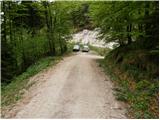
a) From the motorway Ljubljana - Jesenice, take the exit Kranj - East, then continue driving in the direction of Jezersko. When you reach Preddvor, leave the main road and turn left towards the centre of the town, and from there follow the signs for Bašelj. When we arrive in Bašelj, first at the beginning of the left turn in the direction of straight ahead there is a narrower road leading to the parking lot at the log cabin TD Bašelj (in the descriptions the starting point Bašelj), and from the mentioned crossroads we continue along the main road for another 100 m to the next crossroads, where we continue to the right along the road towards the Gamsovemu raje and the hamlet Laško (Laško hamlet). Only about 50 m further on, continue along the left-hand road, which gradually starts to climb moderately. At the hamlet of Laško, turn left again, and then the asphalt ends and we continue along a steep macadam road, which leads us past a trail junction (kolovoz) to the Church of St. Lovrenec and the Doma na Lovrencu. From this turn-off, drive a little further, to the end of the road or a small parking area a few 10 metres earlier.
b) From the motorway Jesenice - Ljubljana, take the exit Kranj - West and continue left at the first junction. Continue through the underpass under the motorway and then reach a roundabout, from where you continue in the direction of Golnik. The road continues through the village Mlaka pri Kranju, and at the end of the village we turn right in the direction of Srakovlje. Then drive through Srakovlje, Spodnja Bela, Srednja Bela, Zgornja Bela (in Zgornja Bela we join the road from Preddvor) to Bašlja, where the main road makes a long left turn, where a narrower road continues in a straight direction, leading to the parking lot of the log cabin TD Bašelj (in the descriptions the starting point is Bašelj), and from this junction we continue along the main road for another 100 m to the next junction, where we continue right along the road towards Gamsovem raje and the hamlet of Laško. Only about 50 m further on, continue along the left-hand road, which gradually starts to climb moderately. At the hamlet of Laško, turn left again, and then the asphalt ends and we continue along a steep macadam road, which leads us past a trail junction (kolovoz) to the Church of St. Lovrenec and the Doma na Lovrencu. From this turn-off, drive a little further, to the end of the road or a small parking area a few 10 metres earlier.
Path description:
At the end of the road, bear left cart track in the direction of Kališe and Storžič. Cart track climbs moderately and after a ten-minute walk leads to a crossroads. Continue along the left-hand cart track, which runs out after a few metres. The path here leaves the small valley along which it climbed and ascends steeply to the left. After this short steep climb, the steepness subsides and the path leads to the partisan hospital Košuta. Behind the hospital the path crosses two successive torrents and then climbs steeply again. The path, which runs through the forest all the time, leads us to the side ridge Kališe, where we join the unmarked path from Bašlja. Gozd then becomes more sparse and occasionally we get a nice view towards Storžič. The path then turns slightly right again into the forest. Suddenly, we see a house in front of us, located at mountain pasture below Kališem. Just a few metres further on, the path from the village of Mače joins us. The path climbs for about 15 minutes through the forest. The path then makes a sharp left turn and we see in front of us the home at Kališe which is only a few steps away.
From the house, continue along the wide ridge path towards Storžič and Bašeljski vrh. After a few minutes, the path to Bašeljski vrh branches off to the right. Take this path, which leads to Bašeljski vrh via dwarf pines in a moderate ascent. The last metres below the summit are dangerous for slipping in the snow.
From the summit, descend towards Mačensko sedlo. This part is a bit more difficult, but the route does not present any major dangers in the terrain. The path descending from the summit is, for the most part, along a ridge, which is slightly exposed in places. From Mačensko sedlo onwards, the path starts to climb again. The ascent is on a grassy slope, mostly covered with dwarf pines. Just a few steps below the summit you reach a crossroads, where you turn left (right Srenji vrh and Dolga njiva) and easily reach the summit.
Laško - Kališe 2:00, Kališe - Bašelj vrh 45 minutes, Bašelj vrh - Mali Grintovec 45 minutes.

Pictures:
 1
1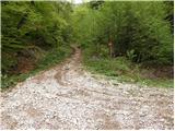 2
2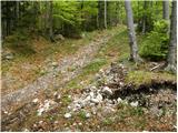 3
3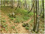 4
4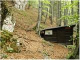 5
5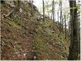 6
6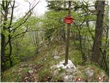 7
7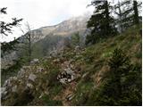 8
8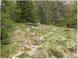 9
9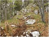 10
10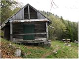 11
11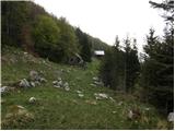 12
12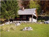 13
13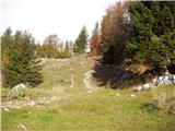 14
14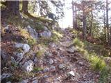 15
15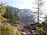 16
16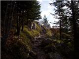 17
17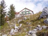 18
18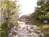 19
19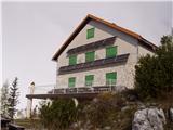 20
20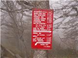 21
21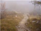 22
22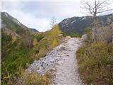 23
23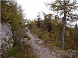 24
24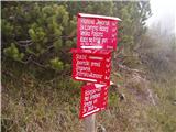 25
25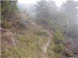 26
26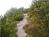 27
27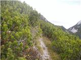 28
28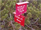 29
29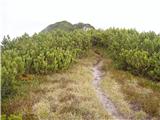 30
30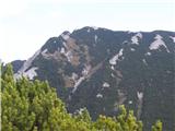 31
31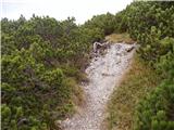 32
32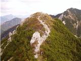 33
33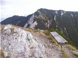 34
34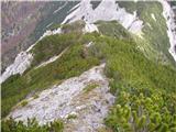 35
35 36
36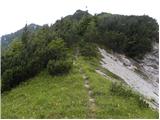 37
37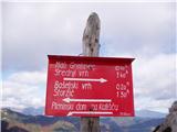 38
38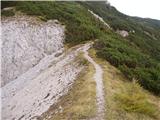 39
39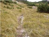 40
40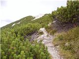 41
41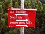 42
42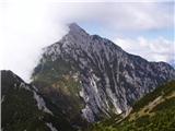 43
43 44
44
Discussion about the trail Laško - Mali Grintovec (via Bašeljski vrh)