Klemenčevo - Kamniški vrh (on southwest slope)
Starting point: Klemenčevo (600 m)
| Lat/Lon: | 46,2739°N 14,5659°E |
| |
Name of path: on southwest slope
Time of walking: 1 h 45 min
Difficulty: easy unmarked way
Altitude difference: 659 m
Altitude difference po putu: 659 m
Map: Kamniško - Savinjske Alpe, 1 : 50.000, PZS
Recommended equipment (summer):
Recommended equipment (winter): ice axe, crampons
Views: 27.636
 | 3 people like this post |
Access to the starting point:
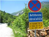
From Kamnik we drive towards Stahovica. Just after the village Godič turn left onto the road in the direction of Županjih njiv, and at the next crossroads turn left in the direction of Bistričica. Follow the road to the village of Klemenčevo, pass the signpost marking the beginning of the village to the village itself, past the bus turnaround, and then park in a small parking area a few 10 metres further on from the turnaround, on the right-hand side of the road, just before the turn-off of a narrower path (kolovoz) that descends slightly towards the Bistričica riverbed (it is also possible to park a few 10 metres further along the road if there is no space lower down). The path towards the riverbed branches off to the right at the point where the road we came along climbs a little steeper and turns slightly to the left.
Path description:
From the parking lot, take the narrower path which branches off to the right and quickly leads down to the shallow Bistričica stream, which is crossed twice (on stones, no bridge). The cart track then climbs gently for the most part, and for a short time a little more steeply, along a meadow and through a sparse forest. Soon you come to a fork in the path, keeping to the wider cart track to the right. A little further on you come to a pasture fence at cart track, after which the dirt track you are following turns right. At the point where the track turns right, there is another path up to the left, but it is less good and joins the track higher up. Soon we come out of the wods and see a pasture fence on our right, and we climb up the path that leads us past it. The path leads us to a viewing slope, where we come across a bench, and after a short climb from the bench we come back to the pasture fence, which we cross. At this point we arrive at the junction of the unmarked path we are walking on, with the marked path that leads from the hamlet of Slevo on our right. We just cross this marked path and climb on in our previous direction (do not continue slightly left on the marked path), following a clearly visible path (wide track), which then climbs all the way along the right-hand edge of the pasture mountain pasture Ravne senožeti (Ravine hay meadows). When you pass a dilapidated wooden shack (on your left), the path climbs more steeply and soon leads to a crossroads. A more difficult, very steep path leads up to the left, climbing along the edge of a ravine called Slevška roža, and we continue straight ahead, following a path that quickly leads us to a slightly awkward scree crossing that descends steeply down this ravine. This area is short, only about 30 m, but the slope of the scree requires a careful step because of the risk of slipping. After this, the vast grassy south-west slope of Kamniški vrh is reached, which is crossed by a very narrow but well-trodden path in a very moderate ascent to the south. The path leads to a viewpoint with a bench to the right of our path, and at this point the path turns left and climbs slightly more steeply, soon leading to a crossroads with direction signs. The path from Stahovica and Županjih njiv joins here from the right, and a signpost to the left points in the direction of Kamniški vrh and mountain pasture Osredek. Straight up a steep direct path to Kamniški vrh, we take the left track, which then climbs in a relatively steep ascent to a saddle, where we turn right, along a wide steep path to Kamniški vrh, which is reached in a further 10 minutes' walk, when we reach a registration box and a stamp. A few minutes further along the trail, you reach a lookout point with a few benches and a bivouac.

Pictures:
 1
1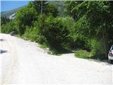 2
2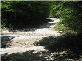 3
3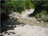 4
4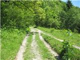 5
5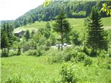 6
6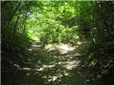 7
7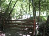 8
8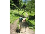 9
9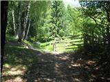 10
10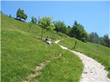 11
11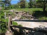 12
12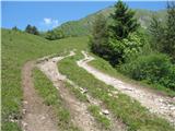 13
13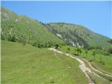 14
14 15
15 16
16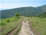 17
17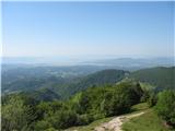 18
18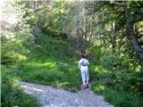 19
19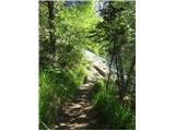 20
20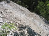 21
21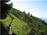 22
22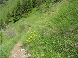 23
23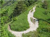 24
24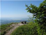 25
25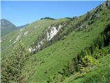 26
26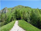 27
27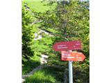 28
28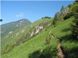 29
29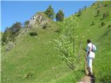 30
30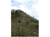 31
31 32
32
Discussion about the trail Klemenčevo - Kamniški vrh (on southwest slope)
|
| AnzeKozjek28. 05. 2013 |
Živjo! A mi kdo zna povedat, če se vidi iz grebena (Kamniški vrh, Kamniška Planjava in Planina osredek)lep razgled na Kamniške Alpa - dvatisočake zadaj? Ker razgled je večali manj samo na južno stran, ker severna je bolj porasla z gozdovi... 
|
|
|
|
| Rokovnjacica28. 05. 2013 |
Kot si že sam napisal:"razgled je več ali manj samo na južno stran". Na dvatis čake v Kamniških alpah ga pa ni. Priporočam ti, da se enkrat podaš na Kompotelo,tam boš imel dvatis čake kot na dlani...
|
|
|
|
| pikec128. 05. 2013 |
Če greš na K.Planjavo, na tistem mali ravninici, vidiš od Brane do Velke, več pa ne Lp
|
|
|
|
| bostjanp30. 05. 2013 |
@anze: lahko združiš sprehod iz Klemečevega preko Osredka do Kriške pl. pod Krvavcem, pl.Koren do Komptele ali pa vrha Korena in boš imel Kamniške na dlani.Nazaj pa do pl.Koren in po dolini Korošice do gondole.
|
|
|
|
| AnzeKozjek1. 06. 2013 |
Za Kompotelo vem, bil sem že tam na vrhu, ko sem bil še malih nog ampak se ne spomnim dosti od takrat... bi pa ponovil zdej v kratkem, samo da se malo sneg skopni... Bil sem že kar nekajkrat na Kamniškem vrhu, ampak nikol se pa nisem še povzpel naprej do Planjave na Kamniškem vrhu.. hvala za odgovore in nasvete!
|
|
|
|
| Hribolazec8110. 07. 2016 |
Danes opravil to pot je zelo zelo lepa, nazaj sem se vračal čez planino Osredek kjer je pihala rahlka sapica ravno prav za okrepčati in uživati v razgledu ted lepotah narave, pot v dolino pa lepa vendar pazljivost potrebna pri koraku čez peščine.
|
|
|
|
| črnozanohtam27. 03. 2021 |
pozdravljeni. včeraj popoldne sem na kupu peska na zgornjem delu parkirišča pozabila palice, black diamond, rumeno-zlate. ko sem zvečer prišla domov, sem poklicala kmetijo tam blizu in prijazna gospa je šla pogledat, vendar palic ni bilo več tam, je pa par, ki se je ravno vrnil s pohoda rekel, da sta jih še videla v pesku, ko sta štartala. če jih je slučajno nekdo vzel domov, bi prosila, če mu niso življenjsko nujne, da me pokliče na 031 467 296. Hvala.
|
|
|