Starting point: End of road (1000 m)
| Lat/Lon: | 46,3118°N 14,7491°E |
| |
Time of walking: 1 h
Difficulty: easy marked way
Altitude difference: 425 m
Altitude difference po putu: 425 m
Map: Kamniške in Savinjske Alpe 1:50.000
Recommended equipment (summer):
Recommended equipment (winter):
Views: 36.484
 | 2 people like this post |
Access to the starting point:
From Kamnik, we drive towards Gornji grad. At the chapel just a few dozen metres before Gornji grad, turn left (direction Sveti Lenart). Continue along the road that goes up along the stream. The road then leaves the stream and leads to a dilapidated wooden shack, where you continue along the road towards the church. At a crossroads a few metres below the church, go left and follow the road, which makes a sharp right turn, to its end, where you park.
From the Štajerska side, take the first exit to Gornji Grad and follow the road in the direction of Kamnik. Just after Gornji Grad turn right (direction Sveti Lenart). Continue as described above.
Path description:
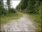
From the end of the road, cross the torrent and immediately afterwards the path climbs steeply and leads us in the keys to an inexpressible ridge. The way forward climbs steeply upwards through the forest. After a good 20 minutes of ascent, the steepness eases and the path leads us in a crossing under the saddle Kal. This is followed by a shorter climb along a mainly muddy track (the exception being longer periods of drought), which after a good five minutes leads us to pastures on the Kal saddle. Just a few tens of metres to the right is a crossroads where you continue left in the route Lepenatka (right: bivouac 3 minutes and Rogatec 1 hour). The trail then begins to climb gently up the grassy slopes of Lepenatka. The path soon passes onto a wide, undistinguished ridge which leads us in 20 minutes to the main ridge of Lepenatka. Here we are again at a crossroads. Continue to the right and in a few steps of easy walking reach the top.
Pictures:
 1
1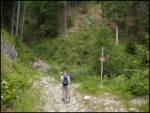 2
2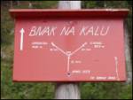 3
3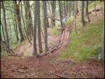 4
4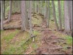 5
5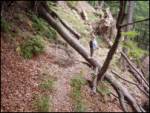 6
6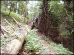 7
7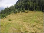 8
8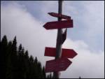 9
9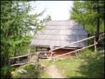 10
10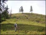 11
11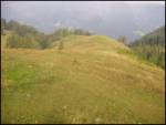 12
12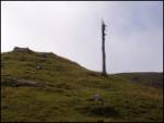 13
13 14
14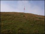 15
15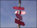 16
16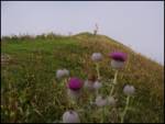 17
17 18
18
Discussion about the trail End of road - Lepenatka
|
| J.P.10. 03. 2019 |
Avto smo pustili malo pod cerkvijo Sv. Lenart. Pot skozi gozd je bila zaprta in smo do Bivaka na Kalu prispeli po široki gozdni cesti ,ki je lepo markirana. Čas hoje je prav tako 1h. Lp, J.P
|
|
|
|
| PUHIPUHI8. 05. 2020 |
Prejšnji teden smo bili na Lepenatki. Res čudovit vrh.
Imam pa eno vprašanje ... Cca 20 min pred cerkvijo je znak za prepovedan promet. Videli pa smo, da se z avtomobili vsi peljejo višje, mimo znaka. Kako je s tem znakom?
Hvala, LP; Petra
|
|
|
|
| jprim9. 05. 2020 |
Znak pač je, vsak pa se odloči po svoje.  Kaj pa vsa tista vožnja po planinskih poteh s krosarji, štirikolesniki, se uničuje planinske poti, samo naravo ... Uršlja gora, Čemšeniška planina še in še bi naštevala in nobeden nikomur nić. Lp!
|
|
|
|
| potpodnoge5. 06. 2020 |
V slučaju, da kaj poškoduje avto, nimaš nobenega opravičila, da ti kdo povrne škodo. Pač, prometni znak je dovolj zgovoren, kdor ga upošteva ga upošteva, kdor pa ne, je pa pač običajen voznik, ki mu je potem, ko se nekaj neprijetnega pripeti, krivo vse drugo, le sam nič. Ampak zgleda, da večina kar lepo pride skozi, policajev ali mestnih redarjev pa tam tudi ni treba pričakovati.
|
|
|