Planina Jezerca - Mokrica (via Kompotela)
Starting point: Planina Jezerca (1410 m)
| Lat/Lon: | 46,2855°N 14,5314°E |
| |
Name of path: via Kompotela
Time of walking: 3 h
Difficulty: easy marked way
Altitude difference: 443 m
Altitude difference po putu: 675 m
Map: Kamniške in Savinjske Alpe 1:50.000
Recommended equipment (summer):
Recommended equipment (winter): ice axe, crampons
Views: 7.016
 | 2 people like this post |
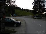
Access to the starting point:
At the end of the parking lot, where the road turns left and the road branches off to the right towards the nearby mountain pasture Jezerca, you will notice red mountain direction signs directing you straight onto the marked footpath in the direction of Kriška planina, Vrh Korena, Košutna, Kompotela and Mokrica, which ascends through the pastures of the aforementioned mountain pasture. After a short climb, cart track is reached, and we follow it to the left, crossing the slopes of Kržišče (1658 m). Cart track, which we are following, quickly splits into two parts, and we continue straight on the lower one. Transitionally, we get a nice view towards Kranj, the Škofjeloško hribovje and Storžič, and then the path starts to descend gently. A few more minutes of walking follow, and then we arrive at the parking lot at the lower part of Kriška planina.
From the parking lot, continue in the direction mountain pasture Koren and follow the worse dirt road, which passes through the underpass under the ski slope. After the underpass, the marked path veers slightly left off the road, continuing parallel to the road along a spruce tree avenue. After a few minutes of gentle ascent, when you reach the eastern edge of Kriška planina, where there is a small watering place for animals, continue slightly left over a pasture fence (right mountain pasture Osredek and Kamniški vrh), but continue the gentle ascent in roughly the same direction. The path continues with mountain pasture to the slightly steeper slopes of Krvavec, over which we climb crosswise to a viewpoint from which we have a fine view towards Kržišče), the ridge of Kamniški vrh, the Korošice valley, Velika planina and towards the nearby Košutna and Velika Zvoh.
From the viewpoint, which is located a few steps to the right of the path, we begin to descend steeply towards the hunting lodge above the Korošica valley. When the descent stops and the trail continues without any major changes in altitude, you will come to a prominent but poorly marked crossroads where the trail branches off to the right towards the aforementioned hunting lodge and further towards the Korošice valley and the Kamniška Bistrica valley. At this crossroads, continue slightly left and start climbing slightly through the forest. The path quickly leaves the forest and passes through bushes and dwarf pines, and then gradually leads us through a pasture fence to the next unmarked crossroads, which is located right in the middle of a sharp right-hand bend. From the serpentine, an unmarked path continues straight ahead towards the Razor saddle (the saddle between Krvavec and Velika Zvoh), and we continue to the right along the further marked path. There is a short cross-climb and the path leads us to the southern part of mountain pasture Koren, from where we have a nice view over the central part of mountain pasture and the surrounding peaks. From the southern part of mountain pasture there is a short descent to the nearby shepherd's hut, which is located in the central part of mountain pasture Koren.
Here our route continues slightly left (slightly right mountain pasture Košutna) through the meadows on the valley floor (the path is initially not very visible). The path then becomes steeper and steeper and after less than 30 minutes of walking leads us to a small puddle where there is a less well marked crossroads. Continue straight ahead (right Košutna) and follow the gently sloping path to the next crossroads, where you continue along the right path in the direction of Kompotela (left Vrh Korena). From here on, the orientation is a little more difficult in the fog, but very difficult. The way forward slowly begins to climb gently on a grassy slope covered with dwarf pines. The path then leads us to the top of Kompotele in beautiful views.
Path description:
At the end of the parking lot, where the road turns left and the road branches off to the right towards the nearby mountain pasture Jezerca, you will notice red mountain direction signs directing you straight onto the marked footpath in the direction of Kriška planina, Vrh Korena, Košutna, Kompotela and Mokrica, which ascends through the pastures of the aforementioned mountain pasture. After a short climb, cart track is reached, and we follow it to the left, crossing the slopes of Kržišče (1658 m). Cart track, which we are following, quickly splits into two parts, and we continue straight on the lower one. Transitionally, we get a nice view towards Kranj, the Škofjeloško hribovje and Storžič, and then the path starts to descend gently. A few more minutes of walking follow, and then we arrive at the parking lot at the lower part of Kriška planina.
From the parking lot, continue in the direction mountain pasture Koren and follow the worse dirt road, which passes through the underpass under the ski slope. After the underpass, the marked path veers slightly left off the road, continuing parallel to the road along a spruce tree avenue. After a few minutes of gentle ascent, when you reach the eastern edge of Kriška planina, where there is a small watering place for animals, continue slightly left over a pasture fence (right mountain pasture Osredek and Kamniški vrh), but continue the gentle ascent in roughly the same direction. The path continues with mountain pasture to the slightly steeper slopes of Krvavec, over which we climb crosswise to a viewpoint from which we have a fine view towards Kržišče), the ridge of Kamniški vrh, the Korošice valley, Velika planina and towards the nearby Košutna and Velika Zvoh.
From the viewpoint, which is located a few steps to the right of the path, we begin to descend steeply towards the hunting lodge above the Korošica valley. When the descent stops and the trail continues without any major changes in altitude, you will come to a prominent but poorly marked crossroads where the trail branches off to the right towards the aforementioned hunting lodge and further towards the Korošice valley and the Kamniška Bistrica valley. At this crossroads, continue slightly left and start climbing slightly through the forest. The path quickly leaves the forest and passes through bushes and dwarf pines, and then gradually leads us through a pasture fence to the next unmarked crossroads, which is located right in the middle of a sharp right-hand bend. From the serpentine, an unmarked path continues straight ahead towards the Razor saddle (the saddle between Krvavec and Velika Zvoh), and we continue to the right along the further marked path. There is a short cross-climb and the path leads us to the southern part of mountain pasture Koren, from where we have a nice view over the central part of mountain pasture and the surrounding peaks. From the southern part of mountain pasture there is a short descent to the nearby shepherd's hut, which is located in the central part of mountain pasture Koren.
Here our route continues slightly left (slightly right mountain pasture Košutna) through the meadows on the valley floor (the path is initially not very visible). The path then becomes steeper and steeper and after less than 30 minutes of walking leads us to a small puddle where there is a less well marked crossroads. Continue straight ahead (right Košutna) and follow the gently sloping path to the next crossroads, where you continue along the right path in the direction of Kompotela (left Vrh Korena). From here on, the orientation is a little more difficult in the fog, but very difficult. The way forward slowly begins to climb gently on a grassy slope covered with dwarf pines. The path then leads us to the top of Kompotela in beautiful views.
Just a few steps from the summit, the marked path to Mokrica branches off to the east. Take this path as it begins to descend. After a good ten minutes of descending on steep grass, the path leads to the ridge of Mokrica. The path, which continues to descend gently, is slightly exposed in a few places. After a walk of less than half an hour from Kompotela, the trail leads to a registration box at the top of Mokrice.
PP: In the fog, orientation is very difficult, especially from mountain pasture Koren onwards.

Pictures:
 1
1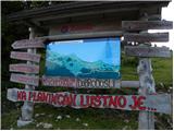 2
2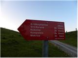 3
3 4
4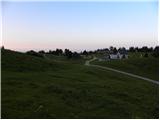 5
5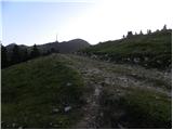 6
6 7
7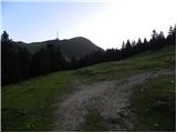 8
8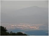 9
9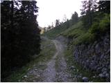 10
10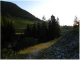 11
11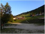 12
12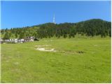 13
13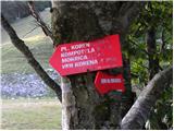 14
14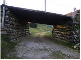 15
15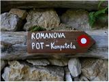 16
16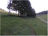 17
17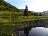 18
18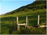 19
19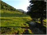 20
20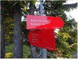 21
21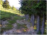 22
22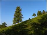 23
23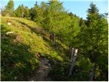 24
24 25
25 26
26 27
27 28
28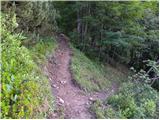 29
29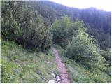 30
30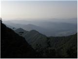 31
31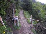 32
32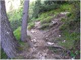 33
33 34
34 35
35 36
36 37
37 38
38 39
39 40
40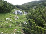 41
41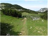 42
42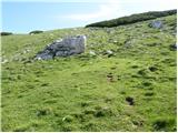 43
43 44
44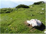 45
45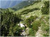 46
46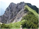 47
47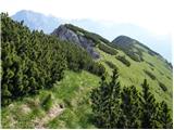 48
48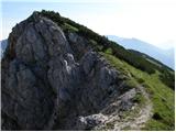 49
49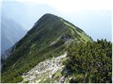 50
50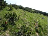 51
51 52
52
Discussion about the trail Planina Jezerca - Mokrica (via Kompotela)
|
| velkavrh31. 08. 2013 |
Baje se od vrha Mokrice spusti do Medvedove jame, kjer še vedno najdemo koščice jamskih medvedov-bom probal v kratkem.
|
|
|
|
| torbica32. 07. 2019 |
Torbica
2.7.2019 Zelo lepa tura. razgledi čudoviti. 29.6.2019 poti in markacije obnovljene. Tura primerna za vse starostne skupine. Varen korak
|
|
|