Planina Podvežak - Deska (Veža) (snowy approach)
Starting point: Planina Podvežak (1500 m)
| Lat/Lon: | 46,3319°N 14,6726°E |
| |
Name of path: snowy approach
Time of walking: 1 h 30 min
Difficulty: easy unmarked way
Altitude difference: 470 m
Altitude difference po putu: 470 m
Map: Kamniške in Savinjske Alpe 1:50.000
Recommended equipment (summer):
Recommended equipment (winter): ice axe, crampons
Views: 6.958
 | 2 people like this post |
Access to the starting point:
a) From Kamnik, drive to Stahovica, where you will reach a junction of two roads. The left one goes into the valley of Kamnik Bistrica, while our road goes straight towards Črnivec. Follow the rather winding road almost to the Črnivec Pass. A few hundred metres before the pass, a steep road to Kranjski rak branches off sharp left. The road then leads to the refreshment rom at Kranjski rak, and just a few metres further on to a crossroads. Continue straight down towards Luce. After a long descent, the road leads to the Podvolovjek valley. Here, on the left-hand side of the road, you will see the bar at Gams. Go about 100m further to where you see signs on the right for Korošica, Podveža, Ravne. . . (the road marking is just over 11km). Turn left onto this road and follow it at the next crossroads, following the signs mountain pasture to Podvežak. The junctions are marked with signs. Park in the parking lot next to the small wooden garage, where a minor road closed to traffic branches off to the right (the gate, if open, does not continue with the drive as others are already on the outside).
b) From the Štajerska side, take the Mozirje and follow the road towards the Logar valley. In the village of Luče turn left towards Kamnik and follow the road until the road sign 10. 5 km. Here you should pay attention, because soon the road to mountain pasture Podvežak branches off to the right. On the left side of the road there are signs for Korošica. Take this road and follow it at the crossroads after the signs mountain pasture Podvežak. Continue following the above description.
PS: The road is ploughed in winter up to Planinsko about 1100 m high. Once the road crosses a large clearing above Planinšek, the ascent can be continued up this clearing to the left, where there is a waymarked trail. When you reach the road, follow it left to the parking lot. Continue following the description.
Path description:
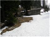
From the parking lot, take the worse road, first through the forest and then along the edge of mountain pasture to the house at mountain pasture. At mountain pasture, a signpost directs you right up mountain pasture. The path quickly leads into the forest, which we soon leave. Continue along a small valley surrounded by a sparse forest. At the end of the valley the path turns slightly left and then crosses the slopes in a few short descents and ascents. After the last descent, the path leads to a beautiful plain where you leave the marked path to Korošica. At the end of the plain, a small valley, at first indistinct, opens up slightly to the left. Take the route of this valley and follow it upwards. If there is little snow, take care to look for suitable transitions between dwarf pines. As dwarf pines is not very dense it will not be difficult to find these passages. Follow the valley, which is prone to avalanches in unfavourable conditions, to where a nice passage opens on the right (the passage straight up is quite steep and dangerous for slipping and avalanches). This passage is a bit steeper but not to steep. At the top of this passage, an undistinguished valley opens up to the left. Continue walking along this valley, which soon bypasses a sinkhole on the right and then leads us in a slight ascent to a small saddle between Tolstim vrh on the right and Desko on the left. Here we turn left and follow the broad summit ridge, which is covered in places with dwarf pines, to reach the summit in just over ten minutes, where cairn stands.

Pictures:
 1
1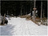 2
2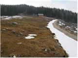 3
3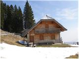 4
4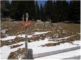 5
5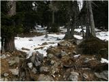 6
6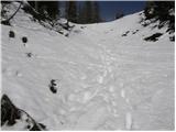 7
7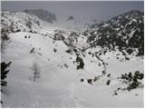 8
8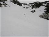 9
9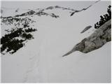 10
10 11
11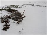 12
12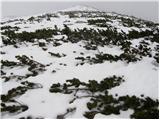 13
13 14
14
Discussion about the trail Planina Podvežak - Deska (Veža) (snowy approach)