Planina Jezerca - Kržišče (Pokovše)
Starting point: Planina Jezerca (1410 m)
| Lat/Lon: | 46,2855°N 14,5314°E |
| |
Time of walking: 40 min
Difficulty: easy unmarked way
Altitude difference: 248 m
Altitude difference po putu: 248 m
Map: Kamniške in Savinjske Alpe 1:50.000
Recommended equipment (summer):
Recommended equipment (winter): ice axe, crampons
Views: 2.282
 | 2 people like this post |
Access to the starting point:
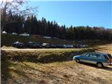
a) From the motorway Ljubljana - Jesenice take the exit Vodice, then continue to the first semaphore crossing in Vodice, where you turn left towards Cerkelj na Gorenjskem and Brnik. When you reach the main roundabout at Spodnji Brnik, continue driving in the direction of Cerkeliai and the ski resort Krvavec. At the end of Cerklje na Gorenjskem, leave the main road, which continues towards Velesovo and Visoke, and turn slightly right onto the road towards the ski resort Krvavec. Continue to the village of Grad, where signs for Ambrož pod Krvavcem direct you to the right on a steep asphalt road (straight ahead to the lower station of the round-cabin cable car to Krvavec and Štefanja Gora). When the steepness of the steep road eases slightly, you will come to a junction, where you will continue to the left in the direction of Ambrož pod Krvavcem (straight ahead to the settlements of Ravne, Apno and Šenturška Gora). A little further on, the road descends a little and then climbs over slopes that are sometimes quite scenic. Higher up, you reach Ambrož pod Krvavcem, where you pass the church of St Ambrose and the tourist farm Pr Ambružarju on the left. From the tourist farm the road passes into the forest and climbs through it to mountain pasture Jezerec, where there is a large parking lot.
b) From the motorway Jesenice - Ljubljana take the exit Kranj - East, then continue to Brnik, Komenda and Mengeš. When you reach the main roundabout at Spodnji Brnik, continue driving towards Cerkeliai and the ski resort Krvavec. At the end of Cerklje na Gorenjskem, leave the main road, which continues towards Velesovo and Visoke, and turn slightly right onto the road towards the ski resort Krvavec. Continue to the village of Grad, where the signs for Ambrož pod Krvavcem direct you to the right on a steep asphalt road (straight ahead to the lower station of the circular cable car to Krvavec and Štefanja Gora). When the steepness of the steep road eases slightly, you will come to a crossroads, where you will continue to the left in the direction of Ambrož pod Krvavcem (straight ahead to the settlements of Ravne, Apno and Šenturška Gora). A little further on, the road descends a little and then climbs over slopes that are sometimes quite scenic. Higher up, you reach Ambrož pod Krvavcem, where you pass the church of St Ambrose and the tourist farm Pr Ambružarju on the left. From the tourist farm the road passes into the forest and climbs through it to mountain pasture Jezerec, where there is a large parking lot.
Path description:
At the end of the parking lot we see the mountain signs for Kriška planina, which direct us to the footpath that climbs between the two roads. After a few minutes of steep ascent, reach cart track (you can also take cart track to get here) and follow it to the left. With fine views as far as Julian Alps, you quickly reach an unmarked crossroads, where you leave the marked path leading to Kriška planina and continue climbing along the right-hand cart track, which then ascends transversely. The cart track ascending soon turns into a footpath which leads to the ski slope. The ascent continues along a fainter path which continues along the ski slope (walking on the ski slope is forbidden when the ski slope is in operation), and it becomes increasingly faint as you go higher up, but there are no problems with orientation, as you follow the path upwards all the time. When we reach the top station of the lift to Kržišče, we are at the summit, from which we are only a few minutes' easy walk from the main summit.
Description and pictures refer to 2016 (October).

Pictures:
 1
1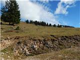 2
2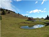 3
3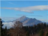 4
4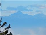 5
5 6
6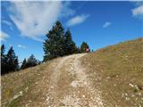 7
7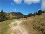 8
8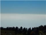 9
9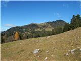 10
10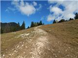 11
11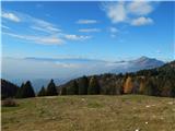 12
12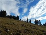 13
13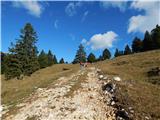 14
14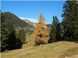 15
15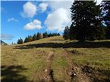 16
16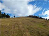 17
17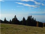 18
18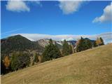 19
19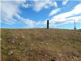 20
20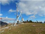 21
21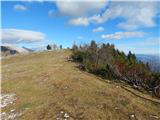 22
22 23
23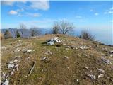 24
24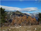 25
25
Discussion about the trail Planina Jezerca - Kržišče (Pokovše)