V Koncu - Jezerska Kočna (via Kokrska Kočna)
Starting point: V Koncu (900 m)
| Lat/Lon: | 46,342°N 14,5682°E |
| |
Name of path: via Kokrska Kočna
Time of walking: 6 h
Difficulty: very difficult marked way
Altitude difference: 1640 m
Altitude difference po putu: 1835 m
Map: Kamniške in Savinjske Alpe 1:50.000
Recommended equipment (summer): helmet, self belay set
Recommended equipment (winter): helmet, self belay set, ice axe, crampons
Views: 15.200
 | 1 person likes this post |
Access to the starting point:
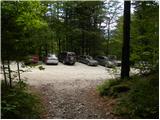
Drive into Kamnik and follow the road towards the Kamnik Bistrica valley. From your home in Kamniška Bistrica, continue driving along the forest road, which takes you higher up to a crossroads where you continue straight ahead (right Jermanca, starting point for Kamniško sedlo). The road then takes you past Žagana peči to the parking lot at the lower station of the cargo cableway to Kokrsko sedlo.
After the new traffic sign, driving from the Kamniški Bistrica hut to the V Koncu parking lot is forbidden, which extends the journey by almost an hour.
Path description:
From the parking lot at the cargo cableway, follow the initially sloping footpath towards Kokrsko sedlo. The path first crosses lane of bushes, then passes into a dense forest, where it starts to climb steeply. Higher up, the forest becomes a little thinner, opening up some views of the surrounding peaks. The path, which continues to climb steeply, leads us higher up to two successive steel cables (quite easy in the dry), after which we come to a pleasant resting place with a bench.
The path then returns to the dense forest and then starts to turn to the right, where the steepness of the path eases for a short time. The path goes a little further out of the forest, crosses an undistinguished ravine and then leads us to the avalanche slopes below Kokrsko sedlo. Here the path turns slightly to the left and starts to climb steeply up the mostly rocky slope. The rather strenuous path (due to the rubble), which passes under the Kalška gora walls on the left and the lesser-known Mali vrh on the right, with increasingly beautiful views, eventually leads to Cojz's hut on Kokrsko sedlo.
From the saddle, continue right in the direction of Grintovec and Kočna (Kalški greben to the left, straight down Kokra) along the path, which climbs steeply for a short time. The steepness soon eases and after a few minutes of further walking the path leads to a marked crossroads where you continue straight in the direction of Grintovec (slightly right Skuta). A few minutes of traversing the slopes follows, along a path that turns increasingly to the left. After a slight descent, the path leads us into a flatter world (the lower part of the Caves), and then begins to climb crosswise towards the roof of Grintovec. At the top of the cross-climb you reach a marked crossroads.
Continue left towards Kočna, and the path to the right leads to the top of Grintovec. The path then crosses steep grassy slopes to the west and then begins to descend. Later, the path turns right and continues to descend gently, crossing slightly exposed slopes until it reaches the gentle grassy slopes (Srednji Dolci). Here it joins the path leading over Grdi graben, and a few metres later we are back at the crossroads.
Bear left towards the bivouac and Kokrska Kočna, and right towards Dolška škrbina and then on to Jezerska Kočna or Grintovec. The path then crosses a scree slope to the left and climbs over a short ravine. Just above the ravine, an unmarked trail branches off to the left towards Bivouac in Kočna, which can already be seen and is only a few minutes' walk from the marked trail. Continue up the marked path to the right and soon start climbing up the scree. In the upper part of the scree, the path turns left and leads to a slightly more difficult rocky part of the path. Here you turn slightly to the right again and climb up the slope with easier climbing. The path is not protected, but there are enough rocks to climb up without any major problems. In the last part towards the top, the path becomes a bit steeper and there are some rope cables to help us.
From Kokrska Kočna continue along the marked path towards Jezerská Kočna. The well-guarded path first descends into the ravine between the two Kočnas and then begins to climb towards the top of Jezerská Kočna. Just before the summit, you will reach a marked crossroads, where you continue to the left (Jezersko and (Z)Dolška notch on the right). A few steps of walking and a very scenic route will lead us to the spacious summit of Jezerská Kočna.

Pictures:
 1
1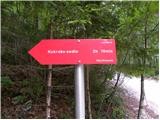 2
2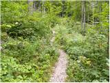 3
3 4
4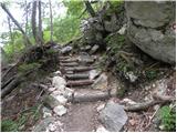 5
5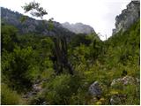 6
6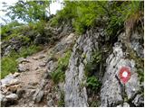 7
7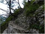 8
8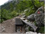 9
9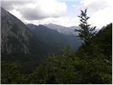 10
10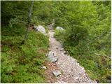 11
11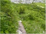 12
12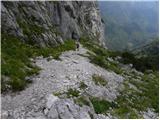 13
13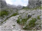 14
14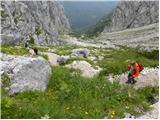 15
15 16
16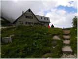 17
17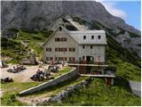 18
18 19
19 20
20 21
21 22
22 23
23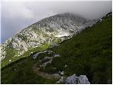 24
24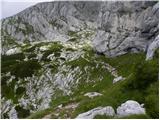 25
25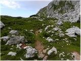 26
26 27
27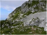 28
28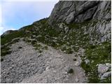 29
29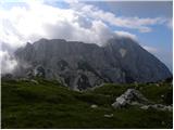 30
30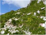 31
31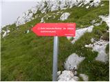 32
32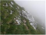 33
33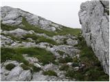 34
34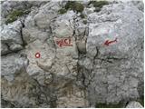 35
35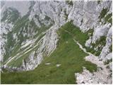 36
36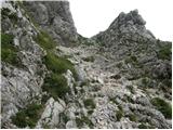 37
37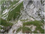 38
38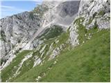 39
39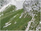 40
40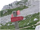 41
41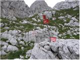 42
42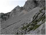 43
43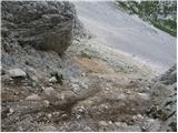 44
44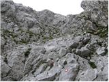 45
45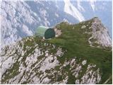 46
46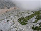 47
47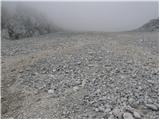 48
48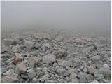 49
49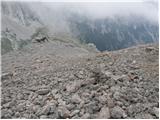 50
50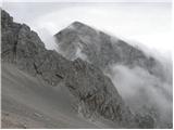 51
51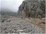 52
52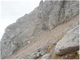 53
53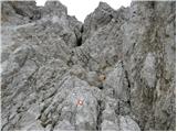 54
54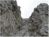 55
55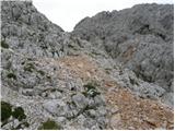 56
56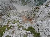 57
57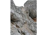 58
58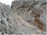 59
59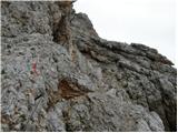 60
60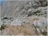 61
61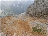 62
62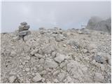 63
63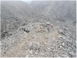 64
64 65
65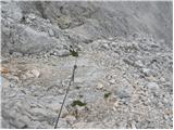 66
66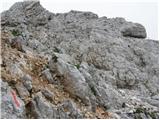 67
67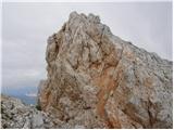 68
68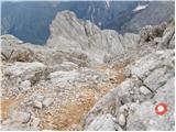 69
69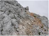 70
70 71
71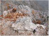 72
72
Discussion about the trail V Koncu - Jezerska Kočna (via Kokrska Kočna)
|
| zokipoki25. 08. 2016 |
Je kdo, ki bi se mi to nedeljo pridružil na tej turi? Hodin počasi 
|
|
|
|
| zokipoki28. 08. 2016 |
Jebena do melišča pod bivakom pod kočno je pot raznolika in nezahtevna. Melišče pa mi je pobralo veliko energije. Ni shojeno in zato se skoraj vsak korak pogrezne za enega nazaj težaven vzpon. Stena do kokrske kočne krušljiva in polna drobirja, sicer ne preveč zahtevna. Grebenska pot je poglavje zase. Poleg drobirja, težavo predstavljajo na dveh delih strgane jeklenice. Pol ure je malo za prehod med vrhoma, vendar je to ključni del poti, ki zahteva veliko previdnosti in zbranosti. Povratek čez dolce brez posebnosti. Pivo na cojzovi neprecenljivo.
|
|
|