Dom v Dragi - Koča na Dobrči (via Preval-a)
Starting point: Dom v Dragi (689 m)
| Lat/Lon: | 46,395°N 14,2183°E |
| |
Name of path: via Preval-a
Time of walking: 4 h
Difficulty: partly demanding marked way
Altitude difference: 789 m
Altitude difference po putu: 995 m
Map: Karavanke 1:50.000 - osrednji del
Recommended equipment (summer): helmet
Recommended equipment (winter): helmet, ice axe, crampons
Views: 1.780
 | 1 person likes this post |
Access to the starting point:
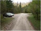
From the motorway Ljubljana - Jesenice take the exit Radovljica (from the Gorenjska side take the exit Lesce) and follow the road towards Begunj. At the end of Begunje village, turn left towards the Draga home (Tržič on the right). The asphalted road then leads to a parking area near the Draga home. Park a little further on, as only guests are allowed to park in front of the Draga home.
Path description:
From the parking lot continue along the road, which takes us past the beehive in a few minutes walk to the crossroads, where we continue to the right in the direction of mountain pasture Preval čez Luknjo (to the left mountain pasture Planinca, Poljška mountain pasture and Roblek's home). The path crosses a stream and then climbs gently along the valley floor for some time.
Further on, the valley narrows, and the path leads us in a moderate ascent to a narrow ravine, along which, with the help of fixed safety gear, we climb steeply upwards.
The short sheltered part is not technically particularly difficult, but is exposed to falling rocks.
Higher up, the path leads out of the ravine, where it then continues along the stream for some time. There is a short climb up a short ladder (not difficult) and then the path enters the forest, where it continues until it reaches a worse road.
Follow the road for a few steps and then the signs direct you to the right onto a waymarked footpath which continues along and along cart track. Higher up, cart track finally turns into a footpath which heads slightly to the right and starts to climb steeply. Follow this relatively steep path in the last part all the way to mountain pasture Preval, which is reached after a few minutes of further walking. On mountain pasture there is also a shepherd's hut, which can be reached in a few further steps.
The hut, which offers a beautiful view all the way to Triglav, is bypassed on the left, and we continue in the direction of Dobrča. The marked trail to Dobrča, which we follow, passes an unnamed peak on the left, and when the trail returns to the ridge, we reach it at the saddle between Čisovec and the unnamed peak.
At this saddle, the marked trail to Dobrča turns right downhill (straight unmarked trail to Čisovec) and passes onto the western slopes of Čisovec, where the trail leads us across the sometimes quite steep slopes. There follows a longer crossing on a poorly maintained path, which is usually full of foliage and in several places somewhat damaged by erosion. In the following we cross a few more ravines, then the slope becomes less steep, but the path occasionally opens up some views towards Begunjščica, Stolu, Julian Alps, Gorenjska. . . A little further on, we reach the southern ridge of Čisovec, where the path starts to descend (here, a few steps off the path, we can see a stand of auricles, usually in April or May), and occasionally we get a view of the Kamniško Savinjske Alps. Lower down, the path descends even more steeply, and then leads to the Vrh Luž preval, where we join the unmarked path past Waterfall Tominčev slap on the left, and the path from the Črnega potok on the right.
Continue straight ahead, mainly along the ridge, which is occasionally climbed. Later, a path leading over the Ledena trata joins us from the right, and our route gradually turns off the ridge to the right and onto the increasingly steep slopes of Dobrča. There follows a cross-climb over a steep slope, where extra care is needed in the wet, and then the path is laid and leads us over a grazing fence to cart track, after which we walk to the edge of Maria Elender Alm, where there is a marked crossroads.
Continue in the direction of the Hut on Dobrča (left Dobrča, right road descending to Zadnja vas), which is reached after 3 minutes of further walking.
Dom v Dragi - Prevala 1:30, Prevala - Koča na Dobrča 2:30.

Pictures:
 1
1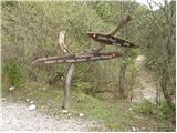 2
2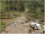 3
3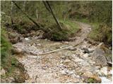 4
4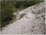 5
5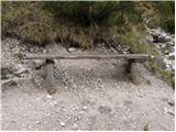 6
6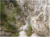 7
7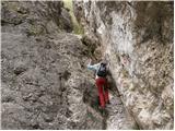 8
8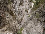 9
9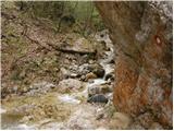 10
10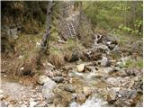 11
11 12
12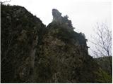 13
13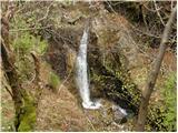 14
14 15
15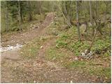 16
16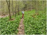 17
17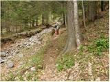 18
18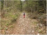 19
19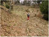 20
20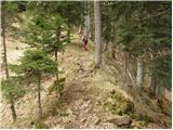 21
21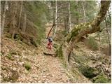 22
22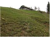 23
23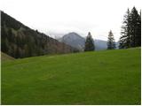 24
24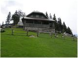 25
25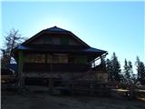 26
26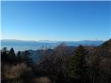 27
27 28
28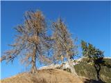 29
29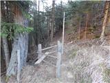 30
30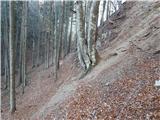 31
31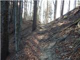 32
32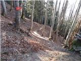 33
33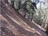 34
34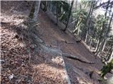 35
35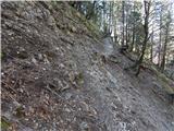 36
36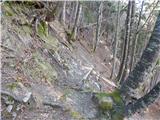 37
37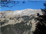 38
38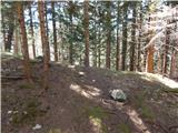 39
39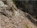 40
40 41
41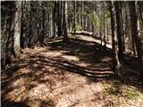 42
42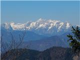 43
43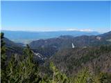 44
44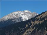 45
45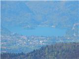 46
46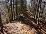 47
47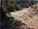 48
48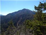 49
49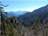 50
50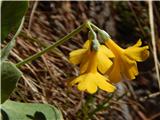 51
51 52
52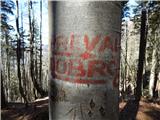 53
53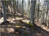 54
54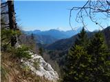 55
55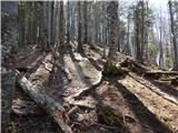 56
56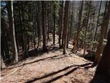 57
57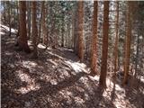 58
58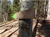 59
59 60
60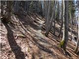 61
61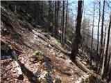 62
62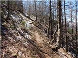 63
63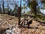 64
64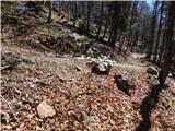 65
65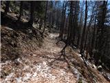 66
66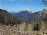 67
67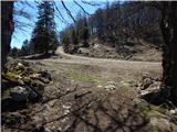 68
68 69
69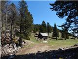 70
70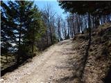 71
71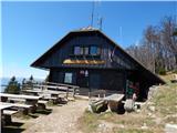 72
72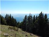 73
73
Discussion about the trail Dom v Dragi - Koča na Dobrči (via Preval-a)
|
| Lord Pes16. 08. 2023 13:18:46 |
Zaradi zadnjih vremenskih ujm, je pot dejansko neprepoznavna, sredi poti zemljski plazovi, zato si primoran večkrat pot zapustiti, prejšnji vikend sva se na tej poti s partnerko izgubila, so pa nama na pomoč priskočili GRZS iz Tržiča in naju varno spravili do Drage, tudi na tem mestu, se jim še enkrat zahvaljujem.
(pot od planine Preval do koče na Dobrči)
|
|
|