Plockenpass - Cima di Mezzo / Keller Warte (via Vallone della Chianevate)
Starting point: Plockenpass (1360 m)
| Lat/Lon: | 46,6027°N 12,9447°E |
| |
Name of path: via Vallone della Chianevate
Time of walking: 4 h 30 min
Difficulty: very difficult pathless terrain
Altitude difference: 1353 m
Altitude difference po putu: 1390 m
Map: Tabacco 09 1:25.000
Recommended equipment (summer): helmet, self belay set
Recommended equipment (winter): helmet, self belay set, ice axe, crampons
Views: 689
 | 4 people like this post |
Access to the starting point:
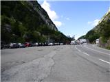
From Trbiž / Tarvisio, take the motorway to Udine. Leave the motorway at the exit for Tolmezzo. Follow the signs for Austria and the Passo di Croce Carnico / Plockenpass. On the Italian side of the pass, park in a large parking lot.
Path description:
At the parking lot, take the narrow road marked Rifuggio Marinelli (route 146). After a few dozen metres, you will reach a crossroads where you turn right onto a military mulatier, which you then follow up through sparse woodland and meadows below the steep slopes of mountain Creta di Collinetta (2238m). The military mulatier becomes a track and soon you will reach a crossroads where the path to the top of the mountain branches off to the right.
We continue on the left path, which crosses the grassy slopes in a slight ascent and leads us to a small plain. An unmarked trail from mountain pasture Collinetta di Sotto joins us from the left, and just after this we reach a marked crossroads where the trail to Cresta Verde (2150m) branches off to the right. Continue along the 146 towards the Marinelli hut, which is still less than two hours away. Here the trail becomes a bit steeper and climbs through lightly overgrown bushes and tall grass. Once out of the scrub, the path becomes more level and a path branches off to the right to Creta di Collina (2659m).
Here, crossing quite steep slopes, we start to descend and some fixed safety gear is helpful. A slightly more challenging descent through a natural window and crossing steep slopes covered with nettles follows, leading to a junction.
The left-hand path leads to hut Rifugio Marinelli, and we head right up path 149 towards the summit of Cima di Mezzo. From the crossroads, we climb cross-country north-westwards for some time. At first it is mainly on grassy terrain, but higher up the trail turns slightly to the right and climbs up on rubble. The path is less visible in this part, but the orientation is aided by markings and some cairns. The path then becomes slightly more visible again and leads us to a crossroads.
Route 171 branches off to the right towards the south ridge of Creta di Collina, and we continue left along route 149. The trail then ascends crosswise over scree and grassy slopes. As the path becomes a little more level, a view opens up to the right towards the Vallone della Chianevate valley between the Creta della Chianevate and Creta Monumenz peaks. Here, leave the marked route 149 and head towards the valley. At first you walk on terrain that is mostly grass and then you come to scree. Continue for a long time along the pathless valley, which gradually turns slightly to the left. In the last part of the valley, the scree becomes a little steeper. Towards the end of the valley, turn left towards the notch between the peaks of Cima di Mezzo and Creta Monumenz. Enter the cliff to the right of this notch. Take the steep drop which leads to a ledge. Continue along the ledge and cross the wall to the left. As you cross, you also climb a little, and the ledge becomes more and more exposed. There is a short, almost vertical climb over which we are helped by a rope. The climb over the wall is not marked, so it is necessary to have some sense of orientation. Again there is a traverse which leads to the ropes. The path here turns right and there is a steep climb along the rocks up to a notch where you join the marked path from the south side. The climb up to this notch is very difficult and the less experienced will necessarily need an additional belaying with a rope.
At the notch where you join the marked trail, continue right and start climbing up the rocky slope. The path then climbs quite steeply for some time and leads us to the southern slopes of the mountain. Here the path turns to the right and climbs up a fairly steep slope to reach the summit.
From the summit, which also opens up a view of the main peak, we first descend a little and then there is a final easy climb to the lookout peak.

Pictures:
 1
1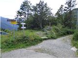 2
2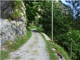 3
3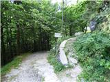 4
4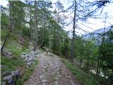 5
5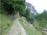 6
6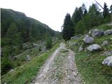 7
7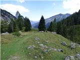 8
8 9
9 10
10 11
11 12
12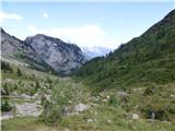 13
13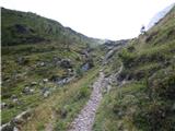 14
14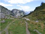 15
15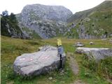 16
16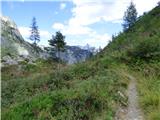 17
17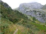 18
18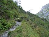 19
19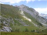 20
20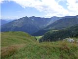 21
21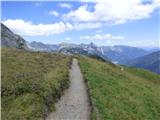 22
22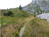 23
23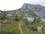 24
24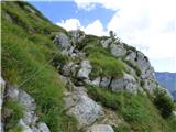 25
25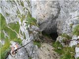 26
26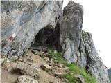 27
27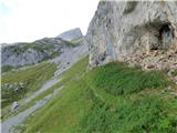 28
28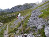 29
29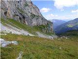 30
30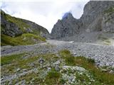 31
31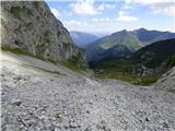 32
32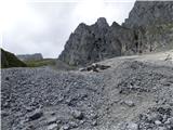 33
33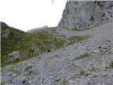 34
34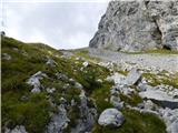 35
35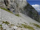 36
36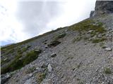 37
37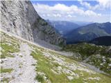 38
38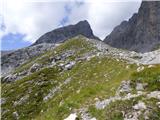 39
39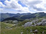 40
40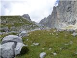 41
41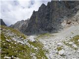 42
42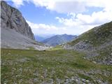 43
43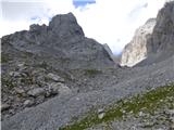 44
44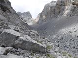 45
45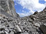 46
46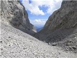 47
47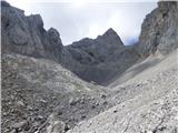 48
48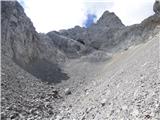 49
49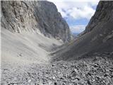 50
50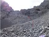 51
51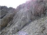 52
52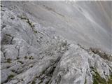 53
53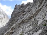 54
54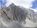 55
55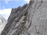 56
56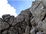 57
57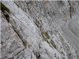 58
58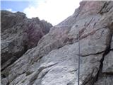 59
59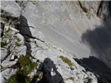 60
60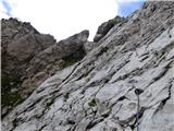 61
61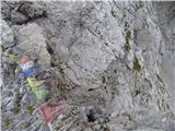 62
62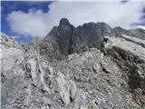 63
63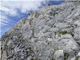 64
64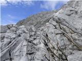 65
65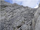 66
66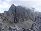 67
67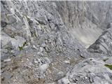 68
68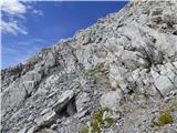 69
69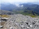 70
70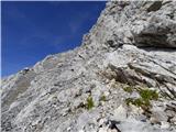 71
71 72
72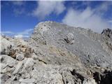 73
73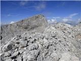 74
74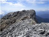 75
75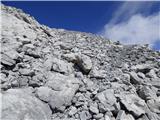 76
76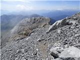 77
77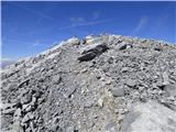 78
78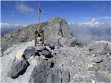 79
79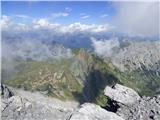 80
80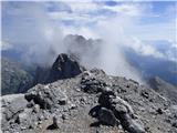 81
81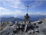 82
82
Discussion about the trail Plockenpass - Cima di Mezzo / Keller Warte (via Vallone della Chianevate)