Gravon di Gleris - Monte Chiavals
Starting point: Gravon di Gleris (1100 m)
Time of walking: 3 h
Difficulty: difficult marked way
Altitude difference: 998 m
Altitude difference po putu: 1160 m
Map: Tabacco št. 018
Recommended equipment (summer): helmet
Recommended equipment (winter): helmet, ice axe, crampons
Views: 1.840
 | 1 person likes this post |
Access to the starting point:
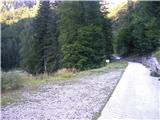
From Ljubljana, you will pass Jesenice, Kranjska Gora and Rateč on the way to Trbiz. Continue along the Kanal valley on the main road to Tablje (Pontebba); you can also use a short stretch of motorway. In Tablja, turn towards the Avpaska valley (Val Aupa). Signposts: Val Aupa, Studena alta. After a ten-minute drive between Frattis and Aupa, turn left into the valley of the Gravon di Gleris stream, where you will see the Crete di Gleris group for the first time. Continue along the valley on the asphalted road to an altitude of 1100 m, where there is a parking area on the left before a barrier.
Path description:
From the parking lot, walk for about 100 vertical metres along the paved road until you see signs on the right for the trail to the Pecora Stump (Forcella della Pecora; trail number 430). Here the leisurely warm-up is over as the trail inexorably heads uphill through the forest. The trail shows no signs of mass visitation and is accordingly narrow and overgrown in places, but is nevertheless easy to follow. At a height of about 1500 metres you reach a crossroads where you have two options for ascent. To the right is the Vacca notch; straight up is the Pecora notch. The first serves us with less unpleasant rubble and is suitable for both ascent and descent, while the second is a bit unpleasant and requires more concentration; neither, however, poses a major problem for the experienced mountaineer. Both options lead to a ridge where you join the beautiful High Route (mark 425; Alta Via C. A. I Moggio), which you follow to the left. If you choose the right-hand option via the Vacca notch, you will lose about 70 metres of elevation, but that's okay; it's a beautiful route. In the distance, we can already see the saddle in the western ridge of Chiavalsa, which seems still far away after the strenuous climb, but is reached surprisingly quickly. There, signs lead us steeply left towards the summit. Between the many climbs, we reach the summit in 15 minutes.

Pictures:
 1
1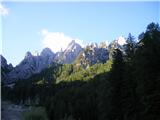 2
2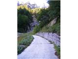 3
3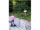 4
4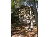 5
5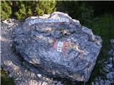 6
6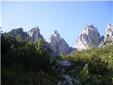 7
7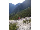 8
8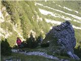 9
9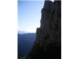 10
10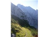 11
11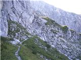 12
12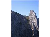 13
13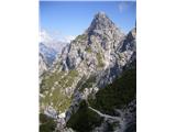 14
14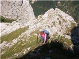 15
15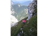 16
16 17
17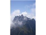 18
18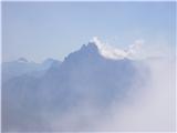 19
19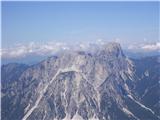 20
20
Discussion about the trail Gravon di Gleris - Monte Chiavals
|
| jani bele20. 10. 2021 09:17:54 |
Če opravimo vzpon čez Škrbino Alta di Ponte di Muro, je bil, preden se začnemo vzpenjati proti Škrbini di Chiavals, velik skalni podor, ki je odnesel del poti. Gibanje po izpranem drobirju je kar tvegano, otežujejo ga tudi sledi (sicer redkih) predhodnikov, ki so vsak po svoje iskali prehod.
|
|
|