Rifugio Sorgenti del Piave - Monte Chiadenis (CAI di Portogruaro)
Starting point: Rifugio Sorgenti del Piave (1815 m)
| Lat/Lon: | 46,6203°N 12,7157°E |
| |
Name of path: CAI di Portogruaro
Time of walking: 2 h 30 min
Difficulty: very difficult marked way
Altitude difference: 644 m
Altitude difference po putu: 750 m
Map: Tabacco 1
Recommended equipment (summer): helmet, self belay set
Recommended equipment (winter): helmet, self belay set, ice axe, crampons
Views: 4.897
 | 1 person likes this post |
Access to the starting point:
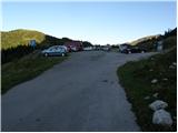
From the Trbiz/Tarvisio-Vieden/Udine motorway, take the Tolmezzo exit and follow the road towards the town. Near Tolmezzo, leave the main road leading to the Pso di Croce Carnico Pass/Plockenpass and head towards Villa Santina in Ampezzo. In Villa Santina, at the roundabout, go straight ahead following the signs Raveo, Rigolato. Follow this road until Cima Sapadda, where you turn right towards the summit of Monte Peralba. Follow the rather narrow and steep road to the large parking lot under the mighty Peralba. Park in the lower parking lot, where you will see signs for the Calvi hut (the hut at the source of the Piave is a little further on, about 500 m).
Path description:
From the parking lot, follow the tarmac road back a little way, then the signs for the Monte Avanza peak direct you left onto a footpath that crosses mostly grassy slopes to the east. After a few minutes' walk, the path starts to descend and quickly leads to a forest road, which you follow to the left. The road soon starts to descend more visibly, and we follow it straight ahead at small junctions (if we keep to the right we will come to a larger byte). The road, which by this time has become a bit wider cart track, then just leads us to the next marker for Monte Avanza (it takes us about 30 minutes to get here).
Continue towards the summit along the marked trail, which begins to climb steeply through the forest. Higher up, the steepness eases and the path leads us out of the forest onto almost unpaved slopes, where we arrive at an unmarked crossroads.
Continue sharp left, again on a steeper path, which is joined at a slightly higher altitude by a second cross-trail (this can also be reached by a cross-trail that crosses the slopes below the Monte Chiadenis summit). The path, which continues north-eastwards, gradually becomes a smaller but very distinct valley, which is followed for the next few minutes. Continue up the path until it reaches the summit of Monte Chiadenis. At a slightly larger rock, the marked path turns sharp left (straight unmarked path leading through the frost towards Monte Avanza - I advise against climbing this path due to the high risk of falling rocks) and climbs over partly overgrown scree to the foot of the wall. A wide path (an old mulatiera) leads over the aforementioned wall and ascends in switchbacks towards the Passo dei Cacciatori. A little below this saddle, a path branches off to the right, leading to the summit of Monte Avanza, and we continue straight ahead along another steeper path, which takes us up to the Passo dei Cacciatori saddle in a few minutes.
At the saddle, which offers a fine view to the north, we continue slightly to the left towards the Passo di Sesis. The path continues climbing gently over grassy slopes towards the imposing walls of the Monte Chiadenis peak. After a few minutes of further walking, the path splits in two. The left path leads to Monte Chiadenis and the right (straight ahead) to the Calvi hut and Monte Peralba. At the crossroads, continue left following the signs "Via Attrezzata Chiadenis, Cai di Portogruaro". After a short, easy climb up a grassy slope, you soon enter the climbing part of the route.
At first, the path climbs along a small ropeway and leads to the eastern slopes of the mountain. The path then turns to the right and starts to climb very steeply upwards to the right. The climbing here is very difficult as the route is only protected by a steel belay. The route continues to climb steeply along the steel cable for some time, and then, just below the ridge, it turns left and begins to cross the precipitous slopes to the south. Here you will also see a number of WWI remains along the way. The trail continues along the eastern side of the ridge and after a short descent and a few climbs along the cliff, it soon reaches a scenic peak.

Pictures:
 1
1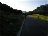 2
2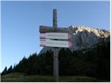 3
3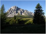 4
4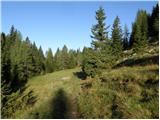 5
5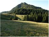 6
6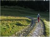 7
7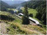 8
8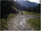 9
9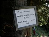 10
10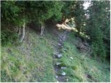 11
11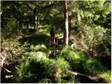 12
12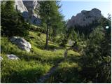 13
13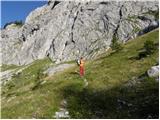 14
14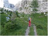 15
15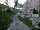 16
16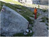 17
17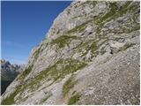 18
18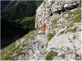 19
19 20
20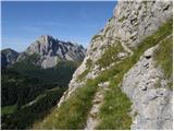 21
21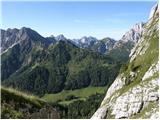 22
22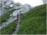 23
23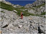 24
24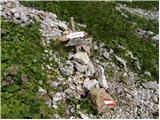 25
25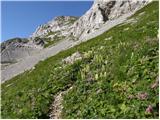 26
26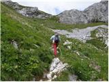 27
27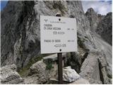 28
28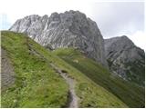 29
29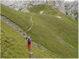 30
30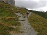 31
31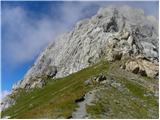 32
32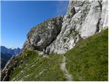 33
33 34
34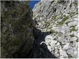 35
35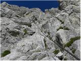 36
36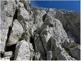 37
37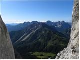 38
38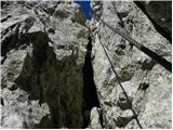 39
39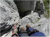 40
40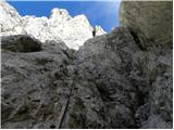 41
41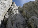 42
42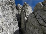 43
43 44
44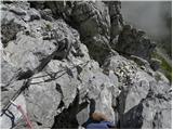 45
45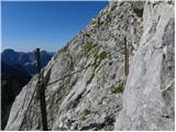 46
46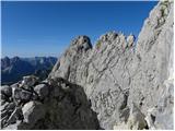 47
47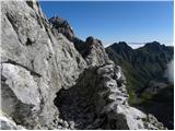 48
48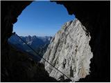 49
49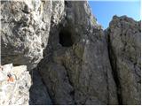 50
50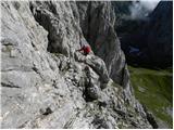 51
51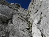 52
52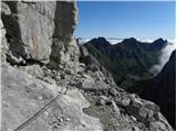 53
53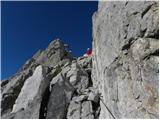 54
54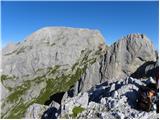 55
55
Discussion about the trail Rifugio Sorgenti del Piave - Monte Chiadenis (CAI di Portogruaro)
|
| malimiha13. 02. 2018 |
Zdravo, zanima me ali je ta pot primernejša za vzpon in sestop po jugozahodni poti ali obratno? Hvala in lp Miha
|
|
|
|
| mirank13. 02. 2018 |
Običajno se tod vzpenjamo; mislim da je tudi malenkost težja od one po jugozahodnem pobočju kjer sestopaš.
No mi smo se tam obakrat vzpenjali tudi zato, ker smo predhodno bili ali na Peralbi ali na Avanzi; torej je tod tudi edino logično nadaljevanje (združevanje) navedenih tur.
|
|
|