Rifugio Sorgenti del Piave - Monte Avanza
Starting point: Rifugio Sorgenti del Piave (1815 m)
| Lat/Lon: | 46,6203°N 12,7157°E |
| |
Time of walking: 3 h
Difficulty: partly demanding marked way
Altitude difference: 674 m
Altitude difference po putu: 800 m
Map:
Recommended equipment (summer): helmet
Recommended equipment (winter): helmet, ice axe, crampons
Views: 6.165
 | 1 person likes this post |
Access to the starting point:
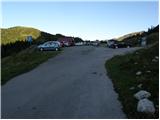
From the Trbiz/Tarvisio-Vieden/Udine motorway, take the Tolmezzo exit and follow the road towards the town. Near Tolmezzo, leave the main road leading to the Pso di Croce Carnico Pass/Plockenpass and head towards Villa Santina in Ampezzo. In Villa Santina, at the roundabout, go straight ahead following the signs Raveo, Rigolato. Follow this road until Cima Sapadda, where you turn right towards the summit of Monte Peralba. Follow the rather narrow and steep road to the large parking lot under the mighty Peralba. Park in the lower parking lot, where you will see signs for the Calvi hut (the hut at the source of the Piave is a little further on, about 500 m).
Path description:
From the parking lot, follow the tarmac road back a little way, then the signs for the Monte Avanza peak direct you left onto a footpath that crosses mostly grassy slopes to the east. After a few minutes' walk, the path starts to descend and quickly leads to a forest road, which you follow to the left. The road soon starts to descend more visibly, and we follow it straight ahead at small junctions (if we keep to the right we will come to a larger byte). The road, which by this time has become a bit wider cart track, then just leads us to the next marker for Monte Avanza (it takes us about 30 minutes to get here).
Continue towards the summit along the marked trail, which begins to climb steeply through the forest. Higher up, the steepness eases and the path leads us out of the forest onto almost unpaved slopes, where we arrive at an unmarked crossroads.
Continue sharp left, again on a steeper path, which is joined at a slightly higher level by another cross-trail (this can also be reached by a cross-trail that crosses the slopes below the summit of Monte Chiadenis). The path, which continues north-eastwards, gradually becomes a small but very distinct valley, which is followed for the next few minutes. At a slightly larger rock, the marked path turns sharp left (straight unmarked path leading through the frost towards Monte Avanza - I advise against climbing this path due to the high risk of falling rocks) and climbs over a partly overgrown scree field to the foot of the wall. A wide path (an old mulatiera) leads over the aforementioned wall and ascends in switchbacks towards the Passo dei Cacciatori. A little below this saddle, we come to a marked crossroads, where the signs for Monte Avanza direct us to the right onto vast scree fields, over which we climb to a pleasant grassy pass, from which we have a fine view of Monte Avanzo.
The path continues along the foot of the southern walls of Crete Cacciatori, crossing a small scree slope that ends at a larger ravine. Cross the ravine and follow the path marked with red dots. The path ahead climbs steeply on a wide and exposed artificial ledge (partly destroyed mulatiera), ending by crossing a precipitous slope (here we are helped by a rope). Next, a traverse is made along the foot of the cliffs, on a path that is dangerous for slipping due to the rubble. After a few minutes of scrambling, the slope flattens out and the path leads to the caverns dating back to the First World War. The path continues into a flatter world, over which you can walk to the top of the mountain in a few minutes. Here the path, which is further marked with numerous cairns (in the fog, orientation is rather difficult), climbs again a little steeper and after a good 10 minutes of further walking leads us to the summit.

Pictures:
 1
1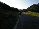 2
2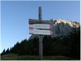 3
3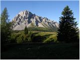 4
4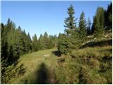 5
5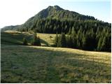 6
6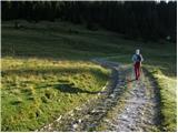 7
7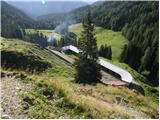 8
8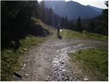 9
9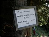 10
10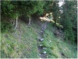 11
11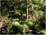 12
12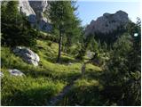 13
13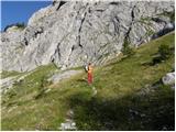 14
14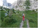 15
15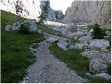 16
16 17
17 18
18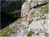 19
19 20
20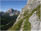 21
21 22
22 23
23 24
24 25
25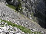 26
26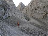 27
27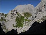 28
28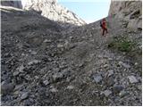 29
29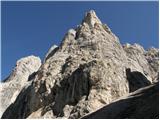 30
30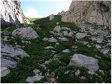 31
31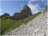 32
32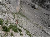 33
33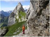 34
34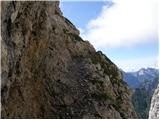 35
35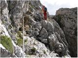 36
36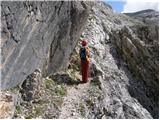 37
37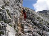 38
38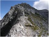 39
39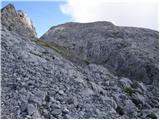 40
40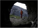 41
41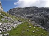 42
42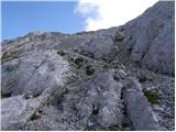 43
43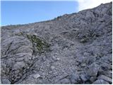 44
44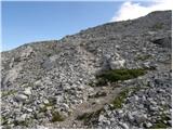 45
45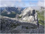 46
46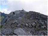 47
47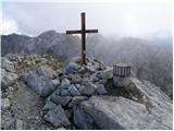 48
48 49
49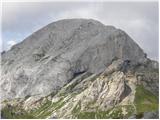 50
50
Discussion about the trail Rifugio Sorgenti del Piave - Monte Avanza
|
| mirank24. 07. 2017 |
Če namesto zavoja levo (sl 17) nadaljuješ naravnost v dolino-lepo vidno na sl 16 in na koncu preplezaš prag-balvan 2m višine (II+) ob pomoči rahitične žice izstopiš na trate 30m pod potjo (sl 42). Pač malo popestritve za tiste ki si tega želijo 
|
|
|
|
| Matjaz_654. 08. 2017 |
sam sem vzpon na monte avanzo združil z vzponom na monte chiadenis ... in napravil krožno turo BLOG in FOTKE
|
|
|
|
| Tadej15. 12. 2018 |
Opis je iz leta 2011, od takrat so tudi slike.
|
|
|
|
| Pi_is_exactly_321. 07. 2019 |
Veter je praktično po celi poti skozi gozd podrl ogromno smrek (par sto metrov nad gozdno mejo izgleda, da je podrtih kar nekaj hektarov). Od slike 10 do 13 je zato pot zelo težko prehodna (gre se za kakšnih 200 metrov višincev). Priporočam drugo variacijo poti: malo pred sliko 6 se zavije levo (je označeno razpotje), pot pa pripelje pod stene malo nad mestom iz slike 14. Ta pot je lahka, lepo označena in sanirana.
Še to: smerokaza iz slike 25 ni več; pot, na katero je potrebno zaviti desno na obsežna melišča pa tudi nima drugih oznak (to razpotje je kakšnih 150 metrov pod sedlom Passo dei Cacciatori).
|
|
|