Starting point: Lokvica (310 m)
| Lat/Lon: | 45,8695°N 13,6155°E |
| |
Time of walking: 4 h
Difficulty: easy marked way
Altitude difference: 333 m
Altitude difference po putu: 725 m
Map: Goriška 1:50.000
Recommended equipment (summer):
Recommended equipment (winter):
Views: 10.022
 | 1 person likes this post |
Access to the starting point:
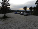
Take the motorway through the Vipava Valley to the border crossing Vrtojba, then at the large roundabout on the Italian side of the border continue towards the village Miren (you can also reach Miren by taking the regional road from Šempeter pri Gorici towards Dornberk. In this case, at Volčja draga, turn right, or left if you have come from Dornberk. From the village Miren continue driving towards Opatje Selo. After a few serpentines, the signs for Cerje direct you to the left on a macadam road, which you then follow to a parking area located just a few minutes below the Veliko Cerje monument.
Path description:
From the parking lot, continue along the macadam road, closed to traffic, which takes 5 minutes on foot to the Veliko Cerje monument.
From the monument, turn right along the initially wide path towards Fajti hrib. The path continues, initially gently descending, then climbing steeply over slopes that are initially quite scenic. The path then passes into a mostly pine forest, where it continues with some short ascents and descents. After a while, the forest road is crossed and the ascent continues along a narrower mountain path surrounded in several parts by thorns. The forest thins out higher up and the moderately steep path leads to Fajti hrib, where a small information board commemorates WWI.
From Fajti hrib we descend through a young pine forest (here we still have nice views) to the saddle between the aforementioned peak and Veliki vrh. At the saddle, cross the broad cart track, then start climbing to the 463 m high Big Peak, which is reached after a climb of about 20 minutes through forest and scrub.
From the Big Peak there is a descent of about 100 metres, ending at the next cart track. Continue along the marked path, which leads past a dilapidated bench into the dense forest, where it begins to climb moderately. After a climb of about 15 minutes, you reach Renški vrh 449 m.
There follows a relatively steep descent along the path, which quickly leads us to an asphalted road, which we only cross. The ascent continues in the direction of 'Trstelj after the peaks' along a rather overgrown mountain path which, after about 20 minutes of ascent, leads us to the forested peak Vrtovka.
From Vrtovka, continue along the path which descends gently to the east. After a few minutes of descent, the path leads us to a macadam road, which we follow for a few minutes, and then signs direct us to the right on a footpath that gradually begins to climb more steeply. Higher up, the path is laid and leads us past the caverns to Lešenjak.
From the top, continue in the direction Trstelj along the path which begins to descend to the east. After a few minutes, cross the power line and then join the less good dirt road. Follow the road for a few minutes and then the signs direct you to the left onto a relatively steep footpath, which will take you up to Stolovec in a few minutes. From Stolovec, the path leads us in a few minutes downhill to a worse forest road, which we follow for about 15 minutes, and then the signs for Trstelj direct us to the ascending footpath. The moderately steep path then quickly leads us to the top of Stol, only this is identified by a larger man, and we continue on the marked path, which descends for a short time, and then leads us in a gently sloping ascent to the top of Stol.
From Stol, we descend to a small sitting place, where there is a bench and a small cross, and then we climb up the moderately steep path to the Trstelj lookout in a few minutes.

Pictures:
 1
1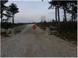 2
2 3
3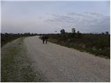 4
4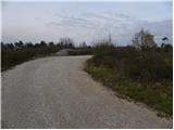 5
5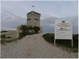 6
6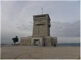 7
7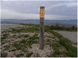 8
8 9
9 10
10 11
11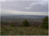 12
12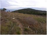 13
13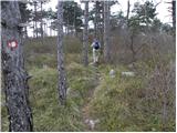 14
14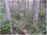 15
15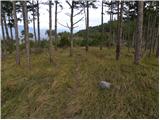 16
16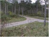 17
17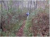 18
18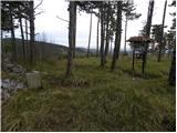 19
19 20
20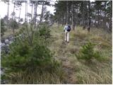 21
21 22
22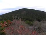 23
23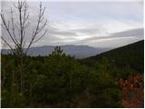 24
24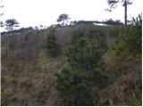 25
25 26
26 27
27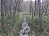 28
28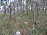 29
29 30
30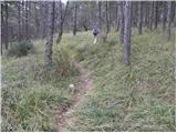 31
31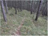 32
32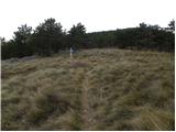 33
33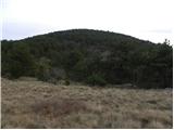 34
34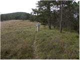 35
35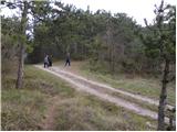 36
36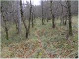 37
37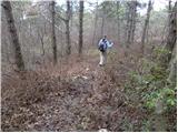 38
38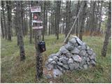 39
39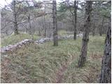 40
40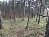 41
41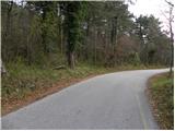 42
42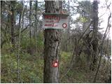 43
43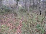 44
44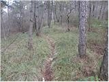 45
45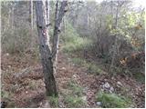 46
46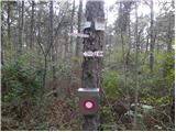 47
47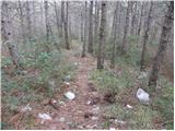 48
48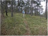 49
49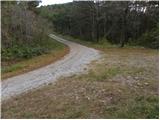 50
50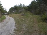 51
51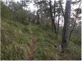 52
52 53
53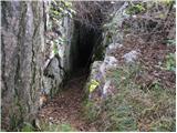 54
54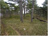 55
55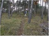 56
56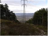 57
57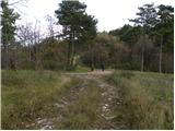 58
58 59
59 60
60 61
61 62
62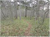 63
63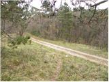 64
64 65
65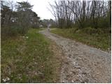 66
66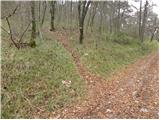 67
67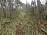 68
68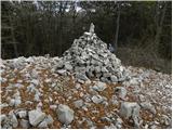 69
69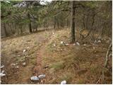 70
70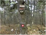 71
71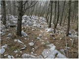 72
72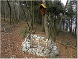 73
73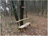 74
74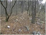 75
75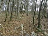 76
76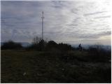 77
77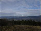 78
78
Discussion about the trail Lokvica - Trstelj
|
| Alpski Slovenc10. 02. 2012 |
Zgodilo se je. Izhodišče najinega pohoda na dan kulturnega praznika je bilo parkirišče pod Cerjami. Od spomenika nadaljujeva desno v smeri Fajti hriba oz. prehodila sva BRICEVO PLANINSKO POT, najino izhodišče je bilo Cerje ali (Veliki hrib) 343 m – ter nadaljevala po naslednjih vrhovih v zaporedju, Fajti hrib 464 m - Veliki vrh 463 m - Renški vrh 449 m - Vrtovka ali (Trešnik) 502 m - Lešenjak 565 m - Stolovec 563 m - Stol 629 m – in najin cilj je bil Trstelj 643 m. Na Renškem vrhu želim opozoriti na tiste, ki urejajo to pot, da bi zamenjali vpisno knjigo saj je že vsa v razsulu in jo je zob časa dodobra obdelal. Z Vrtovke nadaljujeva po poti, ki se spušča proti vzhodu. Že po nekaj minutah spusta naju pot pripelje na makadamsko cesto, kateri slediva, nato pa ni NOBENE markacije a se kljub temu usmeriva desno po makadamski poti, ki se strmo vzpenja in po nekaj minutah hoje zagledava markacijo (niti ni smernika za kateri hrib gre) na levi strani makadamske poti, ki so jo na novo uredili oz. razširili. (t.i. požarna pot). Ko zavijeva levo v hrib nas mimo kavern pripelje na hrib Lešenjak. Na vrhu hriba ni vpisne knjige niti nabiralnika, ta ki je nekoč bil pribit na bor je bil plastičen, a je odtrgan in odvržen na tla. Po nekaj minutah hoje prečiva daljnovod, nato pa se pot priključi na slabšo makadamsko cesto. Cesti slediva nekaj minut, nato pa nas markacije usmerijo levo na strmo peš pot, po kateri se povzpneva na Stolovec. Po spustu naju pripelje pot do gozdne ceste po kateri nadaljujeva približno 15 minut, nato pa naju oznake za Trstelj pripeljejo do zmerno strme poti in kaj hitro prideva do večjega možica, in nadaljujeva po markirani poti na vrh Stola. S Stola se spustimo na manjše sedelce, kjer stojita klop in manjši križ, nato pa se po zmerno strmi poti v nekaj minutah povzpnemo na Trstelj. Ves čas naju je spremljal veter, le na južni strani je bilo zatišje. Na vrhu Trstelja je kar dobro vleklo zato ga po nekaj minutah zapustiva in sva se začela vračati proti izhodišču. Za vso to prehojeno pot, tja in nazaj sva porabila 6 ur 30 minut.
|
|
|
|
| SunnyDay20. 11. 2012 |
Na poti z Vrtovke ob sestopu na makadamsko cesto sva takoj opazila markacije desno v klanec, na razširjeno gozdno pot (kot vlaka), potep pa nobenih več, tako da sva šla v bistvu okrog Lešenjaka po tej gozdni vlaki namesto čez vrh. Podobno se nama je zgodilo s Stolovcem. Skratka, z makadama/gozdne poti nisva opazila nobenih markacij ali pešpoti  . Šele potem s Stolovca na Stol sva spet ujela pešpot. Je pa celotna pot očiščena, nikjer ni bilo zaraščeno. Srečala sva samo le dva para pohodnikov, sicer pa nekaj kolesarjev (na makadamu), na zelo ozki in strmi stezi pa tudi skupino petih motoristov z motorji za kros   Na srečo so se vsaj počasi spuščali ... Prijeten planinski izlet! 
|
|
|
|
| SunnyDay20. 11. 2012 |
Še to: če pustiš avto v Lokvici na koncu vasi, pri zadnji hiši na desno (oznaka za parkirišče), si lahko ob poti ogledaš še 200-letno štirno (vodnjak), ki je bila nedavno obnovljena. Na parkirišču je tudi informativna tabla okoliških poti in znamenitosti ter nekdanje napajališče za živino. Od tu do Cerja (po pešpoti) je ca. 20-30 minut hoje po ravnem oz. položnem terenu.
|
|
|
|
| Ana Fila14. 04. 2019 |
Pot bi lahko bila tudi Cerje - Trstelj.
Prehodili smo jo v 3 urah. Res je, da zgoraj opisana pot na nekaterih mestih ni najbolj dosledna. Ampak vseeno služi temu, da najdeš vse markacije, kar pa je tudi najbolj pomembno. Mi smo našli vse markacije in prehodili vse vrhove do Trstelja. Ni bilo problema z orientacijo. Res pa je, da na nekaterih predelih ni povsem jasno, ko se priključiš makadamski poti v katero smer se obrniti.
|
|
|
|
| Ana Fila14. 04. 2019 |
Še to - klopov je ogromno v tem času.
|
|
|