Jablanica - Koča na Kozleku
Starting point: Jablanica (428 m)
| Lat/Lon: | 45,5429°N 14,2921°E |
| |
Time of walking: 1 h 45 min
Difficulty: easy marked way
Altitude difference: 569 m
Altitude difference po putu: 600 m
Map: Snežnik 1:50.000
Recommended equipment (summer):
Recommended equipment (winter):
Views: 16.402
 | 1 person likes this post |
Access to the starting point:
From the Ljubljana - Koper motorway, take the Postojna exit and follow the road towards Rijeka and Ilirska Bistrica. At the end of Ilirska Bistrica turn left towards the villages of Vrbovo, Jablanica and Trpčane. Continue past the villages Jasen, Vrbovo and Vrbica. Just after the village Vrbica turn left onto a dirt road, which after 30m leads to a village road, where you continue to the right. Continue for a few dozen metres to a roadside parking lot, which is located in front of a small bridge.
Path description:
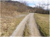
From the parking lot, cross the little bridge and along the road you will see the mountain signs for the castle and Kozlek. The markings direct us left to cart track, which soon has an unmarked crossroads where we continue right into the forest. The path along which we soon see the markings leads us past the ruins of a former church, where we again see the markings for the castle and Kozlek. Continue along the less well-trodden path, which leads us slightly higher to cart track, which we follow to the ruins of the former castle. Further on, cart track soon turns into a path which climbs steeply, on slopes which are sometimes overloked. A little higher up, the path joins the path from Vrbiška dol. Here, continue right on the path, which climbs moderately along a woded ridge. Soon you will reach the viewing slopes, which offer a beautiful view to the south, and to the east you can already see the Srednji vrh, which is the summit of Kozjek. Here the path descends for a short time, and then, in a moderate ascent through the forest, leads us to Srednji vrh.
From Srednji vrh, the path slowly descends to the saddle between the two peaks and then begins to climb again, initially on an uncultivated slope and higher through the forest. When you reach the Kozlek hut, the view opens up to the south and east. From the hut to the summit is only a few steps of easy walking.

Pictures:
 1
1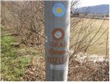 2
2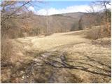 3
3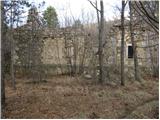 4
4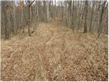 5
5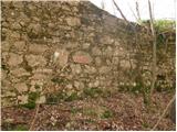 6
6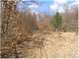 7
7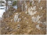 8
8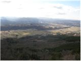 9
9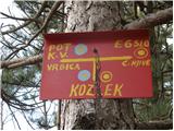 10
10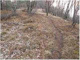 11
11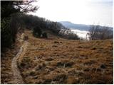 12
12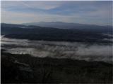 13
13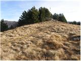 14
14 15
15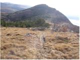 16
16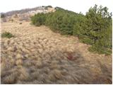 17
17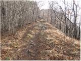 18
18 19
19
Discussion about the trail Jablanica - Koča na Kozleku
|
| odri30. 10. 2010 |
Ali kdo ve, če tudi tukaj kdaj lomastijo kakšni medvedi?
|
|
|
|
| marco11. 11. 2010 |
Na www.medvedi.si si lahko včasih pogledaš, saj spremljajo nekaj medvedov z telemetrijskimi (GPS oddajnik) ovratnicami.
|
|
|
|
| bizgo9326. 03. 2021 |
Večina pohodnikov se na Kozlek odpravi po poti iz Vrbiškega dola (ob cesti proti Sviščakom), ki je povsem primerna tudi za najmlajše.
Steza, ki se začne v Jablanici je daljša in na mestih kar precej strma, vendar zelo zanimiva. Že na začetku poti gremo mimo lepe struge potočka iz lehnjaka ter ruševin cerkve in gradu. Nato se steza precej napne in ne popusti vse do slemena pod Srednjim vrhom (po strmini imamo na nekaterih mestih lep pogled proti Ilirski Bistrici, okoliških vaseh in Ahcu).
Od Srednjega vrha do Kozleka je nato le še kakšnih 10-15 minut. Ob poti predvsem pa iz vrha pa imamo enkratne poglede na dolino reke Reke s Kočanijo in okoliška hribovja, Čičarijo ter Učko, enkraten pa je ob lepem vremenu pogled na severni del Velebita ter Kvarnerski zaliv s Krkom in Cresom. Ob koči se v vpisni skrinjici nahajata tudi vpisna knjiga ter žig.
|
|
|