Podgorje - Kojnik (via hunting cottage)
Starting point: Podgorje (518 m)
| Lat/Lon: | 45,5353°N 13,9435°E |
| |
Name of path: via hunting cottage
Time of walking: 1 h 30 min
Difficulty: easy unmarked way
Altitude difference: 284 m
Altitude difference po putu: 284 m
Map: Primorje in Kras 1:50.000
Recommended equipment (summer):
Recommended equipment (winter):
Views: 8.400
 | 1 person likes this post |
Access to the starting point:
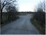
From the motorway Ljubljana - Koper take the exit Kozina. Follow the road towards Koper to the village Petrinje, where turn left towards Podgorje. The road, which climbs steeply at first, soon leads to the next crossroads, where you turn left. Continue to the village Podgorje, where you park in a large parking lot near the sports ground.
Access from Koper. Follow this road to a large parking lot near the sports ground, located in the village of Podgorje.
Path description:
From the parking lot, return to the main road and follow it in the direction of travel. After a few dozen metres, you reach a crossroads where wooden mountain signs direct you to the right. At the crossroads, continue along the road in the direction of Kojnik. The road, which runs without changes in elevation, has a few crossroads at the beginning, but everywhere you continue on the one that is the "main" road. Here and there you can see some faded markings indicating the way to Kojnik. After a while, the road gradually starts to climb and takes us a little higher to a crossroads where we continue to the left. Follow this road to the next crossroads, where you go left again. The way forward takes us past the Kojnik hunting shelter. Just above the shelter, leave the worse road and continue your ascent to the left into the forest along the marked path. After a short climb, we leave the forest and the path leads us to a view of grassy slopes, over which we climb crosswise. Above the viewing slope, the path passes into a pleasant pine grove, through which you climb to the top of Kojnik.

Pictures:
 1
1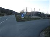 2
2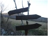 3
3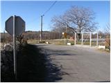 4
4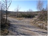 5
5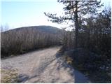 6
6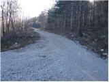 7
7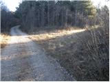 8
8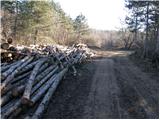 9
9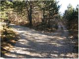 10
10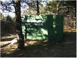 11
11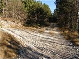 12
12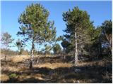 13
13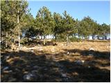 14
14 15
15
Discussion about the trail Podgorje - Kojnik (via hunting cottage)
|
| leibniz21. 05. 2012 |
opomba: Kmalu za lovskim zavetiščem se odcepi položna markirana steza levo, ki bistveno skrajša pot.
|
|
|
|
| leibniz21. 05. 2012 |
Ja se oproščam, v opisu je krajšnica navedena, na sliki pa označena samo daljša pot (z rdečo barvo).
|
|
|