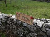
Starting point: Prešnica (480 m)
| Lat/Lon: | 45,5656°N 13,9417°E |
| |
Time of walking: 2 h
Difficulty: easy marked way
Altitude difference: 548 m
Altitude difference po putu: 575 m
Map: Primorje in Kras 1:50.000
Recommended equipment (summer):
Recommended equipment (winter):
Views: 23.130
 | 2 people like this post |
Access to the starting point:
a) From the motorway Ljubljana - Koper take the exit Kozina, then take the old road to Koper. When you reach the viaduct of the motorway, turn left towards Prešnica. At Prešnica we see the first markings, and we follow the markings through the village. At a small crossroads in the village, go right towards a marked parking area (straight ahead marked path to Slavnik), which is still about 500 m away on a narrow asphalt road.
b) From the Koper - Ljubljana motorway, take the Kastelec exit and then follow the old road towards Kozina. The road then leads past the village of Petrinje, and about 2 km after the village, from the junction under the motorway viaduct, turn right in the direction of Prešnica. In Prešnica we see the first markings, and we follow the markings through the village. At a small crossroads in the village, go right towards a marked parking area (straight ahead marked path to Slavnik), which is still about 500 m away on a narrow asphalt road.
Path description:
At the parking lot we see signs for Slavnik, which direct us through the underpass under the railway line, and a little beyond the underpass we continue left in the direction of the mountain path to Slavnik. There are a few more crossroads where we follow the signs for Slavnik, and a little higher up, a path leading from the centre of the village of Prešnica joins us from the left.
Continue to the right and follow the path as it climbs for some time, cross-climbing to the right. Higher up, the path leads past an interesting viewpoint, from which a beautiful view opens up, reaching all the way to the sea. A few minutes further from the viewpoint, the path, which has been steadily climbing moderately most of the time, lies down and crosses a macadam road (Hrpelje on the left, Slavnik and Podgorje on the right).
An easy climb follows, then cross another road, and a little after the crossing, the marked path from Hrpelj joins us from the left.
Continue in the direction of Slavnika, following the path which begins to climb a little more after the sign marking the Slavnik natural monument. The path quickly becomes more steep and just before reaching the macadam road, an unmarked path branches off to the right, which can be followed in a few minutes to the top of Grmada, where there is a fire lookout, and we continue straight ahead and continue along the road for a good 100 m, leaving it just a little further on from where the path from Skadanščina and Povžany joins us on the left. It is a pleasant walk along an initially gentle, then moderately steep grassy slope to Tum's hut on Slavnik, from which it is only a few 10 steps to the top of the scenic Slavnik.
Description and pictures refer to the situation in 2018 (April).

Pictures:
 1
1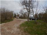 2
2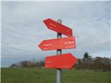 3
3 4
4 5
5 6
6 7
7 8
8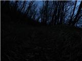 9
9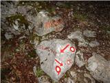 10
10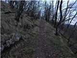 11
11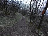 12
12 13
13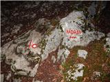 14
14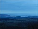 15
15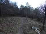 16
16 17
17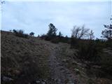 18
18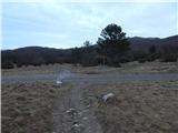 19
19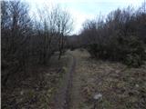 20
20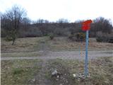 21
21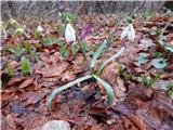 22
22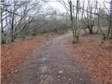 23
23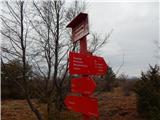 24
24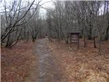 25
25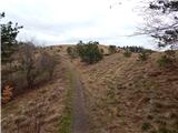 26
26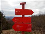 27
27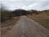 28
28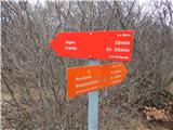 29
29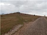 30
30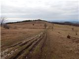 31
31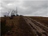 32
32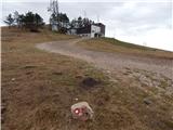 33
33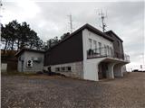 34
34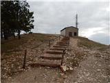 35
35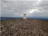 36
36 37
37
Discussion about the trail Prešnica - Slavnik
|
| zlatica18. 04. 2019 |
To je zame najlepša pot na Slavnik, nobenih posebnih strmin ni, ves čas te vodi pot z blagim naklonom skozi gozd in travnati del. Ppsebno lep konec poti po mehki ravni poti skozi borov gozd je od razgledišča naprej vse do izstopa iz gozda..
|
|
|
|
| damjan8523. 04. 2019 |
Odlična nedeljska pot  Naredil sem krožno pot, slika 3 je dala idejo  Prešnica - Podgorje - Slavnik - Grmada - Prešnica.
|
|
|
|
| soraya200222. 03. 2021 |
Včeraj ena lepa vetrovno sončna krožna....Prešnica-Grmada-Slavnik-Planina Jegno-Mišja Šoga-Lovski dom pod Glavico-Prešnica.
|
|
|