Predmeja (tunnels) - Kucelj na Čavnu (Srednječavenska pot)
Starting point: Predmeja (tunnels) (800 m)
| Lat/Lon: | 45,9377°N 13,8692°E |
| |
Name of path: Srednječavenska pot
Time of walking: 2 h
Difficulty: partly demanding marked way
Altitude difference: 437 m
Altitude difference po putu: 515 m
Map: Goriška 1:50.000
Recommended equipment (summer): helmet
Recommended equipment (winter): helmet, ice axe, crampons
Views: 18.128
 | 1 person likes this post |
Access to the starting point:
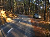
From the expressway Razdrto - Nova Gorica take the exit Ajdovščina and follow the road towards the village Lokavec (Lokavac can be reached from the centre of Ajdovščina, or from the old road Ajdovščina - Nova Gorica, where turn right at Cesta). From Lokavac, continue along the ascending winding road in the direction of Predmeja. Follow the road to the mountain signposts for Čaven, Veliki rob and Kucelj (the signposts are located between the quarry and the tunnels, the road marking is approx. 10 km). Park a few 10 m down the road in the parking lot.
The starting point can also be reached from Godovič, via Črni vrh and Colo to Predmeja. In this case, descend from Predmeja towards Ajdovščina and then park shortly after the third tunnel.
Path description:
From the parking lot, first walk to the route signs and then follow the Srednječavensko trail. The trail, which goes immediately into the forest, first climbs moderately and then continues crossing the slopes to the south. A wide and well-surfaced mountain path, it soon switches to steep slopes (danger of falling rocks) and gradually turns more and more to the right. A little further on, the path offers beautiful views of the Nanos and Vipava valleys, and the path gradually turns into a rockier world. A little further on, the path again enters a dense forest, where it begins to descend gently. After a short, gentle descent, you reach a crossroads, where you continue straight ahead (Lokavec down on the left, the hut at Čavno up on the right) along a path which, although it passes at an altitude of about 900 m, takes on the appearance of a real high-mountain path. The path leads us out of a mostly pine forest onto a scree slope, which opens up a beautiful view of the valley, with steep rocky cliffs to the right. At the end of the scree slope, the path passes into the walls of the eastern Mala gora, where we cross a wide and partly exposed ledge with the help of a rope. At the end of the ledge, we have a nice view of the Slano mudslide above Lokavec, and we continue along the Srednječavenská trail, which turns a little more to the right, where it begins to descend gently through lane of bushes. After a short descent, the path flattens out and we see a large rocky wall and a nice bench next to it for a short or longer rest. The path then continues through the forest and quickly leads to the next crossroads.
This time continue right in the direction of Mala gora and Čavna (left down Stomaž, straight on continues the Srednječavenska trail) on a path that begins to climb steeply. After a few minutes of steep ascent, the steepness eases and the path leads to the uncultivated grassy slopes of Mala gora, where you also reach the next crossroads. Here, continue left (straight up Koča na Čavnu) along the path, which mostly crosses the slopes to the west. After about 10 minutes' walk from the crossroads, the path descends and leads in a few steps to Hut na Mala gora. From the Hut on Mali gori, continue in the direction of Kuclj and Čavno. A few steps further on, we are joined on the left by cart track, which comes from the nearby hunting hut. Continue along the cart track, which soon branches off to the right to the Cottage na Čavnu.
Here, continue straight ahead on the cart track, which then leads us on the path from the Cottage on Čavnu towards Kuclju. Here, continue left along the path, which runs almost horizontally at first and then begins to climb. This path then soon leads us out of the forest, where we can already see Kucelj in front of us. It is only a 10-minute climb up the mountain slope.

Pictures:
 1
1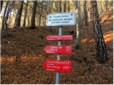 2
2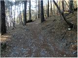 3
3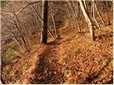 4
4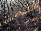 5
5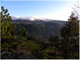 6
6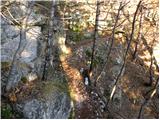 7
7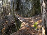 8
8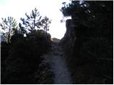 9
9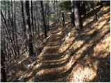 10
10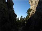 11
11 12
12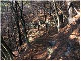 13
13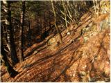 14
14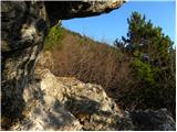 15
15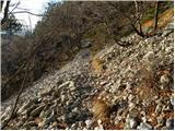 16
16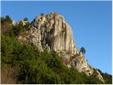 17
17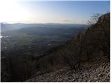 18
18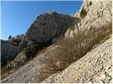 19
19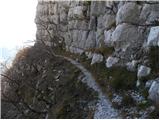 20
20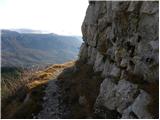 21
21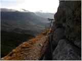 22
22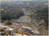 23
23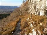 24
24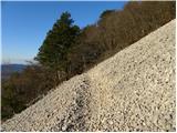 25
25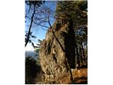 26
26 27
27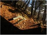 28
28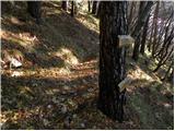 29
29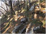 30
30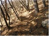 31
31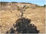 32
32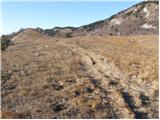 33
33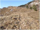 34
34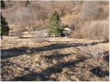 35
35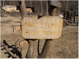 36
36 37
37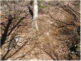 38
38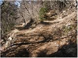 39
39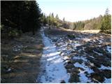 40
40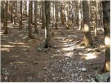 41
41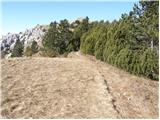 42
42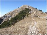 43
43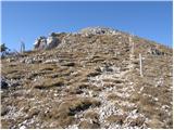 44
44 45
45
Discussion about the trail Predmeja (tunnels) - Kucelj na Čavnu (Srednječavenska pot)
|
| zaaien0310. 12. 2013 |
Pri koči na Mali gori nas je prijazen fant opozoril, da je naprej po poti veliko podrtega drevja, tako da smo šli nazaj do razpotja in do Koče na Čavnu.
|
|
|
|
| Eisheth24. 09. 2016 |
Pei koči na Mali gori je lesen smerokaz na katerem piše, da je do Kuclja ena ura. Midva sva danes prišla v 25-ih minutah. Na Mali gori piše na lesenem smerokazu celo 1,5. Na srečo sva srečala domačina, ki je potrdil, da smerokazi lažejo 
|
|
|
|
| ločanka13. 03. 2019 |
Čudovita pot, jaz bi ji rekla kar kraljevska, ki z vsemi občudovanji okolice (sploh če si prvič na poti) vzame nekaj več časa kot je tu predpisano. Priporočam še podaljšanje poti do Velikega Roba, za kar je potrebno dodati še eno uro, pa je več kot vredno. Če pa pri povratku nadaljuješ še proti Koči na Čavnu in se od tam spustiš spet na Srednječavensko pot, se vprašaš, kako da nisi te poti opravil že kdaj prej. Ja, ker nisi vedel kaj vse lepega te čaka 
|
|
|
|
| michael6622. 05. 2023 15:07:46 |
Za to pot se porabi 2.5 ure ob normalni hoji (pa nikar ne glejte čase po smerokazih)
|
|
|
|
| mirank22. 05. 2023 19:25:42 |
Mislim, da časi na tablah-sl 2, kar držijo: no mogoče je čas do Male gore kar malo raztegnjen. Pa tudi ta bi bil blizu, če se gre preko koče na Čavnu in ne po Poti po robu.
|
|
|