Široko - Veliki vrh (above Lom) (via Kanalski Lom - on trail Lom is my home)
Starting point: Široko (750 m)
| Lat/Lon: | 46,13207°N 13,75932°E |
| |
Name of path: via Kanalski Lom - on trail Lom is my home
Time of walking: 2 h 40 min
Difficulty: easy marked way
Altitude difference: 321 m
Altitude difference po putu: 530 m
Map:
Recommended equipment (summer):
Recommended equipment (winter):
Views: 2.580
 | 1 person likes this post |
Access to the starting point:
The starting point is at the Široko Tourist Farm in Tolmin Lom. Access from Nova Gorica and Idrija is described in more detail, access from Tolmin and across the Banjsko Plateau via Kanalski Lom is also possible.
a) From Nova Gorica, follow the signs for Bovec and Tolmin, drive through Kanal and then look out for the turn-off for Most na Soči (towards Idrija and Ljubljana). Continue driving through the village of Kozaršče, and in the centre of Most na Soči turn right at the crossroads towards Lom (ahead towards Ljubljana, left towards Tolmin). After crossing the bridge over the Idrijca River, continue along the steep local road into a sharp right turn. The road climbs for the next 4 kilometres and leads to a saddle where a steep road branches off to the left towards the Široko Tourist Farm. After about two kilometres of further climbing, you reach the tourist farm, where you find a parking place.
b) From the route of Idrija, follow the signs for Tolmin. In the centre of Most na Soči, at the crossroads, turn sharp left in the direction of Loma (ahead direction Nova Gorica, right direction Tolmin). After crossing the bridge over the Idrijca River, continue along the steep local road in a sharp right turn. The road climbs for the next 4 kilometres and leads to a saddle where a steep road branches off to the left towards the Široko Tourist Farm. After about two kilometres of further climbing, you reach the tourist farm, where you find a parking place.
Path description:
The route is easy and well marked with direction signs and blue-yellow markings (the 'Lom je moj dom' hiking trail), but care must be taken because of the many crossroads and branches. It follows a variety of surfaces - dirt tracks, forest tracks, paved and asphalt roads and paths. There are several places of interest along the way, which are described on info boards. The summit is very scenic.
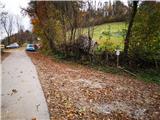
After parking at the tourist farm, you can continue to the viewpoint above the farm, otherwise find the starting point, which is slightly lower than the asphalt road, below the restaurant garden. Here, a signpost directs you to a track that descends towards the Chapel of Our Lady. From the chapel, continue down the cart track for a while and then you will reach a concrete road that leads through the hamlet. Outside the hamlet, just after the isolated house, at a right-hand bend by a concrete electricity point, turn left off the road down a less visible track that leads across meadows. In the warmer part of the year sheep may graze here, but the paddocks can be opened.
Follow cart track to a stream bed, which you must cross (do not turn immediately past the houses!), then you will come to a concrete road, which you follow to the right past two houses and a marked trough to a new hamlet, where the concrete road joins the tarmac local road. Here is the lowest point of the route and an information board on a small building. You can walk straight ahead to an interesting chapel just off the local road, otherwise continue to the left past a playground. After the last house in the hamlet, turn left onto the flatter road leading to the church, but before the incline leading to it, turn left again at the abandoned building. When you reach the next houses, follow the road up the slope to the left (straight ahead is the farm yard), which leads you past a trestle to Martin's homestead with an interesting arched mound. Turn right here and follow cart track, which leads to the cemetery. You can walk to the church on the right, otherwise follow the road to the right past several houses and Arne's stone-roofed blacksmith's shop.
At the next junction, turn right at the top of the hill and follow the road to the first sharp right turn. Leave the tarmac here and go straight through a gate onto a track in a fenced pasture. At the cattle watering trough, turn right off the wider path onto a narrower path that leads uphill through the pasture and may be covered with taller grass early in the grazing season. It is advisable to keep more to the left thereafter, as the path is better there. Higher up, the path loses a little, but soon you will see a small hut and a blue painted gate, through which you will reach the hut on Kal.
The signpost on the hut directs us to the left towards Brezno v Špilah. Follow the sloping and wide forest road, on across the pasture, where you can observe Močilo na Kalu on the right, and then on through the ramp into the forest. Higher up, the wide road ends and we continue on the narrow forest road logging trail, but after a few steps we turn right. Further on, logging trail climbs steeply in a few bends to a junction with the wider forest road logging trail, which crosses the forest in a gentle slope. You can turn left or straight back to the starting point at Široko, and continue sharp right towards Velikie Top. The trail then leads past the Abyss in Špila, slightly higher up the trail, which is open to the public. After a few bends, the path narrows and ascends to the boundary stone. After the boundary stone, turn right onto the slightly wider path again.
In a dried spruce forest, just before a clearing, leave the path and turn right onto a narrower track. This leads to an undistinguished ridge, which rises gently towards Veliki vrh. After a few minutes' walk along the path, you will see a preserved WWI observation post, and then, after a short descent, there is only a short climb to the top. Just below the summit, you will find benches and a WWI-themed info board, and it is only a few metres of climbing to the top. Also at the top are benches and a miniature Aljaž tower with a registration book (opened by lifting the lid).
You can return along the same route and, after Brezno in Špila, continue straight to Široka, past the Ledince lookout point, where you will arrive in an hour and a half. Alternatively, you can continue on the "Lom je moj dom" route through Grudnica, which will take 30 minutes longer than the first option.

Pictures:
 1
1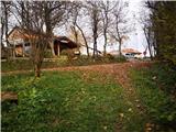 2
2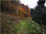 3
3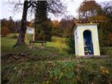 4
4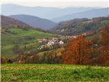 5
5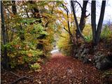 6
6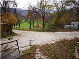 7
7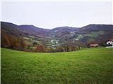 8
8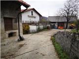 9
9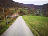 10
10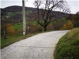 11
11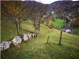 12
12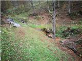 13
13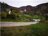 14
14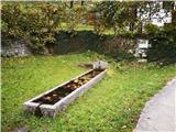 15
15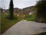 16
16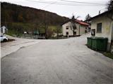 17
17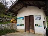 18
18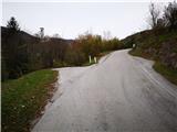 19
19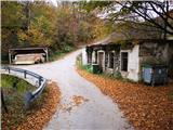 20
20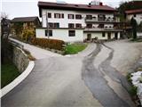 21
21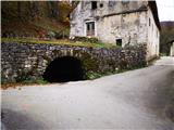 22
22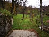 23
23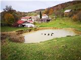 24
24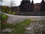 25
25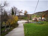 26
26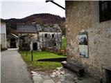 27
27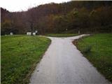 28
28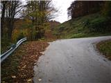 29
29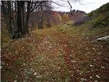 30
30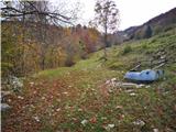 31
31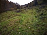 32
32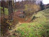 33
33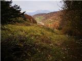 34
34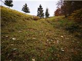 35
35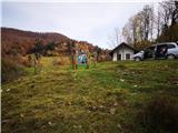 36
36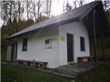 37
37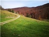 38
38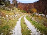 39
39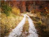 40
40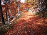 41
41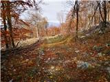 42
42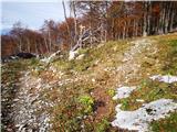 43
43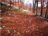 44
44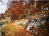 45
45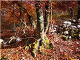 46
46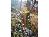 47
47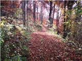 48
48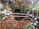 49
49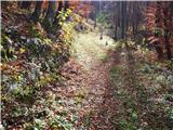 50
50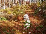 51
51 52
52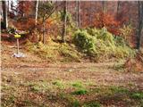 53
53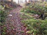 54
54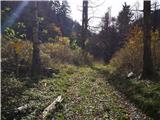 55
55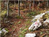 56
56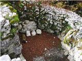 57
57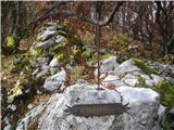 58
58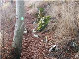 59
59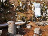 60
60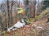 61
61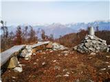 62
62 63
63
Discussion about the trail Široko - Veliki vrh (above Lom) (via Kanalski Lom - on trail Lom is my home)
|
| acti6. 01. 2022 09:18:09 |
Zanima me,če je čas hoje mišljen v eno smer ali kot krožna pot.
Namreč,za celotno pot Lom je moj dom piše,daje čas hoje cca 4 ure.
|
|
|
|
| ločanka6. 01. 2022 11:12:49 |
Na informativni tabli v vasi sem brala, da je krožna pot 12 km in 4,5 ure.
|
|
|
|
| zwbgr6. 01. 2022 21:15:09 |
Čas hoje je v eno smer, od Širokega preko Kanalskega Loma do Velikega vrha (okrog 7 km). Če nadaljujete po krožni poti čez Grudnico, je nazaj na izhodišče še dobra ura (okrog 5 km)
|
|
|