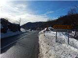
Starting point: Cenc (850 m)
| Lat/Lon: | 45,9087°N 14,0236°E |
| |
Time of walking: 45 min
Difficulty: easy marked way
Altitude difference: 136 m
Altitude difference po putu: 160 m
Map: Nanos 1:50.000
Recommended equipment (summer):
Recommended equipment (winter): crampons
Views: 2.666
 | 2 people like this post |
Access to the starting point:
a) From the road Logatec - Idrija, at Godovič, take the road towards Črnji Vrho and Ajdovščina. After Črnji Vrh the road starts to climb in a few serpentines and then flattens out a bit. At this less winding part you will come to a crossroads where the road to Javornik branches off to the left, and at the same place you will see a macadam road on the right and alongside it mountain direction signs for Špičasti vrh. Turn right here and then park in a suitable place along the road.
b) From the Vipava valley, take the Col, and then continue driving towards Idrija. At the point where the road to Javornik turns off to the right, take a sharp left onto a macadam road, along which you will see mountain direction signs. Park in a suitable roadside parking space along the road.
Path description:
From the crossroads at Cenec, continue along the macadam road towards Špičasti vrh. The ascending road first leads under the power line, then turns slightly to the right. At this point, the marked cart track branches off to the left and the route continues. The cart track first climbs crosswise through the forest, then the forest thins out and the trail opens up to a beautiful view of Nanos, the western peaks of Hrušice, and, a little higher up, of Malo Polje. After a few minutes, the path turns right and leads to a macadam road, which is reached just at a small pass, where there is a marked crossroads.
From the crossroads, continue slightly to the left, on the cart track or worse road in the direction of "Špečk - Križ", which continues along the north-western slope (to the right leads the marked path to Špičasti vrh). The path, which continues along a narrower macadam road, mostly passes through dense forest, only in one part of which we have a nice view of the Big Stone (1076 m) and the Little Stone (1045 m). The road quickly returns to the forest, and we walk along it for a few more minutes, or until we reach the point where the cart track road branches off to the left, leading towards Špiček. The cart track then continues for a short distance through a spruce forest, and higher up through a deciduous forest. When the path is a little higher, the signs for "Križ - Špečk" direct you to the left to a slightly narrower path (there is also a cairn at the point where you leave cart track), which you then follow in 5 minutes to a lookout point, on which there is a metal cross, with a registration box underneath it.
Description and pictures refer to 2015 (January).

Pictures:
 1
1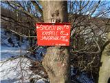 2
2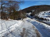 3
3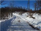 4
4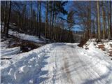 5
5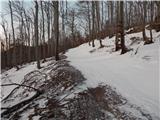 6
6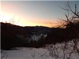 7
7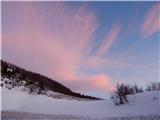 8
8 9
9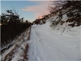 10
10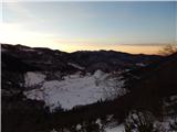 11
11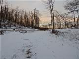 12
12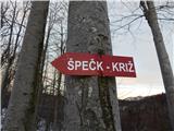 13
13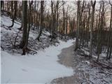 14
14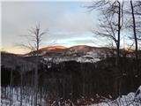 15
15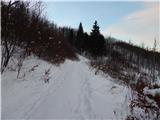 16
16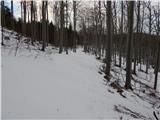 17
17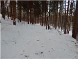 18
18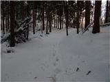 19
19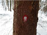 20
20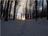 21
21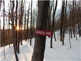 22
22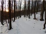 23
23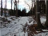 24
24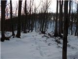 25
25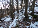 26
26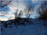 27
27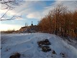 28
28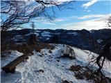 29
29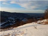 30
30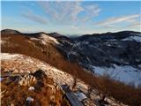 31
31
Discussion about the trail Cenc - Špiček (Špečk)