Starting point: Podtabor (554 m)
| Lat/Lon: | 45,6023°N 14,2294°E |
| |
Time of walking: 1 h 50 min
Difficulty: easy unmarked way
Altitude difference: 197 m
Altitude difference po putu: 260 m
Map: Snežnik 1:50.000
Recommended equipment (summer): helmet
Recommended equipment (winter): helmet
Views: 5.315
 | 1 person likes this post |
Access to the starting point:
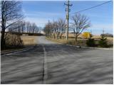
a) From the motorway Ljubljana - Koper take the exit Postojna and follow the road towards Pivka, Rijeka and Ilirska Bistrica. At Pivka, leave the main road leading to Ilirska Bistrica and continue towards Knežak. Just after Knežak, we reach the village of Šembije, after which we take a sharp right towards Podstenje and Podtabor. After a few 100 m of further driving, we reach the crossroads in Podtabor, which is the starting point of our tour. As there are no suitable parking places at the starting point, we have to park somewhere nearby, in a suitable place on the roadside.
b) Take the road to Ilirska Bistrica and then continue driving towards Knežak. Before arriving at Šembije, leave the main road and drive left towards the village of Podtabor. At the beginning of Podtabor, we arrive at a crossroads of several roads, where we start our journey. As there are no suitable parking places at the starting point, we have to park somewhere nearby, in a suitable place along the road.
Path description:
From the crossroads at the beginning of Podtabor, follow the signs Podtabor, and the road will immediately lead you to the next crossroads. Here, continue along the lower left road (straight up Šembije), which leads you on past some houses. A little further on, the asphalt road turns to the left, and we leave it just after the sign indicating the altitude and continue to the right on the parallel dirt road, which quickly leads us under the steep cliffs of the nearby Brkinje Edge. The initially quite scenic route then leads us to a tunnel, through which we continue on the dirt road. On the other side of the tunnel, the cliffs gradually turn into less steep slopes, and the path leads us onwards along a gently ascending macadam road, which after 10 minutes of further walking leads us to a small crossroads. Continue slightly to the right and continue through the forest, climbing gently for the most part. After a while, the road leads to another rocky part, after which it gradually starts to descend.
Continue along the road, which, with occasional views to the west, leads to a small crossroads where the road to Ratečevo Brdo branches off to the left, and a footpath to the right leads to a nearby cross at the Klanec pass. We continue straight on again, and the road leads us to another turning to the right towards the nearby cross and the Klanec Pass. Again, we continue straight on, but the road quickly leads us to a place where the marked path from Narin joins us on the left.
The way ahead leads us past a small spring, after which we arrive at the turn-off of the worse cart track to the left (if we continue along the above-mentioned cart track, we will arrive at the former Roman road, which ends a few 100 m further on).
Continue straight ahead and, passing another spring, you will reach the Church of St Martin in a few minutes' walk.
From St Martin's, go back a few metres and then continue along the ascending road, which continues northwards. There is a short descent and you reach a marked crossroads where you join the route from Zagorje.
From the crossroads, turn slightly left into the village Šilentabor (right down Zagorje), where you pass a few houses and walk to where the marked trail from Pivka joins from the right. Continue straight ahead and walk past the registration box and the transmitters to the summit in a few minutes.

Pictures:
 1
1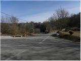 2
2 3
3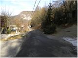 4
4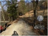 5
5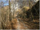 6
6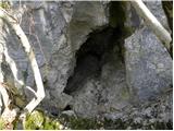 7
7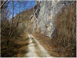 8
8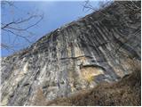 9
9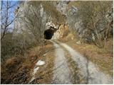 10
10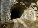 11
11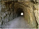 12
12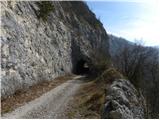 13
13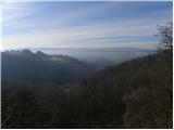 14
14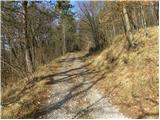 15
15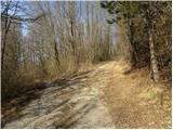 16
16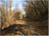 17
17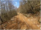 18
18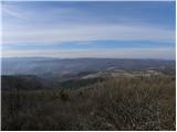 19
19 20
20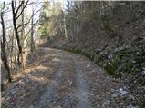 21
21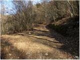 22
22 23
23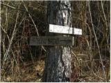 24
24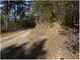 25
25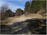 26
26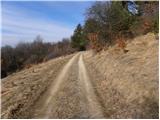 27
27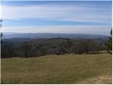 28
28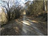 29
29 30
30 31
31 32
32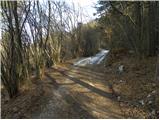 33
33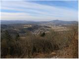 34
34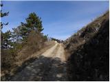 35
35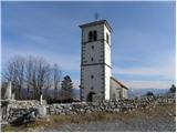 36
36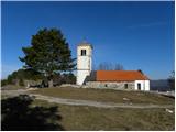 37
37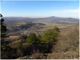 38
38 39
39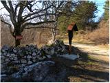 40
40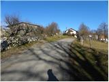 41
41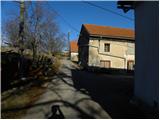 42
42 43
43 44
44 45
45 46
46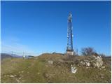 47
47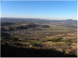 48
48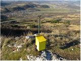 49
49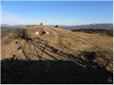 50
50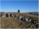 51
51 52
52
Discussion about the trail Podtabor - Šilentabor
|
| ločanka23. 02. 2022 18:30:39 |
Krasna pot! Delala včeraj krožno pot in sicer začela po tej opisani poti, vračala pa po Brkinškem robu in se tako vrnila na izhodišče polna lepih vtisov.
|
|
|