Jezero - Krim (via Ledenica)
Starting point: Jezero (290 m)
| Lat/Lon: | 45,9692°N 14,4313°E |
| |
Name of path: via Ledenica
Time of walking: 2 h 30 min
Difficulty: easy marked way
Altitude difference: 817 m
Altitude difference po putu: 830 m
Map: Ljubljana - okolica 1:50.000
Recommended equipment (summer):
Recommended equipment (winter):
Views: 46.646
 | 3 people like this post |
Access to the starting point:
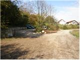
We drive to Podpeč, where we head towards Igo. Follow this road for a short distance to a crossroads, where you turn right towards Jezero. The road quickly leads to the next crossroads, where you turn right again and follow the road to a roadside parking lot. Only guests are allowed to park in the larger parking lot.
Path description:
From the parking lot we return about 100m back to the crossroads, where we see signs for the Krim. Continue on the asphalted road that leads up through the village. After a few minutes of walking, the asphalt ends and the road quickly turns into a cart track, which leads to a crossroads. Continue along the left path towards the Ice Cave (Krim left and right). Continue following cart track, which climbs moderately through the forest and leads us slightly higher to a crossroads. If you wish, you can make a short detour to the Ice Cave, which takes just over five minutes each way.
Otherwise, continue right along the path, which soon leads us to a forest road which we follow up to a small hamlet. Here we also come to a crossroads on the trail, where we continue to the left in the direction of Krima. The path then leads us after a few metres to the church Sveti Tomaž, which we see in front of us. The path continues to climb steeply along the cart track, which has a number of crossroads, so follow the markings carefully. A little higher up, cart track crosses a forest road and starts to climb more steeply. Further on, the steepness eases again and the path leads to the wider cart track, where it joins the path from the villages Tomišelj, Vrbljene and Strahomer. Follow the wide cart track, which occasionally climbs a little more, all the way to the road to Krim.
Here, turn left and follow the road to a large parking lot. Continue right past the cross and up the meadow, which ends in steps, to the house on Krim.

Pictures:
 1
1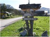 2
2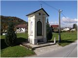 3
3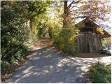 4
4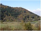 5
5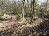 6
6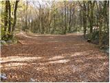 7
7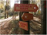 8
8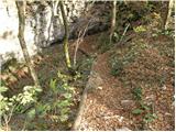 9
9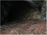 10
10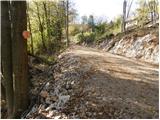 11
11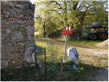 12
12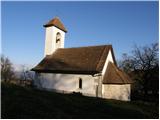 13
13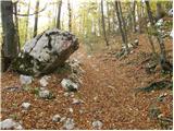 14
14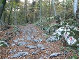 15
15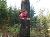 16
16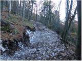 17
17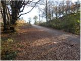 18
18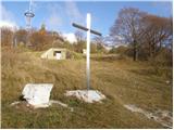 19
19 20
20
Discussion about the trail Jezero - Krim (via Ledenica)
|
| amar nat22. 07. 2010 |
Glede na vse kamenje, ki je na poti, je vzpon kar naporen. Prav tako tudi pot navzdol.
|
|
|
|
| wolphgang11. 11. 2011 |
vceraj na krimu po tej poti. ves cas hoja po megli razen zadnjih 100 visinskih metrov. na vrhu pa pogled na "morje " in nic drugega, zanimiv obcutek. V koci pa prijazna kelnerca
|
|
|
|
| marijakordis27. 05. 2012 |
Večkrat jo mehnemo iz Jezera do sv. Tomaža na Planinci. V zadnjem tednu veliko beremo srečanjih z medvedom. Tudi moj mož je šel v prejšnji petek (18.maja okrog 19h) po tej poti.Po dobrih desetih minutah od Jezera je zagledal kosmatinca Previdno se je obrnil nazaj, da nista prišla blizu. Možno, da je to tisti medved, ki je danes napadel moškega nad Igom, zato previdnost po teh poteh ni odveč.
|
|
|
|
| Aqua_a12. 09. 2016 |
Se strinjam. Vzpon je malo naporen zaradi kamenja, kar predvsem moti pri poti navzdol. Gre pa za lep pohod, testiranje vzdržljivosti, še posebej zadnjih 30 - 45 min, ko se pot kar vzpne. Imaš pa na vrhu vse poplačano  Lp
|
|
|
|
| Tana Debeljak22. 07. 2018 |
Danes sva šli s kolegico in ni bilo nikjer nobenih medvedov. :P Je bil ravno en dan po dežju, tako da znajo kamni do gor zelo drseti. V opisu poti manjka podatek, da ko nadaljujemo pot od jame Ledenica, sledimo tablam za "Planinco"- to je tisti zaselek, ki je omenjen v tekstu, od tam naprej pa so spet smerokazi za Krim. Pa lepo turo!
|
|
|
|
| Mikens23. 06. 2019 |
POMEMBNO!
Vse pohodnike naprošam, naj imajo pse na vrvici! (območje medveda.)
Lep lovski pozdrav.
Klement Mal, LD Tomišelj
|
|
|