Starting point: Solarji (952 m)
| Lat/Lon: | 46,1803°N 13,6676°E |
| |
Time of walking: 45 min
Difficulty: easy marked way
Altitude difference: -3 m
Altitude difference po putu: 130 m
Map: Julijske Alpe - zahodni del 1:50.000
Recommended equipment (summer):
Recommended equipment (winter): ice axe, crampons
Views: 4.588
 | 1 person likes this post |
Access to the starting point:
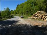
a) From Nova Gorica or Tolmin drive towards Bovec. Just after the roundabout where the routes from Nova Gorica and Tolmin join, you will reach a crossroads where the road to the left branches off towards the Solarji Pass and Kolovrat. The road then leads us to the edge of Volč, where the signpost for Solarji Pass directs us right onto the road, which begins to climb steeply behind the last houses. We continue along the asphalt road which, after a few kilometres of ascent, leads us to the preval, where there is also a crossroads. Here you continue along the lower left road, along which after a few metres you park in a larger parking lot (park in such a way as not to interfere with any forestry work).
b) From Bovec, drive towards Tolmin, and we follow the road to the point where the road to Kolovrat branches off to the right (the branch is marked and is located just before the roundabout where the road to Nova Gorica and Tolmin splits). The road then takes us to the edge of Volč, where a signpost for the Solarji preval directs us right onto the road, which begins to climb steeply behind the last houses. Continue along the asphalt road which, after a few kilometres of ascent, leads to the preval, where there is also a crossroads. Here you continue along the lower left road, along which after a few metres you park in a larger parking lot (park in such a way as not to interfere with any forestry work).
Path description:
On the opposite side of the "parking lot" we see a mountain direction sign with the inscription Ježa and Planinski dom pod Ježo, which directs us to the folded and relatively overgrown cart track. Cart track soon turns into a footpath, which begins to descend first steeply and then more steeply. The way forward leads past an old military cavern and leads us behind it to a short place guarded by a steel bar (not difficult). There is a short descent and the path leads us to a macadam road, which is reached just at a small crossroads. Here we continue on the road to the left, and soon we turn right off it onto the ascending and initially wide cart track. We follow cart track for a short time, and then the signs for Ježa direct us right onto a footpath that starts to climb steeply through the forest. The path, which is less well trodden and in some places more overgrown, lies higher and leads us out of the forest to the partially overlooked summit ridge of Ježa, along which we walk in a few 10 steps to the registration box.

Pictures:
 1
1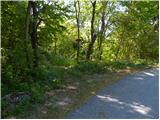 2
2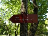 3
3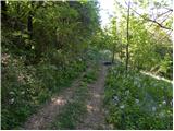 4
4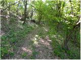 5
5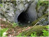 6
6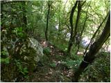 7
7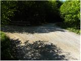 8
8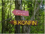 9
9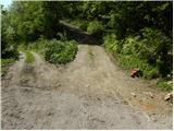 10
10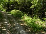 11
11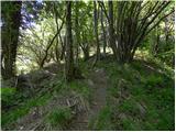 12
12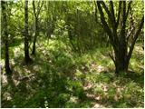 13
13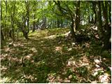 14
14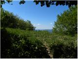 15
15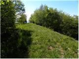 16
16 17
17 18
18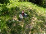 19
19 20
20
Discussion about the trail Solarji - Ježa