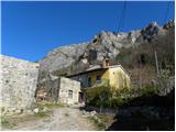
Starting point: Podpeč (312 m)
| Lat/Lon: | 45,5213°N 13,9084°E |
| |
Time of walking: 25 min
Difficulty: partly demanding marked way
Altitude difference: 137 m
Altitude difference po putu: 137 m
Map: Slovenska Istra - Čičarija, Brkini in Kras 1:50.000
Recommended equipment (summer): helmet
Recommended equipment (winter): helmet
Views: 8.518
 | 1 person likes this post |
Access to the starting point:
From the motorway Ljubljana - Koper take the exit Črni Kal. From Črni Kal, continue along the old road towards the sea, and we take it only as far as the next slightly larger crossroads, where we turn left towards Border crossing Sočerga. We drive along the road for a short time, and then the signs for Predloka, Loka, Bezovica, Podpeč, Zanigrad, Zazid and Rakitovec direct us to the left onto a slightly narrower local road. Continue to Bezovica, where at a small crossroads in the middle of the village, turn left towards Podpeč. As there are no suitable parking places in Podpeč, you can park in a suitable place on the roadside in front of or behind the village (this will extend your journey by 5 to 15 minutes).
Path description:
The trailhead is just before the sign marking the end of Podpeč. Here, the signs direct us left into the forest, through which we start to climb steeply. The steep path soon becomes a transitional path and turns left, where it crosses quite steep and slippery slopes. At the end of the traverse, the path turns to the right and climbs steeply up a chain link fence towards an 11th century defensive tower. The tower, which is normally closed, is bypassed on the right and the ascent continues up a slightly less steep slope. After a few minutes' walk from the tower, the path flattens out and leads to vast karst meadows above the steep level of the Karst Edge. Here we continue to the left and climb along the edge of the cliffs to the undistinguished, but very scenic Zjat.
Pictures:
 1
1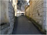 2
2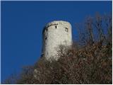 3
3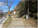 4
4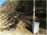 5
5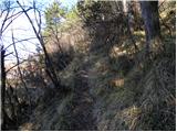 6
6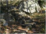 7
7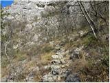 8
8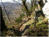 9
9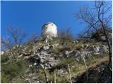 10
10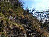 11
11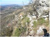 12
12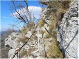 13
13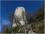 14
14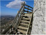 15
15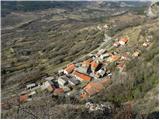 16
16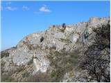 17
17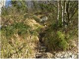 18
18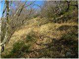 19
19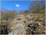 20
20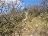 21
21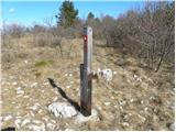 22
22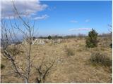 23
23 24
24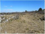 25
25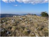 26
26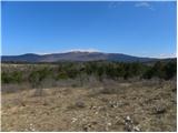 27
27
Discussion about the trail Podpeč - Zjat
|
| Kigeot18. 11. 2014 |
Pot ni zahtevna, stopnice so varovane z verigo. Škoda, ker so lesene stopnice ob stolpu polomljene in se tako ne moreš povzpeti bližje/višje.
Ko prideš na vrh na rob stene, sicer so markacije, ampak razpotje ni označeno. Levo je markirana pot po robu, desno pa je z rumeno markacijo slabše označena peš pot P2 proti Brežcu in še naprej Zazidu.
|
|
|
|
| di19. 02. 2023 11:13:31 |
Nad sosednjo vasjo Zazid se tudi nahaja vrh Zjat.
|
|
|