Col - Križna gora (Hrušica)
Starting point: Col (627 m)
| Lat/Lon: | 45,8816°N 14,001°E |
| |
Time of walking: 2 h 20 min
Difficulty: easy marked way
Altitude difference: 535 m
Altitude difference po putu: 550 m
Map: Nanos 1:50.000
Recommended equipment (summer):
Recommended equipment (winter): crampons
Views: 3.808
 | 3 people like this post |
Access to the starting point:
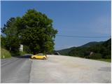
a) From the expressway Razdrto - Nova Gorica, take the Ajdovščina exit and then continue in the direction of Cola and Idrija. When you reach Col turn left towards Predmeja and then after a few metres turn right into the parking lot opposite the parish church on Col. You can also park in the parking lot next to the nearby sports ground.
b) Drive to Logatec, and from there continue to Idrija. At the end of Kalce, turn left towards Podkraj and Cola, then follow the slightly curvier road first to Podkraj, then follow the slightly flatter road to Cola. At Col, where you join the road from Ajdovščina, turn right and then after a few 10 metres turn left in the direction of Predmeja. Towards Predmeja, drive only a few metres, as just after the crossroads turn right into the parking lot opposite the church of St. Lenart.
c) Drive into Idrija, then continue towards Logatec. When you reach Godovič, leave the main road towards Logatec and turn right in the direction of Črni Vrho, Cola and Ajdovščina. When you reach Col, turn right towards Otlica and Predmeja and then right again into the nearby parking lot opposite the church.
Path description:
From the parking lot, return to the main road Ajdovščina - Godovič, then walk along it towards Godovič, but only until the crossroads, where the signs for Vodice direct you to the right onto a slightly narrower road. The asphalt road then leads past a few houses and a shoe factory, then gradually turns into a forest, through which it begins to climb moderately. Walk along the road for a while, then the signs direct you slightly right on a marked footpath, which returns to the road after a few minutes. The road then leads us to a marked crossroads where we continue to the left in the direction of Vodice (right Vodice house Nos. 1 and 2 and Podkraj). Just a little further on we arrive at the next crossroads, where a macadam road branches off sharply to the right towards Sveti Duh (straight ahead the road leading to Vodice, slightly to the right the marked path to Javornik).
Take the macadam road towards Sveti Duh, where after a few steps you will emerge from the forest at the lower part of the hayfield, where there is a house or cottage. In front of the house there is an interesting wooden sculpture in the shape of a mother bear with her cub, and after the house the road returns to the forest. Through the forest, the road climbs gently to moderately, and higher up, a worse road joins us from the right, or cart track from the Fratar homestead. A little further on, a narrower forest road branches off from a left turn to the right, which ends higher up and turns into a cart track, which can be followed up towards Križná hora (the road and the cart track are unmarked, cart track joins the marked trail just below the summit), we continue to the left and continue along the wide dirt road. Higher up, the road opens up some views towards Golaki, the hills above the Gora plateau and Vodice, where you can see individual farmhouses. We continue along the road, which in the last part, with the exception of the serpentines, climbs eastwards. Above the last two serpentines, the road splits into two parts, one to the left, which continues towards Vodice, and the other to the right, which leads towards the Church of the Holy Spirit.
From the crossroads, continue slightly to the right, where you will see signs for St. Duha along the road (the path from the place where we left the asphalt to this crossroads was not marked), as well as occasional old markings further on. After a further short climb, at a small crossroads, turn sharp right (signs for Sv. Duh), along the road, which soon flattens out and turns left, where it turns into a flatter world. Here the path to the Church of the Holy Spirit branches off to the left, the well-marked path continues straight ahead towards Podkraj, and we continue right towards Križna gora. The path continues on a flatter terrain through the forest. Shortly after the crossroads we see signs for Škol, which is a minute's walk from the marked path to the right (Škol is a slightly precipitous viewpoint from which a beautiful view opens up, reaching all the way to the Alps), and we continue straight on the marked path, which leads us just a little further on to a smaller crossroads, where we continue to the right in the direction of Križná gora (with a shortcut from the left comes the shortcut of the footpath leading from Podkraj). Crossing follows, and we arrive at the next smaller crossroads. This time continue left (from the direction of straight on, the

Pictures:
 1
1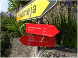 2
2 3
3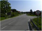 4
4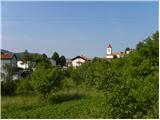 5
5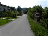 6
6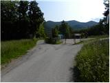 7
7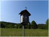 8
8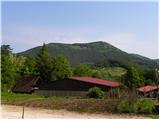 9
9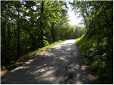 10
10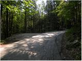 11
11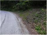 12
12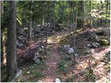 13
13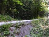 14
14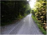 15
15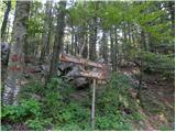 16
16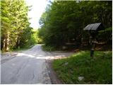 17
17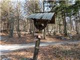 18
18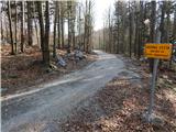 19
19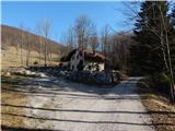 20
20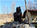 21
21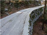 22
22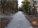 23
23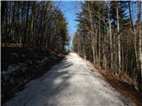 24
24 25
25 26
26 27
27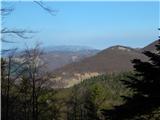 28
28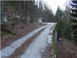 29
29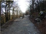 30
30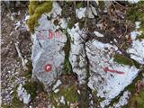 31
31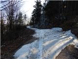 32
32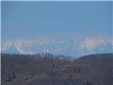 33
33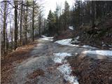 34
34 35
35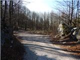 36
36 37
37 38
38 39
39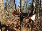 40
40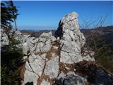 41
41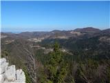 42
42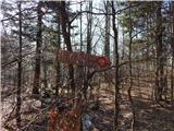 43
43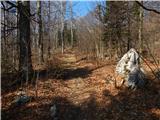 44
44 45
45 46
46 47
47 48
48 49
49 50
50 51
51
Discussion about the trail Col - Križna gora (Hrušica)