Lom - Koča na Kamnem griču
Starting point: Lom (817 m)
| Lat/Lon: | 45,7145°N 14,609°E |
| |
Time of walking: 45 min
Difficulty: easy marked way
Altitude difference: 199 m
Altitude difference po putu: 215 m
Map:
Recommended equipment (summer):
Recommended equipment (winter):
Views: 1.220
 | 1 person likes this post |
Access to the starting point:
a) First drive to Sodražica, then continue driving in the direction of Hrib-Loški Potok. A few 100 metres after the 8,5 km road marker, at the beginning of a long left turn, a side road branches off to the left, and you drive along it for approximately 1 km, or to the point where the marked cart track branches off to the left. Just before the track, there are mountain signs for the Koča na Kamnem griču (Cottage on the Stone Hill). Park in a suitable place at the crossroads.
b) First drive to the settlement Hrib-Loški Potok, then continue driving in the direction of Sodražica. Shortly after the road marker 9 km, at the last part of the right-hand bend, turn right onto a side road and drive along it for about 1 km to a place where a marked track branches off the road slightly to the left in the direction of Koča na Kamnem griču (Cottage on the Stone Hill). Park in a suitable place at the crossroads.
Path description:
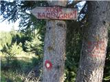
From the starting point, continue in the route Koča na Kamnem griču, and notice the marker on a tree by the roadside a few 10 paces before the start cart track. Cart track first climbs gently into the forest lane and then continues without any major change in elevation, partly through the forest and partly across mown meadows. Then cart track starts to climb moderately, and higher up leads to a meadow, where the track disappears. Continue straight up here, and when you re-enter the woods, the track reappears. Before entering the forest, it is worth turning back, as a beautiful view opens up, reaching all the way to Snežnik. In the forest, in addition to the markings, you will also see the KG (Kamni grič) sign, which confirms that you are on the right path. When we leave the forest again, we arrive at the next hayfield, where the path turns left again. There is a moderate climb, and then the path returns to the forest, where the path leads through a short lane, where the path is slightly more overgrown, but easy to follow. After this part there is a short descent before reaching the wider cart track and a marked crossroads.
From the crossroads continue straight on in the route Koča na Kamnem griču to which you have 5 minutes of moderate ascent on a mostly grassy slope.
From the hut you can climb a few steps to the nearby summit, which offers a beautiful view that reaches all the way to the Alps.
Description and pictures refer to the situation in 2016 (August).

Pictures:
 1
1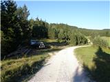 2
2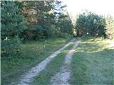 3
3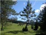 4
4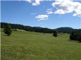 5
5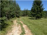 6
6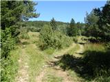 7
7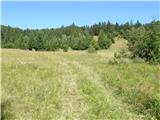 8
8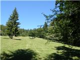 9
9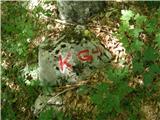 10
10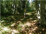 11
11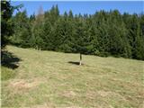 12
12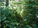 13
13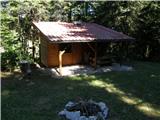 14
14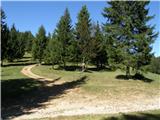 15
15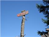 16
16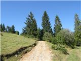 17
17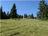 18
18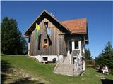 19
19 20
20
Discussion about the trail Lom - Koča na Kamnem griču