Celje - Old Castle of Celje (Celje - Stari grad na Grajskem hribu - Teharje)
Starting point: Celje (241 m)
Name of path: Celje - Stari grad na Grajskem hribu - Teharje
Time of walking: 1 h 30 min
Difficulty: easy marked way
Altitude difference: 166 m
Altitude difference po putu: 290 m
Map: Posavsko hribovje Boč - Bohor 1:50.000
Recommended equipment (summer):
Recommended equipment (winter):
Views: 4.044
 | 2 people like this post |
Access to the starting point:
Celje, Slovenia's third-largest city, is practically reachable from several sides. Park somewhere between the train station and the bridge over the Savinja towards Laško. The problem could be that the car parks are mainly pay-per-use. . . if you arrive by train, of course, these problems disappear.
Path description:
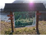
The route starts at the bridge over the Savinja River at a sign with a panoramic view of the Celje Hills. The trail is also the introductory part of the CPP - Celjska planinsko trail until the turn-off for Teharje in the village of Osenca. In the first part, you walk along the path between the Savinja and the railway line to the confluence of the Voglajna and the Savinja. Continue over the bridge and under the railway line to the right and continue along the Pelikan Trail to the Old Castle.
From the castle, continue left steeply uphill past the Tlačan guesthouse and follow the well-trodden path through the village of Osenca. The path is partly asphalt, partly macadam and the section through the forest is a mountain path.
In Osenca, at the crossroads, which is well marked, continue left under the homestead and cross a fenced pasture. After crossing the pasture, continue steeply downhill through the forest on a typical forest mountain path and soon reach a crossroads by the NOB monument. Continue along the forest road along the stream and reach the asphalt road along the Voglajna. Across the Voglajna is the industrial zone of Železarna Štore. At the junction with the asphalt road, turn left and after a few hundred metres walk, end the trail at the bridge over the Voglajna River, where the town of Celje ends and on the other side of the bridge is the beginning of the settlement of Teharje. There are also mountain signs by the bridge.
The length of the route from Celje is 4. 50 kilometres, 290 metres of positive and the same number of negative vertical metres.

Pictures:
 1
1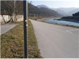 2
2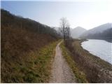 3
3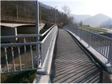 4
4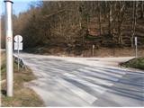 5
5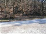 6
6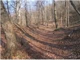 7
7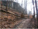 8
8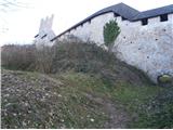 9
9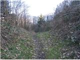 10
10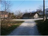 11
11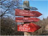 12
12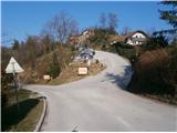 13
13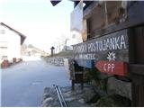 14
14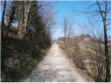 15
15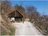 16
16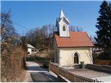 17
17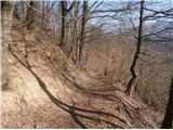 18
18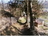 19
19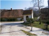 20
20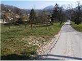 21
21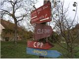 22
22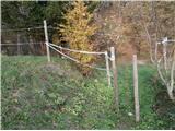 23
23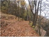 24
24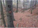 25
25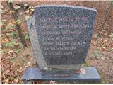 26
26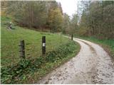 27
27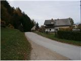 28
28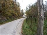 29
29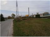 30
30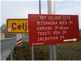 31
31
Discussion about the trail Celje - Old Castle of Celje (Celje - Stari grad na Grajskem hribu - Teharje)
|
| bruny9. 11. 2014 |
Teharje je po večkrat videnem najmanj ,,obremenjeno,, izhodišče ali pa tudi zaključek za aktivnosti v Celjskem hribovju...Prijetna pot, tu in tam jo kdo odhodi...domačini in verjetno dobri poznavalci seveda do točke z CPP potjo med slikami 22 - 31. Danes bil v bližini, hodil in sestopil po njej v dolino k Voglajni. Na poti bil aktiven med slikami 12-31. Bila je daljša aktivnost, morda nekaj več o njej v razmerah...Lp
|
|
|