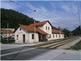
Štore - Old Castle of Celje
Starting point: Štore (240 m)
| Lat/Lon: | 46,2213°N 15,3215°E |
| |
Time of walking: 1 h 30 min
Difficulty: easy marked way
Altitude difference: 167 m
Altitude difference po putu: 330 m
Map: Posavsko hribovje Boč - Bohor 1:50.000
Recommended equipment (summer):
Recommended equipment (winter):
Views: 3.123
 | 3 people like this post |
Access to the starting point:
Štore is ideally accessible by rail. At the end of the tour at the castle, descend along the Pelican Trail to the bridge over Voglajna and return to Celje along the trail under the railway. . . By road. . . leave the motorway in Celje and practically in the centre of Celje head towards Štory or Šentjur. Park your car near the Štore railway station, where there are plenty of parking spaces and also the start of a marked mountain trail.
Path description:
Combination of the most "right" mountain trail from Štorje "past Marija" into the Celje hills to the contact with the most "left" mountain trail from Celje via Old Castle of Celje into the Celje hills, which is also the introductory part of the Celje Mountain Trail.
The trail starts at the railway station in Štory. We head via Voglajna, where a direction sign immediately directs us to the right and shortly afterwards straight through the area of the old Štora ironworks. Continue along the asphalt road in the lower part by the Bojan ditch to a new fork in the trail, where you continue straight ahead, left along the trail 'over Žlajfa'. Soon the road turns sharp left slightly uphill, flattens out again by the playground and after a few terraced houses, turn left onto the forest road, which turns into a forest trail. The path "through Bojanski graben" branches off to the left, while we continue uphill to the right. The path from Celje and Tehari soon joins from the right.
At the junction with the path from Celje and Teharij, turn right and head slightly downhill towards Grad and Celje respectively. The trail is well marked, unfortunately it is mainly on asphalt. The main road passes through the settlement Osenca, with two small local peaks Gorica and Osenica slightly above the road on the right. The only trail that branches off is the marked mountain trail to Teharje. The whole route is alongside houses or homesteads and the friendly locals are always ready for a friendly chat.
The length of the trail is about 6000 metres, 330 positive vertical metres and 190 negative vertical metres.

Pictures:
 1
1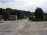 2
2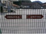 3
3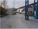 4
4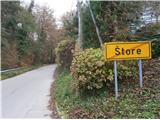 5
5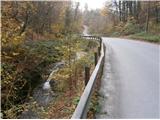 6
6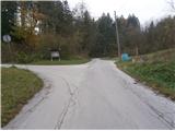 7
7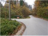 8
8 9
9 10
10 11
11 12
12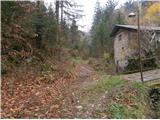 13
13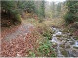 14
14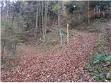 15
15 16
16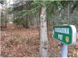 17
17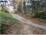 18
18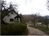 19
19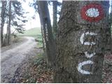 20
20 21
21 22
22 23
23 24
24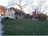 25
25 26
26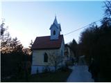 27
27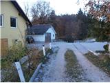 28
28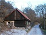 29
29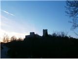 30
30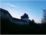 31
31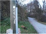 32
32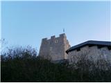 33
33
Discussion about the trail Štore - Old Castle of Celje
|
| bruny26. 02. 2014 |
V večerni pohodniški aktivnosti zgoraj opisano pot nekoliko nadgradila…Iz Štor po opisu do sečišča z Celjsko planinsko potjo – slika št. 18 in podaljšek pod Srebotnik do kapelice vklesane v steno pri Mariji. Od tam nazaj po poti, ki je v opisu in ker ura še ni bila pozna pri sliki št. 25 desno navzdol do mostu preko Voglajne med naseljem Teharje in Teharsko cesto, na izhodišče planinske poti iz Teharij. Še podaljšel v center naselja in od tam takoj povratek nazaj do slike št. 25 in lepo po opisani trasi do starega celjskega gradu, sestop po Pelikanovi poti in preko tretjega mostu v aktivnosti čez Voglajno v bližini sotočja s Savinjo po poti med Savinjo in železnico do Celja… Ker je bilo do odhoda vlaka še nekaj časa ni bilo druge kot na desni breg Savinje in po strmi/planinski poti na Miklavški hrib in nazaj sestop. Podaljšek na železniško postajo in povratek domov v Poljčane z vlakom. Ja, kar prava večerna aktivnost…zanimiva povezava Štor, Teharij in Celja v eni bi rekel ,,M,, kombinaciji. Celotno traso sem poznal, vendar v tej kombinaciji hodil prvič. Kolegu je bilo več odsekov nepoznanih – predvsem osrednji del. Nočna orientacija ni predstavljala problem, nekaj pasjega laježa gospodarjev dvorišč in prav prijetno je bilo. Poti dobro prehodne razen iz Teharij je na začetku bolj konkretnega vzpona, nekoliko nad pomnikom NOB padlo nekaj bukev, ki nekoliko ovirajo prehod. Trasa: Štore - Teharje - Celje, 26.02.2014
|
|
|
|
| bruny16. 04. 2016 |
Po ppisani poti danes kratka aktivnost v najnižjem svetu Celjskega hribovja nad levim bregom reke Voglajne. V prijetnih barvah pomladi. Razdalja in višinski metri še vedno držijo, označenost odlična...Bil je še dodatek na desnem bregu Savinje. Na desni breg čez most v Polulah. O dodatku morda kaj več v Razmerah...
|
|
|