Starting point: Šentjur (280 m)
| Lat/Lon: | 46,2026°N 15,3932°E |
| |
Time of walking: 45 min
Difficulty: easy marked way
Altitude difference: 288 m
Altitude difference po putu: 288 m
Map:
Recommended equipment (summer):
Recommended equipment (winter):
Views: 19.933
 | 2 people like this post |
Access to the starting point:
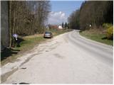
From the motorway Ljubljana - Maribor take the exit Dramlje and follow the road in the route Šentjur. In Šentjur, at the traffic lights, continue straight into the underpass under the railway line and follow the road in the direction of Šentrupert. Just past the sign at the end of Šentjur, you will see a parking lot on the right side of the road and mountain signs for Resevno.
Path description:
From the parking lot we return along the road about 100m back towards Šentjur, where we see the mountain signs for Rifnik by the bus stop. A marked footpath directs you to the steps that climb up across the meadow. Next, the path crosses a short lane of wodland and then leads to a tarmac road, which is followed for some time to a junction, where you continue straight up a minor road in the direction of Rifnik (to the left the ruins of Reicheneck Castle 5 minutes). The deteriorating road then changes to a cart track, which is followed in the direction of the archaeological site of Rifnik. A little higher up, the cart track turns into a footpath which climbs steeply for a short time and then quickly leads to the top of Rifnik.
Pictures:
 1
1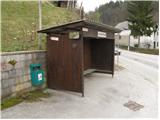 2
2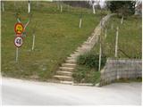 3
3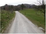 4
4 5
5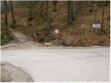 6
6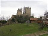 7
7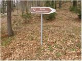 8
8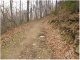 9
9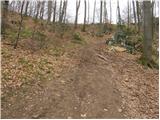 10
10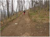 11
11 12
12
Discussion about the trail Šentjur - Rifnik
|
| andymann5. 05. 2009 |
A morda kdo ve, zakaj so okoli grada Reicheneck tiste table 'gibanje na lastno odgovornost'? A je morda zaradi kakega norega lastnik zemljišča s šibrovko ali kaj drugega?
|
|
|
|
| aljazzz5. 05. 2009 |
zato ker zidovi niso lih varni, vse se lahko vsak hip podre..ljudje pa tja hodijo veselo in razkopavajo, ker je vse bolj kot ne odprta zadeva.
|
|
|
|
| Planinček6. 05. 2009 |
Res je! Zidovi niso v najboljšem stanju in pričakujemo lahko, da lahko vsak trenutek odpade kakšna skala.
|
|
|
|
| andymann29. 07. 2009 |
Lahko bi napisali, da je na koncu asfalta (šesta slika)parkirišče, ker pol urna hoja po asfaltu pač ni zanimiva. Ali pač. 
|
|
|
|
| klavdipo17. 12. 2009 |
Ali je na tem vrhu tudi žig?
|
|
|
|
| rogi18. 12. 2009 |
Na vrhu Rifnika je tudi žig.
|
|
|
|
| klavdipo18. 12. 2009 |
Se da narediti tudi krožno varianto Šentjur-Rifnik-Resevna-Šentjur? Da se ne bi nazaj vračala z Rifnika po isti poti?
|
|
|
|
| rogi19. 12. 2009 |
Se da in pot je dolga okrog 4 ure, pa tudi markirana.
Lp
|
|
|
|
| boba:)15. 03. 2012 |
Danes sem bila na Rifniku.Žal na vrhu ni več žiga.V skrinjici je ostala samo še veriga,kjer je bil pripet.  Kje bi bilo možno žigosati knjižico?
|
|
|
|
| Zvonček22. 04. 2013 |
Tudi mene zanima, kje se sedaj nahaja žig? Ali pa morda ve, koga vprašati?
|
|
|
|
| onsight22. 05. 2013 |
Zdravo. Res je, na Rifniku manjka žig, sam sem telefoniral na PD Šentjur, kjer so mi pojasnili, da lahko žig dobim v času uradnih ur na sedežu...to sem tudi storil. Uradne ure imajo vsak četrtek od 17h do 18h.
|
|
|
|
| bruny29. 09. 2017 |
Danes na Rifnik po opisani poti...
|
|
|
|
| bruny30. 03. 2019 |
Vzpon danes po opisani poti...
|
|
|