 | Trbovlje - Kum (via Čebulova dolina)
At 1220 metres, Kum is the highest peak of Posavsko hribovje. Because it rises above Zasavje, some people call it the Zasavje Triglav. On the sum...
3 h 30 min |
 | Zidani Most - Kum (through Škratova dolina (old path))
At 1220 metres, Kum is the highest peak of Posavsko hribovje. Because it rises above Zasavje, some people call it the Zasavje Triglav. On the sum...
3 h |
 | Hrastnik (Podkraj) - Kum (via Matca)
At 1220 metres, Kum is the highest peak of Posavsko hribovje. Because it rises above Zasavje, some people call it the Zasavje Triglav. On the sum...
2 h 55 min |
 | Zidani Most - Kum (through Škratova dolina (new path))
At 1220 metres, Kum is the highest peak of Posavsko hribovje. Because it rises above Zasavje, some people call it the Zasavje Triglav. On the sum...
3 h 5 min |
 | Hrašče - Vojkova koča na Nanosu (via Brižnik)
Vojkova koča is located on the southern edge of the Nanoše plateau, close to Pleše, a peak that is clearly visible from the motorway. From the hu...
3 h |
 | Hrašče - Vojkova koča na Nanosu (past troughs)
Vojkova koča is located on the southern edge of the Nanoše plateau, close to Pleše, a peak that is clearly visible from the motorway. From the hu...
3 h |
 | Gradišče - Vojkova koča na Nanosu (via Sveti Miklavž)
Vojkova koča is located on the southern edge of the Nanoše plateau, close to Pleše, a peak that is clearly visible from the motorway. From the hu...
3 h 45 min |
 | Podnanos - Vojkova koča na Nanosu (Pod zatrepom)
Vojkova koča is located on the southern edge of the Nanoše plateau, close to Pleše, a peak that is clearly visible from the motorway. From the hu...
3 h 45 min |
 | Kamnje - Kucelj na Čavnu
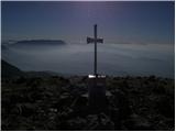
Kucelj is located on the southern slopes of Trnovo Forest, north-west of the Vipava valley. From the uncultivated summit on which the cross stand...
2 h 45 min |
 | Lokavec - Kucelj na Čavnu
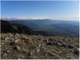
Kucelj is located on the southern slopes of Trnovo Forest, north-west of the Vipava valley. From the uncultivated summit on which the cross stand...
3 h 15 min |
 | Stomaž - Kucelj na Čavnu
Kucelj is located on the southern slopes of Trnovo Forest, north-west of the Vipava valley. From the uncultivated summit on which the cross stand...
3 h |
 | Gojače - Kucelj na Čavnu
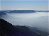
Kucelj is located on the southern slopes of Trnovo Forest, north-west of the Vipava valley. From the uncultivated summit on which the cross stand...
2 h 55 min |
 | Malovše - Kucelj na Čavnu
Kucelj is located on the southern slopes of Trnovo Forest, north-west of the Vipava valley. From the uncultivated summit on which the cross stand...
3 h |
 | Hrastnik - Mrzlica (via Klobuk)
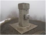
Mrzlica has become an extremely popular excursion point in the last few years, especially for visitors from the Savinjska Valley and Zasavje. At ...
3 h |
 | Hrastnik - Mrzlica (via Ravne)
Mrzlica has become an extremely popular excursion point in the last few years, especially for visitors from the Savinjska Valley and Zasavje. At ...
3 h |
| Železniška postaja Sevnica - Lisca (Iz Sevnice preko Zajčje Gore na Lisco)
Lisca is a scenic peak located north of Sevnica. From the top of the peak, where the meteorological radar station stands, there is a beautiful vi...
2 h 50 min |
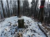 | Straža - Želin - Bevkov vrh
Bevkov vrh, which is a point on the Slovenian mountain trail, is located between Cerkno and Spodnja Idrija. The summit is covered with forest and...
2 h 45 min |
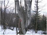 | Prebold - Reška planina
Reška planina is a peak in Posavsko hribovje, located southwest of Prebold. The marked trail does not lead to the summit, but to a nearby viewpoi...
3 h |
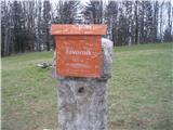 | Kozje - Veliki Javornik (Bohor) (via Koprivnik)
Veliki Javornik is the highest peak of Bohor at 1023m. Although the peak is unspoilt and there are no higher hills far around, there is no view f...
2 h 45 min |
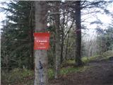 | Kozje - Koprivnik (Bohor) (via Vetrnik)
Koprivnik or Veliki Koprivnik is one of the many peaks in Bohor. It is located between Koča na Bohorju and Veliki Koprivnik. From the top of the ...
3 h 10 min |
 | Reka - Kojca
Kojca is a scenic peak rising south of Baška Grape. The hay pile on the top offers a beautiful view of the Lower Bohinj Mountains, the Škofjelošk...
3 h 55 min |
 | Gojače - Veliki Rob
Veliki Rob is a scenic peak located between Kuclje (1237m) and Čavno (1185m). From the summit on which the cross is located, there is a beautiful...
3 h 30 min |
 | Malovše - Veliki Rob
Veliki Rob is a scenic peak located between Kuclje (1237m) and Čavno (1185m). From the summit on which the cross is located, there is a beautiful...
3 h 35 min |
 | Osilnica - Cerk
At 1192 m, Cerk is the highest peak of Borovška Gora, a mountain range located between the Kolpa River valley and Goteniškje Snežnik. From the to...
4 h 5 min |
 | Straža - Vrhovec
Vrhovec 1079 m (also Lokvarski vrh) high grassy peak located south of the Šebrelje plateau. From the top, where there is a panoramic signboard, y...
3 h 30 min |
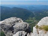 | Osilnica - Loška stena
Loška stena is located above the Upper Kolpa Valley, specifically above the villages of Grintovec pri Osilnici, Ložec and Ribjek. From the top of...
3 h 50 min |
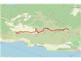 | Nakovana - Sveti Ilija (Pelješac)
Sv. Ilija, also known as Zmija's Bumblebee, is a 961-metre-high mountain and the highest peak on the Pelješac peninsula. From the top, you can en...
2 h 45 min |
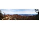 | Railway station (Most na Soči) - Veliki vrh (above Lom)
Veliki vrh is located in the NE part of the Banjška plateau, rising above the Čepovan valley, the valley of the Soča River and the valley of the ...
3 h 15 min |