Marija Reka (Strgar) - Golava
Starting point: Marija Reka (Strgar) (450 m)
| Lat/Lon: | 46,2079°N 15,0884°E |
| |
Time of walking: 1 h 15 min
Difficulty: difficult marked way
Altitude difference: 384 m
Altitude difference po putu: 384 m
Map: Posavsko hribovje - zahodni del 1:50.000
Recommended equipment (summer): helmet
Recommended equipment (winter): helmet, ice axe, crampons
Views: 10.275
 | 2 people like this post |
Access to the starting point:
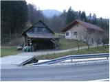
From the motorway Ljubljana - Celje, take the exit Šentrupert (from Ljubljana) or Šempeter (from Celje) and continue in the direction of Prebold and Trbovlje. After Prebold, the road leads to the village of Marija Reka, where the drive continues along the stream. When you see the mountain signs on the left side of the road (these are located across the little bridge on the other side of the stream by the edge of the house), park in the parking lot by the road (the parking lot is located 100m before the trailhead, and the other parking lot is 500m above the trailhead).
Path description:
From the parking lot, first walk along the main road to the start of the footpath, cross a small bridge and then, between two houses and gardens, climb up to the path that leads into the forest. The path, which climbs steeply, leads us after a few dozen steps to cart track, which we quickly leave, as the markings direct us right up a poorly graded but marked path. The path continues to be poor and overgrown, but leads us slightly higher to a dilapidated house. In front of the house, the path turns left (porly marked) and crosses over it. After about half an hour's walk, you reach a farm where there is a crossroads. Continue straight on in the route Golava and turn right just after the house. After a few more steps, a sign on a tree informs you that you will continue the ascent on a difficult path. The path then climbs gently for some time before quickly becoming quite steep. Next, we climb up the increasingly steep path, which mostly leads us through the forest (the exceptions are the rare viewpoints). Soon, however, the path leads us under a short rocky cliff, which we retreat to the left on very steep but sheltered slopes. Cross this slope with the help of a rope, after which the steepness eases only slightly. Continue up the steep, slippery path in the wet, where you have to use your hands to help yourself from time to time. Just below the summit, the steepness eases and the path leads to the bivouac at Golava.

Pictures:
 1
1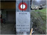 2
2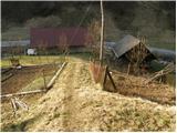 3
3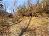 4
4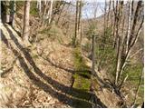 5
5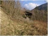 6
6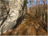 7
7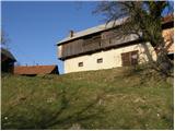 8
8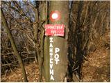 9
9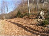 10
10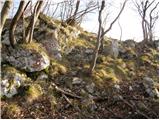 11
11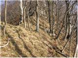 12
12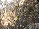 13
13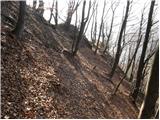 14
14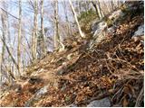 15
15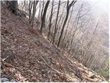 16
16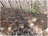 17
17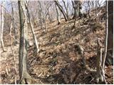 18
18 19
19
Discussion about the trail Marija Reka (Strgar) - Golava
|
| savinjcan23. 09. 2009 |
Hja ta pot je pri sestopu zelo nerodna/nevarna, še posebej če so tla razmočena.
|
|
|
|
| VanSims4. 12. 2011 |
Pot je neprijetna v mokrem tudi pri vzponu.
V zgornjem delu bi lahko bila še kaka zajla!
|
|
|
|
| trbovc5722. 06. 2012 |
Pot je slabo označena že v začetnem delu, ker sva s kolegom vstrajala sva se povspela na vrh po brezpotju in se vrnila po Zvonetovi poti in v delu pod domačijo spet izgubila markacijo. Sama pot je zelo zahtevna tudi v suhem.
|
|
|
|
| aditaker20. 09. 2015 |
Pozdravljeni!
Jaz bi vprasal, kaksne so kaj sedaj razmere na tej poti in zanima me se to, ali bi bila ta pot primerna zame, kljub temu, da imam vrtoglavico v visinah in prepadih in me je strah visine, ce je primerna da bi se povzpel po njej in ce ti na tej poti slucajno zdrsne ali pades v prepad ali ni nic kaj tak nevarnega da bi lahko kam padel. Kondicijsko sem pa dobro pripravljen, tako da strmina me ne ovira.
l.p. Aditaker
|
|
|
|
| Marx20. 09. 2015 |
Aditaker!
Za začetek moraš vedet da je štart poti zdaj nekaj bolj severno - ne več čez kmetijo Strgar.
Ta pot je zahtevna , ampak ni izpostavljenih delov. Jaz sem tudi vrtoglav , ampak na Golavi z tem ni problema (Kot recimo na sosedni Krvavici...)
Za razmere pa me ne vprašaj ker tukaj nisam bil še skoraj tri lete. Kaj je škoda - Golava je zelo lepa , ampak z to ceno bencina in malim otrokom je ćudež če nasploh greš na hribe...
|
|
|
|
| aditaker21. 09. 2015 |
Marx kje bolj severno je start ali mi lahko priblizno opises kje pustim avto in kam moram potem na startu iti da nebom zgresil pravega zacetka poti in se to ali je sploh markirano?
l.p. Aditaker
|
|
|
|
| Tomaž0012. 11. 2022 20:16:44 |
Pot prehodil 12.11,brez posebnosti in lepo oznacena
|
|
|