Marija Reka (Strgar) - Reška planina
Starting point: Marija Reka (Strgar) (350 m)
Time of walking: 1 h 45 min
Difficulty: easy marked way
Altitude difference: 575 m
Altitude difference po putu: 585 m
Map: Posavsko hribovje - zahodni del 1:50.000
Recommended equipment (summer):
Recommended equipment (winter): ice axe, crampons
Views: 8.812
 | 2 people like this post |
Access to the starting point:
From the Ljubljana - Celje motorway, take the Šentrupert (from Ljubljana) or Šempeter (from Celje) exit and continue in the direction of Prebold and Trbovlje. After Prebold, the road leads to the village of Marija Reka, where you continue along the stream. When you see the mountain direction signs on the right side of the road, park in the parking lot next to the road (the parking lot is located 10 m before the trailhead or almost opposite the parking lot!
Path description:
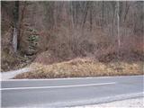
From the parking lot, first walk across the main road to the start of the footpath cart track, then climb up to the path that goes into the forest (past the former quarry on the left). The path then turns left a little further on from the quarry and climbs steeply up to a poorly graded but marked path, which is very slippery in the wet!. Continue on the poor and overgrown path, but a little higher leads us to a signpost (Prebold straight, and Golava and Mrzlica back), where we turn left on the marked path over a small ridge, behind the ridge the path begins to climb steeply again on the poorly shored marked path, which leads us to a meadow, where the path continues across the meadow, where we come to the house and the trestle, which is stamped for Gradišče!
Continue along the dirt road to the chapel, where you join the route from Preboldo, where a footpath branches off the tarmac road uphill, which quickly turns into cart track. Follow this path, which descends gently at first and then ascends gently, all the way to Doma pod Reško mountain pasture.
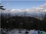
From the house, continue along the marked path which, after a short climb, leads to the Church of St Mary. Here you continue on, on the left side of the church and after a few steps you see a marked footpath branching off the road (straight ahead, direction lookout point). Continue moderately up the cart track, which ends after 15 minutes. The marked but poorly surfaced path then climbs steeply. The steep path is a slip hazard in wet and snowy conditions. After a good 20 minutes of steep ascent, the steepness eases and the path leads to a ridge, where you continue to the right. After a few more steps, we reach a viewpoint, which is also the goal of our tour.

Pictures:
 1
1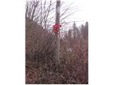 2
2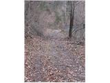 3
3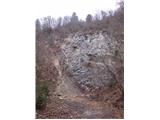 4
4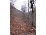 5
5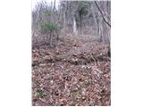 6
6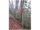 7
7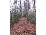 8
8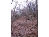 9
9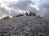 10
10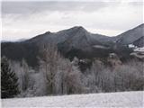 11
11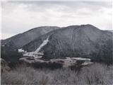 12
12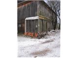 13
13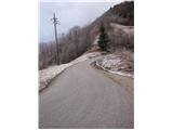 14
14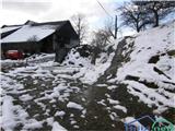 15
15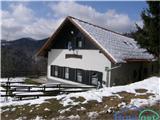 16
16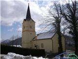 17
17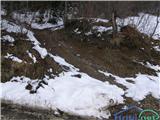 18
18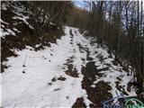 19
19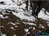 20
20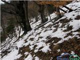 21
21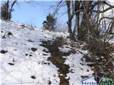 22
2223
 24
24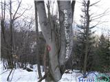 25
25
Discussion about the trail Marija Reka (Strgar) - Reška planina
|
| Hribolazec8129. 04. 2018 |
Tale pot je zelo slabo označena tako od izhodišča kot po poti
|
|
|
|
| zdejan3. 01. 2021 |
Markacije so obnovljene, so tudi novi kažipoti. Pot je sedaj lepo označena.
|
|
|
|
| Aljosad20. 11. 2021 22:08:57 |
Slabo označena pot na posameznih odsekih.
Dvakrat zgrešil: prvič že na začetku pri kamnolomu kjer je potrebno zaviti levo v breg. Slabo označeno, zaradi sečnje in zaraščenosti.
Drugič zašel na grebenu Gradišča, kjer sem na grebenu sledil kolovozu, zgubil markacije, se prebijal čez čedalje bolj neprehodno grmičevje. Nato pa odvil navkreber in sem prišel do Podbregarja iz vzadaj. Drugače zanimivo, samotno in lepo.
|
|
|
|
| Hribolazec811. 04. 2023 01:09:32 |
Pot še kar ni označena, niti izhodišča ne najdeš, po poti par markacij, potem se izgubijo za lep čas, vmes tudi hitro zalutaš in hodiš čez zelo zaraščena trnje, skratka naj avto popravi "neoznačena pot" 
|
|
|
|
| Quentin18. 12. 2023 17:45:10 |
Danes je čudovit razgled in toplotni obrat, tla suha, zato si izberem hrib, na katerem še nisem bil. Avto pustim pri cerkvi Marije Vnebovzete tik nad planinskim domom. Prvi lepi razgledi na Zasavsko hribovje (Golava, Mrzlica, Kamnik, Gozdnik, Hom ...) me pričakajo že tukaj. Odtod vodi na vrh lepo označena in primerno nadelana, a precej strma steza. Brez kolovozov in cest. Hoja traja 45 minut. Na vrhu me preseneti čudovit razgled proti vzhodu (Celje, Boč, Sljeme ...) in proti severu ter severozahodu (Savinjske Alpe, Ojstrc/Hochobir, Golica/Koralpe, Spodnja Savinjska dolina ...). Proti jugu se skozi veje vidijo Kum in Gorjanci. Poleti je razgled verjetno slab zaradi listja.
V lepo vzdrževanem bivaku na vrhu doživim prijetno presenečenje: na mizi najdem steklenico žganja, čokoladne Miklavže in bonbone. Vso pot ne srečam nikogar, slišim samo glasove ujed.
|
|
|