Rimske Toplice - Kopitnik (via Ogeški potok)
Starting point: Rimske Toplice (213 m)
| Lat/Lon: | 46,1208°N 15,2007°E |
| |
Name of path: via Ogeški potok
Time of walking: 2 h 5 min
Difficulty: partly demanding marked way
Altitude difference: 697 m
Altitude difference po putu: 715 m
Map: Posavsko hribovje - zahodni del 1:50.000
Recommended equipment (summer):
Recommended equipment (winter): ice axe, crampons
Views: 31.364
 | 2 people like this post |
Access to the starting point:
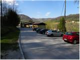
a) From the motorway Ljubljana - Maribor take the exit Celje - centre, then continue driving towards Laško and later Rimske Toplice. At the end of Rimske Toplice (just after the crossroads where the road to the village of Globoko and the railway station Rimske Toplice branches off to the left over a bridge), take a sharp right in the direction of Rimske terme. Continue for another 10 m and then you will reach the next crossroads, at which you will park (there is a Tuš shop near the starting point).
b) From Zasavje, first drive to Hrastnik, then continue towards Celje. When you arrive in Rimske Toplice, turn right at the main crossroads towards Zidanega Most. At the end of Rimske Toplice (just after the crossroads where the road to the village of Globoko and the railway station Rimske Toplice branches off to the left over a bridge), take a sharp right in the direction of Rimske terme. Continue for another 10 m and then you will reach the next crossroads, at which you will park (there is a Tuš shop near the starting point).
c) From the direction of Posavje, first drive to Zidani Most and then continue towards Celje. When you arrive in Rimske Toplice, pay attention, because at the beginning of the town you will turn left in the direction of Rimske terme (leave the main road just a few metres before the town, where the road to the village of Globoko branches off to the right over a bridge). Continue for another 10 m and then you will reach the next crossroads, at which you park (there is a Tuš shop near the starting point).
Path description:
From the starting point, focus on the road that continues along a small stream (direction Kopitnik). The road quickly leads us to a nearby residential house, after which it turns into a moderately steep mountain path. We continue along the stream for a short time, and then signs direct us to the right to a slope, over which we start to climb steeply. A little higher up, the path leads us out of the woods, and then past a cross and the next dwelling house leads to an asphalt road. Follow the road uphill, then right at the next crossroads in the route Kopitnik. Continue along the road for a few minutes and then arrive at a marked crossroads.
At the crossroads, leave the asphalt road and continue right on the footpath in the direction of "Kopitnik - koča" (straight ahead Kopitnik and Stražnik). The path continues to climb crosswise to the right, soon becomes a footpath and then joins a worse forest road, which you follow to its end.
From the end of the road, continue along the well-trodden path, which begins to climb moderately to occasionally steeply through the forest. Higher up, the path leads alongside "fields" of hemlock, then joins cart track, which you follow to the right. Cart track soon turns quite right and crosses a less steep slope, where you come to the edge of the forest. Here the path turns left and gradually widens into a dirt road. A little further on, the path from Šmarjeta joins us from the right, and we continue straight on to the nearby homestead at Izera.
At the homestead, the road becomes asphalt, and we walk along it for only a few metres, then a sign on a tree "cottage" directs us left into the forest. We continue climbing through the forest for a short distance and then join the path from the villages Marno and Turje. From the crossroads onwards we leave the forest, and a gently sloping path continuing across a larger meadow leads us in a few minutes to Koča na Kopitniku.
From the hut at Kopitnik, continue left, initially even slightly downhill, then the path becomes more distinct and starts to climb. After a short climb, get on the road and follow it to the left. The path ahead leads us past the forestry hut, after which the path from Zidanega Most joins from the right. Continue straight ahead and then at the next crossroads turn slightly left towards the summit. The path continues in a slight ascent through the forest and then descends for a few metres. A short climb follows and the path leads to a ridge where we join the path from Lukovškega prevala (starting point Rimske Toplice). Here, continue right onto a narrow and partly precipitous ridge, along which you continue. As the path is wide enough and protected by a rope in exposed places, the ascent to the top of Kopitnik does not present any major problems.

Pictures:
 1
1 2
2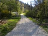 3
3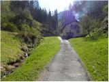 4
4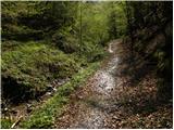 5
5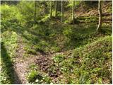 6
6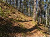 7
7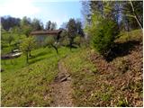 8
8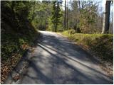 9
9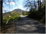 10
10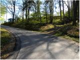 11
11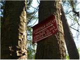 12
12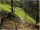 13
13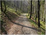 14
14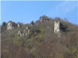 15
15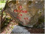 16
16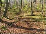 17
17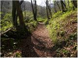 18
18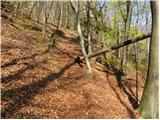 19
19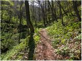 20
20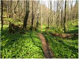 21
21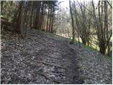 22
22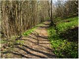 23
23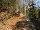 24
24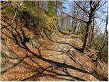 25
25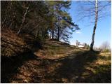 26
26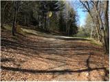 27
27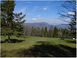 28
28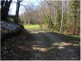 29
29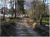 30
30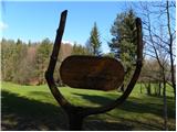 31
31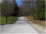 32
32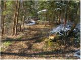 33
33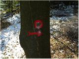 34
34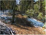 35
35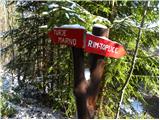 36
36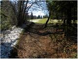 37
37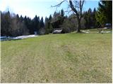 38
38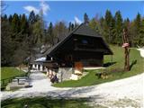 39
39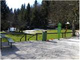 40
40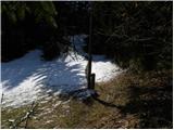 41
41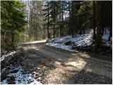 42
42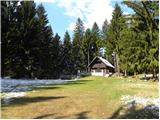 43
43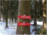 44
44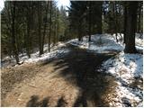 45
45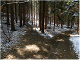 46
46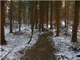 47
47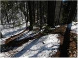 48
48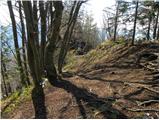 49
49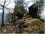 50
50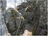 51
51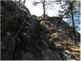 52
52 53
53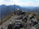 54
54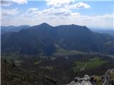 55
55
Discussion about the trail Rimske Toplice - Kopitnik (via Ogeški potok)
|
| šoni12. 01. 2013 |
tega opisa ne razumem, cesta je med savinjo in rimskimi toplicami, se pravi na desnem bregu, kako potem desno čez most čez savinjo?
|
|
|
|
| šoni12. 01. 2013 |
mislim glavno cesto celje-zidani most, po mojem se ne gre nič čez savinjo, razen če se ni kpotnik kam prestavil 
|
|
|
|
| šoni12. 01. 2013 |
kopitnik 
|
|
|
|
| Tadej13. 01. 2013 |
Hvala za opozorilo, sem popravil.
|
|
|
|
| mustejn21. 12. 2014 |
danes sem prehodil to pot in sem bil zelo zadovoljen.Pot je dobro označena,kava v koči odlična... skratka vredno obiska.
|
|
|
|
| modrook123. 02. 2020 |
Po tej poti se vračamo iz Kopitnika. Pot na določenih delih slabo markirana,markacije zbledene. Pot skozi lurd veliko bolj prijetna
|
|
|
|
| garmont23. 02. 2020 |
Lahko pa na razpotju pri sliki 14 nadaljujemo levo po cesti in sledimo markacijam pod razglednim Stražnikom na vrh Kopitnika. Tako se bomo najprej povzpeli na vrh, sestopili pa bomo krožno mimo koče.
|
|
|
|
| garmont26. 04. 2021 15:25:47 |
Na sliki št.7 je markirana pot označena ostro levo, mimo hiše. Bolj priporočljivo je pot nadaljevati naravnost in se izogniti hoji mimo stanovanjskega objekta. Pri obeh variantah pridemo na asfaltno cesto, po kater nadaljujemo pot. 
|
|
|