Prvine - Koča na Čemšeniški planini
Starting point: Prvine (870 m)
| Lat/Lon: | 46,1867°N 14,9395°E |
| |
Time of walking: 45 min
Difficulty: easy marked way
Altitude difference: 250 m
Altitude difference po putu: 250 m
Map: Posavsko hribovje - zahodni del 1:50.000
Recommended equipment (summer):
Recommended equipment (winter):
Views: 32.341
 | 2 people like this post |
Access to the starting point:
From the motorway Ljubljana - Celje take the exit Trojane. Continue in the direction of Zagorje and the road will then take you through the tunnel V V Zideh, after which you will come to a place where the road to the village Šentgotard branches off to the left. At the end of the village Šentgotard you will come to a crossroads where you continue left in the direction of Prvine (on the right Čemšenik). A little further on you reach the next crossroads, where you continue right again in the direction Prvine (left Zaplanina). The road then soon leads to the next crossroads, where you continue left for the direction Prvine (right Čemšenik). Follow this road, which then leads past the hunting lodge, to the parking lot near the ski centre at Prviny.
From Zagorje, take Kisovec and Izlake towards Trojane, but only until the road to Šentgotard branches off to the right. Continue as described above.
Path description:
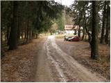
From the parking lot, continue along the road along which you parked. The road then passes the house you see in front of you on the left and crosses the ski slope just a little further on. At the point where the road crosses the ski slope, leave the ski slope and turn right uphill to cart track, which also crosses the ski slope. The path then enters the forest and climbs gently eastwards. The path, which only occasionally climbs a little more, crosses a few paths and tracks. However, as the path is well marked, there are no problems with orientation. A little further on, the path from Zagorje, Izlake and Čemšenika joins us from the right. The way forward runs along the edge of the steep hayfields of Čemšeniške mountain pasture from which we have beautiful views, especially towards Kumu. A few minutes of walking along the edge of the steep hay meadows then leads to the place where the cable car crosses the mountain path. Cross the cableway carefully, taking care not to bump your head on the cableway. On the other side of the cableway, you can already see the mountain hut, which can be reached in a few steps.

Pictures:
 1
1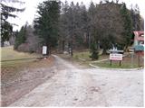 2
2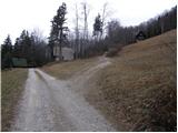 3
3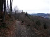 4
4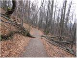 5
5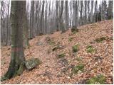 6
6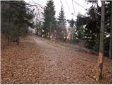 7
7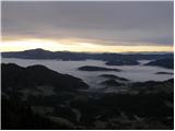 8
8 9
9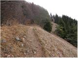 10
10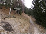 11
11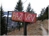 12
12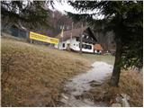 13
13
Discussion about the trail Prvine - Koča na Čemšeniški planini