Starting point: Besnica (342 m)
| Lat/Lon: | 46,042°N 14,6457°E |
| |
Time of walking: 2 h 15 min
Difficulty: easy marked way
Altitude difference: 450 m
Altitude difference po putu: 525 m
Map: Ljubljana - okolica 1:50.000
Recommended equipment (summer):
Recommended equipment (winter):
Views: 23.178
 | 3 people like this post |
Access to the starting point:
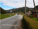
a) From the Ljubljana Eastern Bypass, take the Bizovik exit, then continue towards Sostrem and Besnice. After the pass, where the road to Javor branches off to the right, the road starts to descend and then, after a short macadam section, leads into the valley of the Besnica stream. At the crossroads by a few houses, continue left towards Zalog, and after the crossroads, pay attention to the right-hand forks in the roads. After about 500 metres, we reach the first road turning off to the right, where we can see some markings or signs with more attention, and about 100 metres further on, at the road turning off towards the Vnajnarje settlement, we can see red mountain signs. There are no parking spaces at the first or second turnoff, but it is possible to park in a suitable place on the roadside at the first turnoff.
b) First, drive to Zalog (a part of Ljubljana), then cross the Ljubljanica River and continue to Podhrad, where you turn right towards Besnice. The road ahead first passes through a narrow underpass under the railway line and then gradually begins to climb. Follow this road to the road turning left towards the settlement Vnajnarje, where you will see red signs for Janče, or you can drive on for another 100 metres to the second road turning left, where there are a few more parking options.
Path description:
From the starting point at the marked road turnoff towards the Vnajnarje settlement and the red mountain signs, continue along the road in the direction of the settlement and the footpath to Janče. Leave the road to Vnajnarje at the first road turning to the right, where you will also join the trail from the second possible starting point (both trails take less than 5 minutes to get here).
The two paths join at the wodshed, where you can see the markings of the Path of the Couriers and Liaison Officers (the path is marked with round yellow-blue markings, and in addition to the above-mentioned markings, you can also see the old TV markings at the wodshed and elsewhere).
From the point where the two paths join, continue along the narrower ascending asphalt road, which you leave just after the right-hand bend, as the markings lead you left into the forest. Through the forest, the path mostly follows old train tracks, and then, when you leave the forest, it ends or disappears. Here we continue along the right-hand edge of the forest, and higher up the cart track, which climbs over the upper part of the hay meadow. Cart track joins a macadam road a little further on, which is followed to the right to a nearby house. At the house, go left and follow the slightly steeper cart track quickly up to an asphalt road, which you follow to the right. The tarmac road son lays down and then continues for some time without any major changes in elevation. At a small crossroads, where the road to the left branches off and leads to the Jožman and Jakopič farms, continue straight ahead. The way forward leads us past a small sign and a little further on past a signpost for the end of the settlement of Vnajnarje. The road opens up some views further on, all the way to the Krim and beyond. A little further on from the NOB memorial, which can be seen on the right-hand side of the road, we leave the asphalt road and continue slightly to the left on the macadam road, which we follow to the first left-hand bend. At this bend, where the Borovnice trail joins, continue straight ahead and follow the wide cart track for a short distance through the forest. When the forest ends, the road becomes a nice macadam road, and a nice view opens up towards Janče and the surrounding hills. After the brick chapel, we join the wider macadam road, which is then resurfaced with asphalt at the nearby houses. Behind the houses, you reach a small crossroads where the asphalt road continues to the right, the forest road to Breza branches off to the left, and the marked path to Janče continues straight ahead. The first metres after leaving the road are on an overgrown path, at first mainly blackberries, but higher up there are a few fallen trees. After a short climb, the path leads us to cart track, which is laid after a while, and then leads us back to the asphalt road in a slight downhill. Once back on the road, the path leads past a wooden cross and later on past a primary school. When the road returns to the forest, we leave it temporarily and climb up the marked footpath, which returns to the road just before the larger chapel. The chapel offers a beautiful view, and we follow the main road past another chapel to the village of Janče. In Janče, in the firstDescription and figures refer to the situation in 2014 (September).

Pictures:
 1
1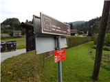 2
2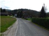 3
3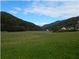 4
4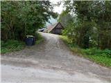 5
5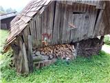 6
6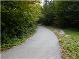 7
7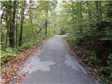 8
8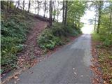 9
9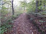 10
10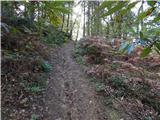 11
11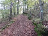 12
12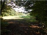 13
13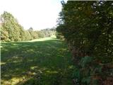 14
14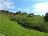 15
15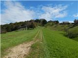 16
16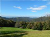 17
17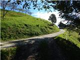 18
18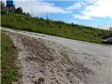 19
19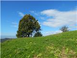 20
20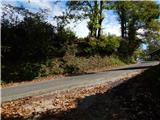 21
21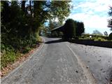 22
22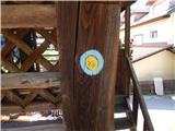 23
23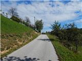 24
24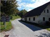 25
25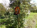 26
26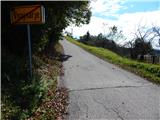 27
27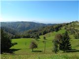 28
28 29
29 30
30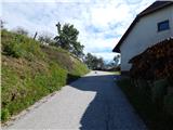 31
31 32
32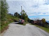 33
33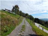 34
34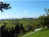 35
35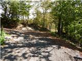 36
36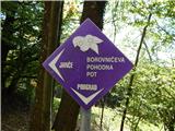 37
37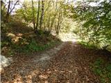 38
38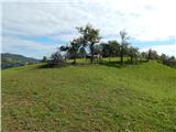 39
39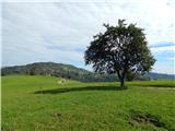 40
40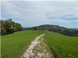 41
41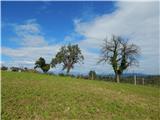 42
42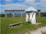 43
43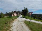 44
44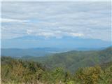 45
45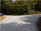 46
46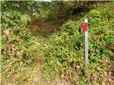 47
47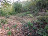 48
48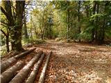 49
49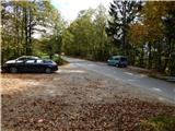 50
50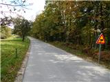 51
51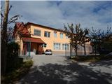 52
52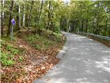 53
53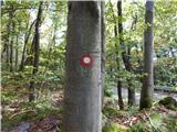 54
54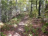 55
55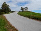 56
56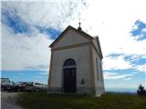 57
57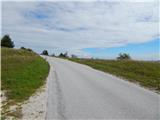 58
58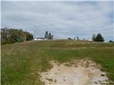 59
59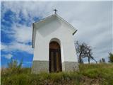 60
60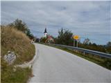 61
61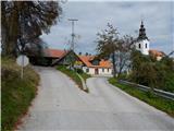 62
62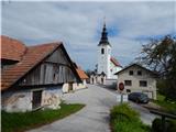 63
63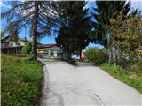 64
64 65
65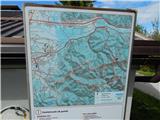 66
66 67
67 68
68
Discussion about the trail Besnica - Janče
|
| nisa9. 10. 2014 |
Zanima me če so ob poti Knafeljčeve markacije, ker na slikah se to ne vidi.
Drugače zanimiv izlet v bližini Ljubljane.
|
|
|
|
| vrhnika4. 01. 2019 |
Tudi mene zanima kako je z markacijami na tej poti. Ali so samo table ali tudi Knafeljčeve rdeče bele.
LP
|
|
|
|
| zwbgr29. 02. 2020 |
markacije so, poleg knafeljčeve tudi markacije poti vezistov in kurirjev, ampak so mestoma že zelo obledele in je treba biti pozoren
|
|
|
|
| Gizelca24. 04. 2020 |
Za vikend sva šla s partnerjem po tej poti. Slike na začetku ne kažejo prave poti. Na začetku je slikana privat cesta, ki ni več prehodna. Zdaj gre pot po glavni cesti, kjer več ljudi pusti avte - torej od znaka Vnajnarje naprej gor po glavni cesti.
Pot je super, ni zelo naporna. Midva sva pričakovala malo več gozda. Če bi se radi sprehajali po gozdu priporočam raje Debni vrh, ki je tudi v tem okolišu.
|
|
|