Marija Reka (Strgar) - Mrzlica
Starting point: Marija Reka (Strgar) (450 m)
| Lat/Lon: | 46,2079°N 15,0884°E |
| |
Time of walking: 2 h 30 min
Difficulty: easy marked way
Altitude difference: 672 m
Altitude difference po putu: 720 m
Map: Posavsko hribovje - zahodni del 1:50.000
Recommended equipment (summer):
Recommended equipment (winter):
Views: 22.012
 | 3 people like this post |
Access to the starting point:
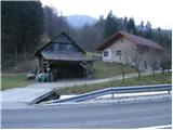
From the motorway Ljubljana - Celje, take the exit Šentrupert (from Ljubljana) or Šempeter (from Celje) and continue in the direction of Prebold and Trbovlje. After Prebold, the road leads to the village of Marija Reka, where the drive continues along the stream. When you see the mountain signs on the left side of the road (these are located across the little bridge on the other side of the stream by the edge of the house), park in the parking lot by the road (the parking lot is located 100m before the trailhead, and the other parking lot is 500m above the trailhead).
Path description:
From the parking lot, first walk along the main road to the start of the footpath, cross a small bridge and then, between two houses and gardens, climb up to the path that goes into the forest. The path, which climbs steeply, leads us after a few dozen steps to cart track, which we quickly leave, as the markings direct us right up a poorly graded but marked path. The path continues to be poor and overgrown, but leads us slightly higher to a dilapidated house. In front of the house, the path turns left (porly marked) and climbs over it. After about half an hour's walk, you reach a farm where there is a crossroads.
Continue right in the route Mrzlica, following cart track, which, after a few minutes, leads to an asphalted road without any major changes in elevation. Follow this road for 5 minutes until a footpath branches off up to the left. The path soon leads to a farm, where you continue left up a porly marked path to another farm. Continue cross-climbing through a meadow with a view, to a wood where the slope eases. The path leads to a road where we continue in the route Mrzlica (left Golava). After a few minutes, we leave the road and continue our ascent along cart track in the direction of Mrzlice. Soon you will come to the road again, where you continue left up and follow it to the end. From the end of the road, continue left up the porly marked cart track. After a half-hour climb from the end of the road, you come to a large grassy ridge where you rejoin the road. Here, continue left up the road and follow the winding road all the way to the house on Mrzlica.
From the house to the top, it is a 5 minute climb.

Pictures:
 1
1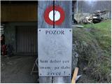 2
2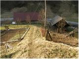 3
3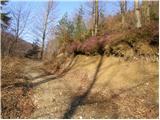 4
4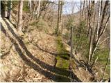 5
5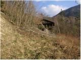 6
6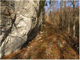 7
7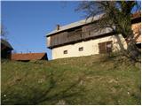 8
8 9
9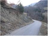 10
10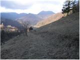 11
11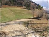 12
12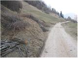 13
13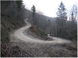 14
14 15
15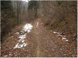 16
16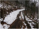 17
17 18
18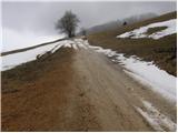 19
19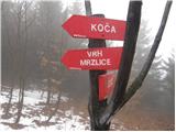 20
20 21
21 22
22
Discussion about the trail Marija Reka (Strgar) - Mrzlica
|
| iztok15. 03. 2008 |
Mi smo danes podaljšali pot na Kalški hrib, se spustili do koče in se preko Zg. Lemeška vrnili nazaj. Prijetna krožna pot, ki delno poteka tudi po partizanski poti  . Toplo priporočam
|
|
|
|
| IvoK6. 10. 2012 |
Izhodišče ni več tapravo. Skedenj krasi napis, da je prehod prepovedan, ker gre za privatno latnino. Tudi markacija je izbrisana. Iskala sva kaksno drugo izhodišče v bližini in potem obupala ter se odpeljala do Podmeje, od koder sva potem šla na Mrzlico.
|
|
|
|
| di6. 05. 2015 |
Slabo razpoznavna oz. vidna pot; za "nedomače" ne ravno priporočljiva.
|
|
|
|
| eva148817. 07. 2017 |
Izhodišče se sedaj nahaja v smeri Prebold - Marija Reka okoli 100 metrov pred hišo na sliki. Čez potok je speljan lesen mostiček, pot pa potem pelje v hrib, tako da se ni treba potikati ljudem po parceli.
Sama pot je na nekaterih delih zelo slabo označena... Sva pa Mrzlico dosegla v dveh urah, s tem da sva okoli pol ure porabila za izgubljanje.
|
|
|