Lake Gradišče - Limbarska gora
Starting point: Lake Gradišče (355 m)
| Lat/Lon: | 46,1621°N 14,708°E |
| |
Time of walking: 1 h 55 min
Difficulty: easy marked way
Altitude difference: 418 m
Altitude difference po putu: 460 m
Map:
Recommended equipment (summer):
Recommended equipment (winter):
Views: 14.420
 | 2 people like this post |
Access to the starting point:
From the motorway Ljubljana - Maribor, take the exit Lukovica, and then continue driving towards Moravče. After crossing Radomlje, you will reach the beginning of the settlement Spodnje Prapreče, where at the crossroads turn left towards Gradiška jezera. After a short climb, you reach a junction with a priority road, where you continue right towards Lake Gradišče (left Gradišče), and then just a little further, from the priority road, left towards Lake Gradišče (right Preserje pri Lukovici), in front of which you park in a larger parking lot.
Path description:
From the starting point, continue along the marked trail in the direction of Limbarska gora, which continues along the northern shore of Lake Gradiška. The trail, which continues along a dirt road closed to public traffic, soon turns right and passes to the eastern side of the lake, where the marked trail to Limbarska gora turns left into the forest.
Continue towards Limbarska gora, where you first climb steeply and then the path, which follows cart track, quickly flattens out. Higher up, out of the woods, a fine view opens up to the Church of St. Mohor on Mohorje Hill to the right, and the path descends in a few minutes to the settlement Vinje pri Moravčah, where there is a marked crossroads.
Continue left in the direction Limbarska gora (St. Mohor on the right), where you will pass a few houses, a chapel and a registration box for the Rokovnja Mountain Trail. A little further on, at a small crossroads with a wooden sign, continue right in the direction Limbarska gora and climb up to the settlement Negastrn, where you follow the markings at the crossroads. When you leave the asphalt road, quickly leave the village, and at the crossroads take the bottom right cart track, which descends to a marked crossroads, where you will join the marked trail from Krašnja.
Continue in the direction Limbarska gora, and a little further on the path crosses the asphalt road Krašnja - Moravče. The way forward leads us along a macadam road, from which we soon turn left onto a marked path that gradually turns into a forest. After a few minutes we reach the wide cart track, from which the markings direct us to the left. There is a moderate ascent through the forest, and when the forest ends you reach a larger hayfield where the path turns left. There is some fairly gentle walking, and then you reach an asphalt road, which, in a few minutes and with increasingly beautiful views, takes you to the top of Limbarska gora, where the Church of St Valentine is located.
Starting point - Vinje pri Moravčah 0:45, Vinje pri Moravčah - Limbarska gora 1:10.
Description and pictures refer to the situation in 2018 (November).

Pictures:
 1
1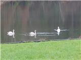 2
2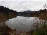 3
3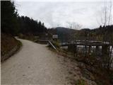 4
4 5
5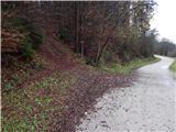 6
6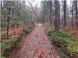 7
7 8
8 9
9 10
10 11
11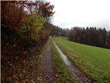 12
12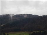 13
13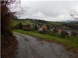 14
14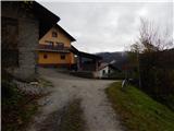 15
15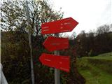 16
16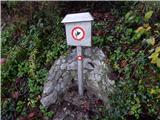 17
17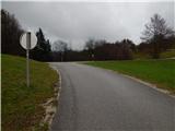 18
18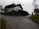 19
19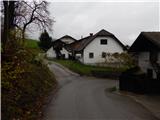 20
20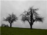 21
21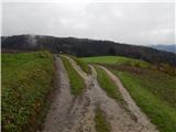 22
22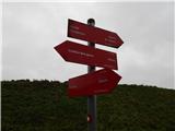 23
23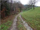 24
24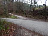 25
25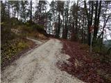 26
26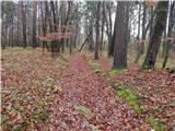 27
27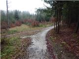 28
28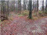 29
29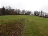 30
30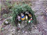 31
31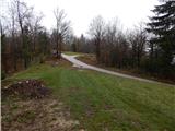 32
32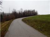 33
33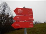 34
34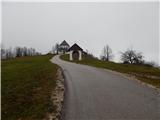 35
35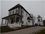 36
36 37
37
Discussion about the trail Lake Gradišče - Limbarska gora
|
| zlatica18. 02. 2019 |
Raznolika in zanimiva pot, le da je zame trajala precej več, kot je zgoraj napisan čas. Pot je dolga v obe smeri 15km in Očitno ne dosegam več teh norm hitrohodcev. Pa nič hudega, pomembno je biti v naravi in si vzeti čas za oglede zanimivosti, ki se ti ponudijo ob poti.
|
|
|
|
| roženkravt17. 02. 2020 |
Izjemno lepa, skoraj pravljična pot. Zagotovo je v vseh letnih časih tako.Poleti, kot je videti, daje lepo, senčno zavetje. Opis poti z vsemi fotografijami pa je enkraten. In vsa pohvala planinskemu društvu Blagovica za več kot vzorne markacije. Zlepa ne najdeš tako odlično markirane poti. Nobene možnosti nimaš, da bi zgrešil. Obiščite Limbarsko goro po tej poti. Ne bo vam žal. 
|
|
|
|
| TamaraTP5. 03. 2020 |
Res je lepa pot, kot sta zapisala oba predhodnika. Palčkov klanec je prav zanimiv. Habitata dovolj. Primerna pot s štirinožcem.
|
|
|
|
| J.P.1. 01. 2021 |
Vsekakor priporočam štart od jezera. En lep izlet poln krasnih razgledov, lepe narave... ne glede na letni čas in vreme. Lp
|
|
|
|
| smatjaz2. 01. 2021 |
Še lepše pa je od jezera v Gradišče in vrh Gradišča nad cerkvico Sv. Marjete od koder je lep razgled nad večjim delom Ljubljanske kotline, Vodiške ravnice , KSA in Julijcev, ter spust čez gozd do jezu in naprej na Limbarsko, ta dodatni krog vam zame cca 1 uro.
|
|
|