Zvodno - Bavč (via Suhi potok)
Starting point: Zvodno (254 m)
| Lat/Lon: | 46,21223°N 15,27846°E |
| |
Name of path: via Suhi potok
Time of walking: 1 h 10 min
Difficulty: easy marked way
Altitude difference: 438 m
Altitude difference po putu: 438 m
Map: Celjska kotlina, 1:50000
Recommended equipment (summer):
Recommended equipment (winter):
Views: 762
 | 1 person likes this post |
Access to the starting point:
From the motorway Ljubljana - Maribor, take the exit Celje - centre and continue in the direction of Laško and Zidanega Most. The road continues through the centre of Celje and then leads to a roundabout with a water meter. Here, continue "straight ahead" (towards Laško and Zidani Most) and follow the road to the next traffic lights, where you turn left, cross the Savinja River and then turn right at the junction after the bridge. Continue to the underpass under the railway line and a few metres further to the fire station in Zagrad. Continue straight ahead and follow the road through the village, which leads us higher up to a small crossroads, where we see signs for Suhi potok to the right and Hudičev graben to the right. At the crossroads, park near the bus stop.
Path description:
In Zvodno, at the crossroads by the bus station, according to the signs today, continue to the right in the direction of Pečovniška koča on Grmada (and Suhega potok - there used to be a visible sign on a concrete cliff), and straight along the asphalt goes the path to Hudičev graben, from where you can also climb Bavč. Follow the macadam surface or forest road for a few hundred metres. At a marked crossroads, turn left and continue slightly up the forest path or the bed of the Suhego potok. Continue slightly to the left again (to the right you come to an abandoned quarry) and follow the mountain forest path up, passing the quarry on the left. The path is well beaten and marked. It winds pleasantly along the bed of the Dry Stream higher up into the world between Bavč on the left and Grmada on the right. Soon reach a crossroads, continue left along the Bavč (the path to the right goes to the Pečovník hut on Grmada). Join the macadam road coming from the right. Continue up the road and after a while you will reach a crossroads, where you turn sharp left in the direction from where the path from Hudičův grabno to Pečovniška hut comes. A few more 100 metres and you will reach a major fork in the path by the hunting observation post. Continue left on the Bavč ridge (a little less to the left down the marked path to Hudičev graben, and straight ahead is the unmarked path to Srebotnik). Continue north along the Bavč ridge and soon arrive at our destination along the unmarked path.

Pictures:
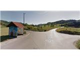 1
1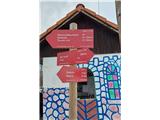 2
2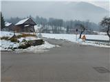 3
3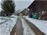 4
4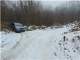 5
5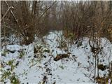 6
6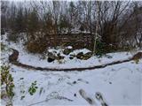 7
7 8
8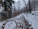 9
9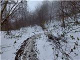 10
10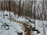 11
11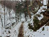 12
12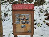 13
13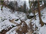 14
14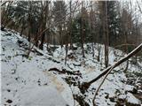 15
15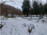 16
16 17
17 18
18 19
19 20
20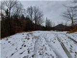 21
21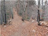 22
22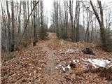 23
23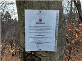 24
24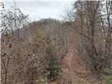 25
25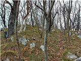 26
26 27
27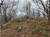 28
28 29
29
Discussion about the trail Zvodno - Bavč (via Suhi potok)
|
| zdejan27. 12. 2020 |
Danes sem opazil, da so v križišču zgoraj opisanega izhodišča (slika 1) namestili nov prometni znak, ki označuje, da je parkirišče 1,2 km naprej (pred ribogojnico na začetku Hudičevega grabna - slika 29). Tako se do našega izhodišča lahko vrnemo peš. Alternativna možnost pa je tudi, da se od parkirišča ob Hudičevemu grabnu vrnemo le cca 300 metrov nazaj po cesti in nato zavijemo ostro levo v gozd, kjer sledimo kažipotom za Pečovniško kočo in markirani stezi po gozdu v smeri Suhega potoka. Markirana pot se priključi na našo zgoraj opisano pot v bližini kamnoloma (slika 9), zato je praktično enako dolga, kot da bi šli iz osnovnega izhodišča (slika 1).
|
|
|
|
| zdejan20. 02. 2021 |
Alternativna pot od novega zgledno urejenega parkirišča v Zvodnem (pred ribogojnico na začetku Hudičevega grabna - slika 29) do Suhega potoka (slika 9) je sedaj podrobneje prikazana na poti "Zvodno - Tolsti vrh nad Celjsko kočo (skozi Suhi potok)" oz. na spletni strani https://www.hribi.net/izlet/zvodno_tolsti_vrh_nad_celjsko_koco_skozi_suhi_potok/25/879/8083 od slike 1 do slike 18. Menim, da je bolj primerno parkirati na novem parkirišču ob ribogojnici, kot pa v bližini križišča ob avtobusni postaji.
|
|
|