Veliko Trebeljevo - Obolno
Starting point: Veliko Trebeljevo (620 m)
| Lat/Lon: | 46,0039°N 14,7395°E |
| |
Time of walking: 1 h 20 min
Difficulty: easy marked way
Altitude difference: 156 m
Altitude difference po putu: 250 m
Map: Ljubljana - okolica 1:50.000
Recommended equipment (summer):
Recommended equipment (winter):
Views: 8.364
 | 2 people like this post |
Access to the starting point:
a) From Ljubljana's eastern bypass, take the Ljubljana Bizovik or Sostro exit, then continue towards Sostro. At the end of Sostre, the road starts to climb and after a few kilometres leads to a small pass where a steep road branches off to the right, leading to Javor. Here you continue straight ahead and descend into the valley of the Besniškega potok. Once in the valley, the road from Zalog joins us on the left, and we continue to the right and start climbing again. Follow the main road to Veliko Trebeljevo, where at the crossroads turn right towards the centre of the village (left along the main road Šmartno pri Litija). Pass through the village, past the renowned pastry shop and the Church of the Holy Cross. Above the village the road climbs steeply and then leads to a crossroads where you continue straight on in the direction of Višnja Gora (to the right Mali Vrh). Park just after the crossroads in a suitable place on the roadside.
b) First drive to Litija and from there continue towards Šmartné pri Litija. From Šmartno pri Litiji turn right and continue driving towards Štangarske Poljane and Maly and Veliki Trebeljevje. At the beginning of Veliko Trebeljevo we reach a crossroads where the main road to Zalog turns slightly to the right and we continue straight towards the centre of Veliki Trebelje. Through the village we pass a renowned pastry shop and the Church of the Holy Cross. Above the village, the road climbs steeply and then leads to a crossroads where you continue straight on in the direction Višnja Gora (right Mali Vrh). Park just after the crossroads in a suitable place along the road.
c) From the Ljubljana - Novo mesto motorway, take exit Višnja Gora and from there continue towards Vrh pri Višnji Gori, Leskovec and Veliko Trebeljevo. After approximately 3 km drive from the village Leskovec, you will reach a small crossroads where the road to Male Vrhe branches off to the left and the road to Veliko Trebeljevo continues to the right. Park in a suitable place a few metres before the crossroads.
Path description:
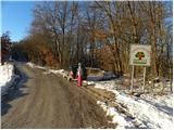
Near the signboard "Welcome to the Land of Strawberries (fruit road between Javor and Janče)" you will see cart track, which immediately splits into three parts. It doesn't matter which one you take, as all three merge after a few minutes, and the leftmost one is marked, next to which you will see a mountain direction sign for Janče, pointing down to the left. Continue slightly to the right, climbing moderately at first, and then the trail flattens out and joins the aforementioned cart track. Walk along cart track for a few minutes and then the signs direct you slightly right on a marked footpath which climbs gently up the slopes of the nearby Kopanca (684 m). Later on the trail is laid, or cart track, and then the trail is followed by a footpath with a footpath with a footpath with a footpath. From the crossroads onwards, the path starts to descend more visibly and then quickly joins the forest road leading towards Obolný.
Follow this road to the left (to the right to return to the Leskovec - Veliko Trebeljevo road), which descends for a short distance. When the road stops descending, we reach a small crossroads where a worse forest road branches off to the left towards the scattered settlement Gozd - Reka, and we continue to the right in the direction of a small village and the eponymous peak Obolno. The road continues to climb gently to moderately, and higher up, the road from Poljan pri Stični joins us from the right.
Continue straight ahead and, just a little further on, emerge from the woods onto a viewing slope, from where a fine view of the Menino mountain pasture and the Posavje hills opens up. At the beginning of the viewing slope, a marked cart track branches off sharply to the right, leading to the Obolno summit (straightforward agritourism). Climb through the forest for a few minutes, then the path will lay down and lead to a grassy ridge, from where it's just a walk to the summit.
From the top, you can continue left past the radio club hut and descend in a few minutes to the agritourism, where there is a stamp.

Pictures:
 1
1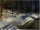 2
2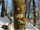 3
3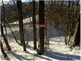 4
4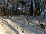 5
5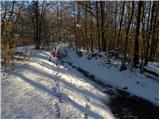 6
6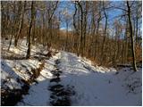 7
7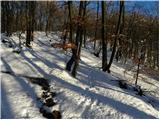 8
8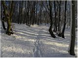 9
9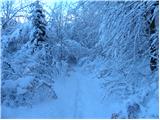 10
10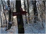 11
11 12
12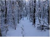 13
13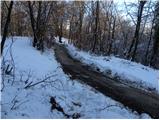 14
14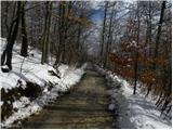 15
15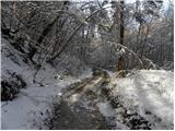 16
16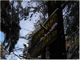 17
17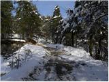 18
18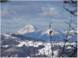 19
19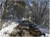 20
20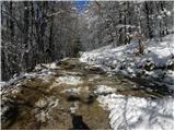 21
21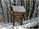 22
22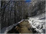 23
23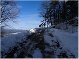 24
24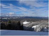 25
25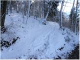 26
26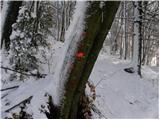 27
27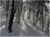 28
28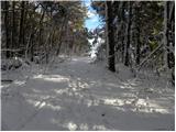 29
29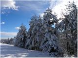 30
30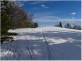 31
31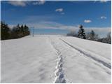 32
32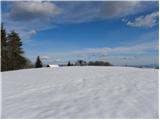 33
33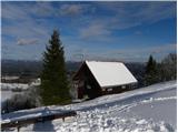 34
34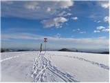 35
35 36
36
Discussion about the trail Veliko Trebeljevo - Obolno
|
| colinbrooks12. 07. 2014 |
An alternative route to Obolno, with more interest and better views, is as follows. Begin by turning onto a cart track sign-posted Gozd Reka that heads E from V. Trebeljevo. After a short uphill section, the road goes downhill for ~1.5km in large zig-zags to a farm in the valley bottom. It passes through the farm in a SE direction, and after ~0.5km comes to a junction where you should turn off to the right climbing gently in a S direction through the woods. After ~1km the road zig-zags more steeply uphill, and eventually comes into the open again at the picturesque farm "Pri Gozdarju" on an open ridge. (From here a detour can be made to another farm at the N end of the ridge with good views towards Obolno, Prezganje, and Jance.) Continuing S along the ridge from Pri Gozdarju, the views become increasingly impressive as the road bends slowly to the right, reaching a house called Krmuc in ~1km, from where there is a beautiful view towards Prezganje and Jance to the N. If you are too tired to continue to Obolno or if there is bad weather, the walk can be shortened at this point by continuing past Krmuc into the forest. After ~0.5km of gradual ascent the path reaches the ridge road coming from Obolno, and after ~1km of travel W along this you come to the main forest road from Leskovec to Trebeljevo where you should turn right reaching Trebeljevo in another ~3km. To continue from Krmuc to Obolno, walk back from Krmuc ~300m and at a junction of paths turn SE onto a path that bends gradually left around the top of a valley passing a quarry before reaching the farm Rehar in ~1km. Here turn sharp right onto a tarmac road that briefly heads E, then N. After ~0.5km, turn right onto a cart track that heads E uphill. At a rather neglected farm the track continues into the forest. After ~0.5km it crosses a stream and switches back N before climbing round to the E with increasingly impressive views towards Jance as you approach the farm Matevzek. From there a tarmac road heads S up the ridge with good views now opening to the E, reaching the farm Karmuje after ~1km, where you should turn right onto a road that ascends SW to the settlement at Obolno. Here you can obtain some well-deserved refreshments at the Gostilna. A little further along the road a track branches off to the left that shortly brings you to the summit of Obolno with impressive 360o views. Returning to the road, you soon enter the pleasant woods along a ridge that runs SW then W. After ~2km a path on the right sign-posted Gozd Reka will take you down to Krmuc, where you could reverse the first part of the walk back to Trebeljevo. Alternatively, continue along the forest road for another ~1km and you arrive at the main forest road from Leskovec to Trebeljevo (very little traffic). The simplest option is to turn right along this road, which after ~1km reaches the junction with the road that heads up to Mali Vrh, where you should keep right and follow the now tarmac road that descends towards V. Trebeljevo in ~ 1km. Alternatively, if you prefer not to walk on the road, a path can be found through the woods that leads from the junction with the Leskovec to Trebeljevo road almost to Trebeljevo. For a map of this route go to: http://www.everytrail.com/view_trip.php?trip_id=2864484
|
|
|
|
| janez25358. 10. 2020 |
Iz slik ni razvidno, pot gre večinoma po cest
|
|
|