Pri Babi - Hleviška planina
Starting point: Pri Babi (600 m)
Time of walking: 1 h 30 min
Difficulty: easy marked way
Altitude difference: 308 m
Altitude difference po putu: 400 m
Map: Nanos 1:50.000
Recommended equipment (summer):
Recommended equipment (winter):
Views: 14.196
 | 2 people like this post |
Access to the starting point:
From Logatec, drive to Tolmin or vice versa. When you reach Idrija, turn left (from Logatec - Tolmin) towards the centre. In the middle of Idrija, turn left towards Vojsko and follow the road until the next crossroads, where you turn left towards Hleviška mountain pasture. The road leads us higher up to a small crossroads and mountain signs. Park in the roadside parking lot near this crossroads, called "pri Baba".
Path description:
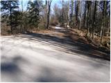
From the parking lot, continue along the path towards the Sanitary Station Monument. After a few minutes, the wide path leads to a crossroads, where you continue straight up the path, which climbs steeply (to the right of the NOB monument). After a few minutes, the steepness eases and the path descends a few times and climbs again. After the last descent, the path leads to a wide cart track, which is followed to the left and after a few steps immediately to the right. The way forward leads to a large parking lot in front of the Pšenk Scout Home (you can also drive here). From the hut, continue along the path, which crosses a small bridge and then climbs up along the stream. The path then passes a spring and leads us a little further on to a forest road, which we follow to the right. The road leads us on past another small crossroads, where we continue straight ahead. Just a little further on, we leave the road as the poorly marked path heads upwards to the left. After a few minutes, we rejoin the road, which we then follow to the hut at Hleviška mountain pasture. From the hut, continue along the path towards the summit. After a 10-minute climb through the forest, the path leads us to a scenic peak.

Pictures:
 1
1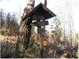 2
2 3
3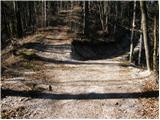 4
4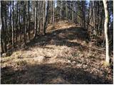 5
5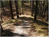 6
6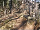 7
7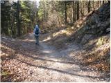 8
8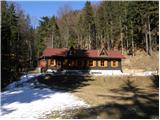 9
9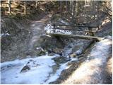 10
10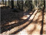 11
11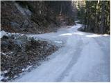 12
12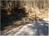 13
13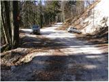 14
14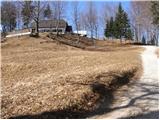 15
15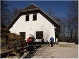 16
16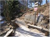 17
17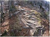 18
18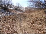 19
19 20
20
Discussion about the trail Pri Babi - Hleviška planina
|
| main27. 04. 2011 |
Pred taborniškim domom je iz te smeri popolnoma neoznačeno križišče. Graja PD-ju.
|
|
|
|
| miri27. 04. 2011 |
Samo v vednost.Lphttp://www.planinsko-drustvo-idrija.si/Mackova_pot.htm
|
|
|
|
| main29. 04. 2011 |
Sem pregledal stran PZS in PD Idrija in ta pot ni nikjer opisana in zanjo noben ne skrbi. Ne pozabite opisa poti s te strani če greste peš. Sploh če vam ti kraji niso domači, se je boljše peljati z avtom skoraj do koče in potem cca.200m peš.
|
|
|
|
| miri29. 04. 2011 |
http://www.planinsko-drustvo-idrija.si/ Na prvi strani PD Idrija je pod naslovom Mačkova pot,obrazložitev,zakaj PD te poti ne vzdržuje.Poti na Hleviško planino je namreč preveč,da bi jih vse markirali .Lp in se vidimo na Hleviški planini.
|
|
|
|
| Ajda_Zitnik1. 01. 2012 |
Včeraj sem prehodila to pot, pa moram reči, da čeprav ni označena, ji ni zelo težko slediti, res pa je da so bile sploh malo višje zgoraj v pomoč stopinje v snegu. Pot je lepa, je pa sploh od koče do vrha potrebna pazljivost zaradi rahlo poledenele poti.
|
|
|