Škofja Loka - Vrh soteske (Križna gora)
Starting point: Škofja Loka (364 m)
| Lat/Lon: | 46,173°N 14,2951°E |
| |
Time of walking: 1 h 25 min
Difficulty: easy unmarked way
Altitude difference: 371 m
Altitude difference po putu: 380 m
Map: Škofjeloško in Cerkljansko hribovje 1:50.000
Recommended equipment (summer):
Recommended equipment (winter): crampons
Views: 1.680
 | 2 people like this post |
Access to the starting point:
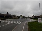
a) From Gorenje vas, Ljubljana or Kranj, drive to Škofja Loka, then continue to Železniki. At the end of Škofja Loka, more precisely at the village of Podlubnik, you will come to a crossroads where the road to Trnje turns off to the right. Park in one of the nearby car parks; only residents are allowed to park in the tower blocks, and you can park in front of the Mercator shop when it is closed.
b) Drive to Železniki, then continue driving towards Škofja Loka. At the beginning of Škofja Loka, at the village of Podlubnik, you will come to a crossroads where the road to Trnjo turns off to the left. Park in one of the nearby car parks; only residents are allowed to park in the tower blocks, and you can park in front of the Mercator shop when it is closed.
Path description:
From the main road, we continue towards Trnje and through it, following a slightly narrower asphalt road. After a few minutes, the road splits into two, and we continue slightly to the right, on the one that descends slightly. A little further on, we reach a marked crossroads, where the mountain signs for Križna gora direct us left to cart track, which continues along the Virlog brook. We continue to climb for a few minutes on a small grassy valley, then cross a small stream and start to climb steeply through the forest. After about 15 minutes of climbing, the path will lay down and lead to the hamlet of Cavrn, where you will step out onto an asphalt road. The road first leads past a few houses, then turns right at a cross. At the cross, i. e. at the point where the road turns right, continue straight on to cart track, which takes you up to the nearby woods, with fine views. In the forest, cart track splits into two parts, we choose the slightly left marked one, which only a little higher starts to climb crosswise to the right. During the crossing, a beautiful view opens up towards the Church of the Holy Cross on Križná hora and the Kamink Savinja Alps.
The path quickly returns to the forest, ending in front of a small pass where the path splits again.
If you continue to the right, you will reach the Church of St. Križ in a minute, and we continue to the left to the nearby hunting lodge, which is open on Saturdays, Sundays and public holidays.
After the hunting lodge, follow the wide cart track, which continues southwards. At the crossroads, follow the wider cart track, and when the cart track drops slightly, continue to the right, on a beaten track, which ascends to a wooded summit in 5 minutes at a moderate ascent.
Škofja Loka - hunting lodge 1:10, hunting lodge - Vrh soteske 0:15.
Description and pictures refer to the situation in 2019 (April).

Pictures:
 1
1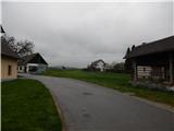 2
2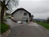 3
3 4
4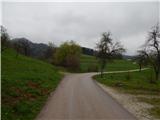 5
5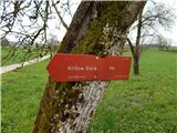 6
6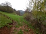 7
7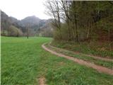 8
8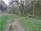 9
9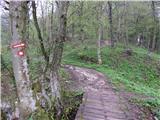 10
10 11
11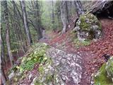 12
12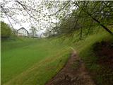 13
13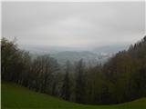 14
14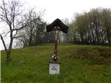 15
15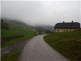 16
16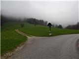 17
17 18
18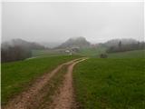 19
19 20
20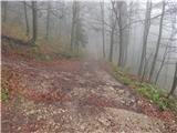 21
21 22
22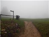 23
23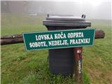 24
24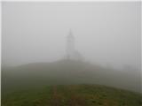 25
25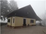 26
26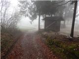 27
27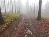 28
28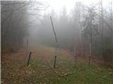 29
29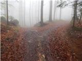 30
30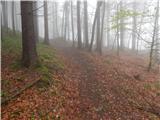 31
31 32
32 33
33 34
34 35
35
Discussion about the trail Škofja Loka - Vrh soteske (Križna gora)