Ledinica - Planinska koča Mrzl'k (via Jarčja Dolina)
Starting point: Ledinica (484 m)
| Lat/Lon: | 46,0552°N 14,0993°E |
| |
Name of path: via Jarčja Dolina
Time of walking: 1 h 45 min
Difficulty: easy marked way
Altitude difference: 487 m
Altitude difference po putu: 540 m
Map: Škofjeloško in Cerkljansko hribovje 1:50.000
Recommended equipment (summer):
Recommended equipment (winter): ice axe, crampons
Views: 954
 | 1 person likes this post |
Access to the starting point:
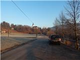
a) First drive to Škofja Loka, then continue to Gorenjska vas and Žire. At the beginning of Žiri, you will see signs for Ledinica, which will direct you to the right onto the local road, which starts to descend moderately. The road then lays down and leads to a bridge over the Poljanska Sora river. After the bridge, turn right and park in the parking lot.
b) From the motorway Ljubljana - Koper take the exit Logatec, then continue driving in the direction of Rovt and Žiri. Continue driving along the rather winding road, which you follow until you reach Žiri, and here in the centre of the town you will see signs for Ledinica, which will direct you to the left. Continue through the industrial zone and then you will reach a bridge over the Poljanska Sora river. After the bridge, turn right and park in the parking lot.
Path description:
From the parking lot, continue along the macadam road that continues along the left bank of the Poljanska Sora River, along which you will see signs. At first we walk without any change in altitude, but as we approach the hill where the Church of St Anne stands, the mountain signs for Mrzli vrh and the Mrzlk Mountain Hut direct us to the left, across the meadow, and when we reach the forest, the path begins to climb, turns right at the wooden sign and quickly climbs to the Church of St Anne.
Go around the church on the left, and from the nearby crossroads continue along the path on the left in the direction of Mrzlega vrh (right Selo). The way ahead takes you along a narrow macadam road, where you pass individual houses, and at the nearby crossroads go right uphill. The road then turns right after the last house and descends over a small precipice on the cart track.
After some 10 steps downhill, the marked path to Mrzli vrh branches off to the left, and we continue along cart track, which descends gently. A little further on, we arrive in a small valley, and the path begins to climb steeply across the meadow. A little higher up, you reach a dirt road, which ascends to a small pass, from which you continue straight ahead and start to descend crosswise to the right. When you reach the asphalt road at a lower level, follow it to the left (marked differently on some maps), and follow it past a few houses to the Svetle homestead, where the asphalt road turns sharp right and we continue straight on to the dirt road that continues along the valley. At the abandoned Lukač homestead, turn right and continue climbing along cart track, which climbs out of the valley crosswise, slowly turning slightly to the left. When you reach the edge of the forest, the path turns left (here the path shown on some maps joins from the right) and continues for some time to climb cross-country along the edge of the hay meadow. Higher up, the path transitions into the woods and becomes slightly steeper, and when you leave the woods you follow cart track up to the vicinity of the Nožina homestead, where the path turns left. We continue for a short time without any change in altitude, and then the signs direct us to the right, where we start to climb steeply through the forest. The forest soon ends, and we follow the beaten track, which leads us to increasingly beautiful views of the surrounding hills. Higher up, at the bench, we reach an undistinguished grassy ridge, where the path turns slightly right once more, and when we reach the edge of the forest we go left and within a minute's further walking we reach the Mrzlk mountain hut.
Description and figures refer to January 2020.

Pictures:
 1
1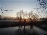 2
2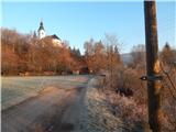 3
3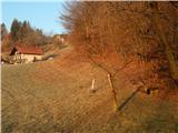 4
4 5
5 6
6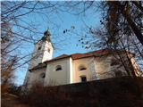 7
7 8
8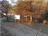 9
9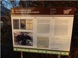 10
10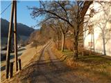 11
11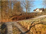 12
12 13
13 14
14 15
15 16
16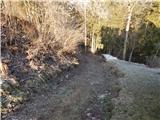 17
17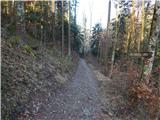 18
18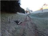 19
19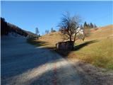 20
20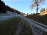 21
21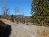 22
22 23
23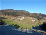 24
24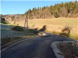 25
25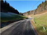 26
26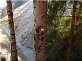 27
27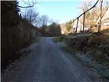 28
28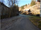 29
29 30
30 31
31 32
32 33
33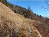 34
34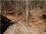 35
35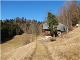 36
36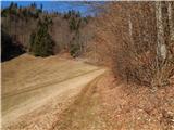 37
37 38
38 39
39 40
40 41
41 42
42 43
43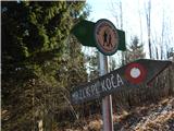 44
44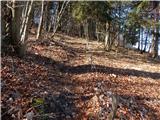 45
45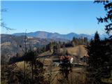 46
46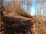 47
47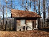 48
48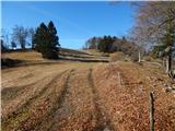 49
49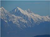 50
50 51
51 52
52 53
53 54
54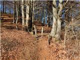 55
55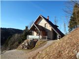 56
56 57
57
Discussion about the trail Ledinica - Planinska koča Mrzl'k (via Jarčja Dolina)