Bohinjsko sedlo - Kačji rob (Ovharn)
Starting point: Bohinjsko sedlo (1277 m)
| Lat/Lon: | 46,2409°N 14,0101°E |
| |
Time of walking: 2 h
Difficulty: easy marked way
Altitude difference: 275 m
Altitude difference po putu: 315 m
Map: Škofjeloško in Cerkljansko hribovje 1:50.000
Recommended equipment (summer):
Recommended equipment (winter): ice axe, crampons
Views: 9.830
 | 1 person likes this post |
Access to the starting point:
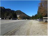
a) From the motorway Ljubljana - Jesenica take the exit Lesce and follow the road towards Bled and on to Bohinjska Bistrica. From Bohinjska Bistrica turn left towards Tolmin and Soriška mountain pasture. Follow this road to a large parking lot near the Soriška ski centre mountain pasture.
b) From Železniki, drive towards Podbrdo or vice versa, but only until you reach the point where the signs for Soriška planina direct you to the ascending road. Follow this road to the large parking lot at the foot of the Soriška ski slope mountain pasture.
Path description:
From the parking lot under the Soriška planina ski centre, continue along the asphalt road towards Železniki and Podbrdo. Soon, i. e. after about 50 m, we will notice signs for Ratitovec on the left side of the road, which direct us to a marked footpath, which initially descends cart track, then turns left and turns into a slightly more difficult to follow path. The path ahead takes you across a larger grassy clearing, crosses lane of woodland beyond, and then leads to another clearing where you step onto a wide cart track. Follow Cart track to the right and walk along it to a nearby road, which is reached just at the bottom of a short tarmac section. Once on the road, first ascend and then gradually start descending towards the Mišji grund pass, where you join the path from Soriška peča.
From here, continue left on the initially steep cart track towards Ratitovec, which gradually turns into a slightly less steep footpath. Higher up, the path becomes even steeper and passes a slightly larger animal watering place on the right. From here on, the forest becomes rarer, so that the path begins to open up increasingly beautiful views of Porezen, Blegoš and other surrounding peaks. The path continues to climb for some time, then crosses over to a more extensive grassy slope, where we step onto a small undistinguished saddle.
Here a "path" branches off to the left to the nearby Žbajnek, which is less than a 5-minute walk away, and we continue straight on along the waymarked path, which turns slightly to the left and then climbs a small ridge.
Once on the ridge, you will see a sign with a stamp pointing to the right towards the top of Kačji rob, which is reached after a minute's further walking.

Pictures:
 1
1 2
2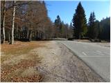 3
3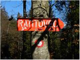 4
4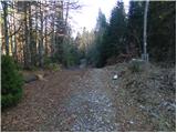 5
5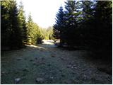 6
6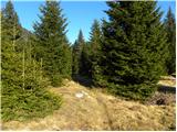 7
7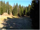 8
8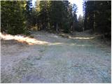 9
9 10
10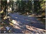 11
11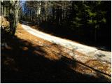 12
12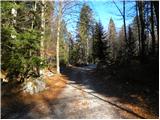 13
13 14
14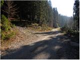 15
15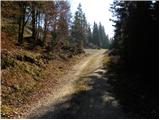 16
16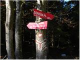 17
17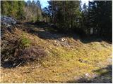 18
18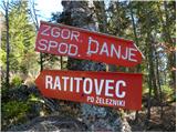 19
19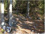 20
20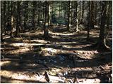 21
21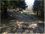 22
22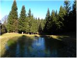 23
23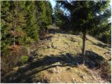 24
24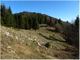 25
25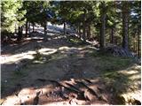 26
26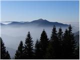 27
27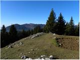 28
28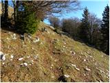 29
29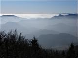 30
30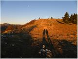 31
31 32
32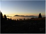 33
33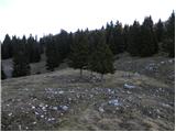 34
34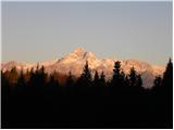 35
35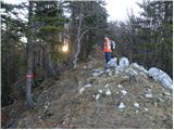 36
36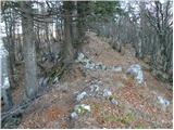 37
37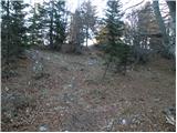 38
38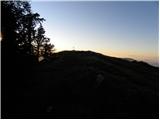 39
39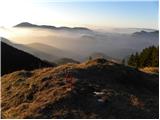 40
40 41
41
Discussion about the trail Bohinjsko sedlo - Kačji rob (Ovharn)
|
| natasja1. 04. 2017 |
Lepa pot, ampak markirana pa ni najbolje. Ponekod markacije manjkajo, ponekod so zbledele, ponekod jih težko najdeš. Še posebej to pride do izraza v snegu, ko so markacije pod njim.
|
|
|
|
| AndrejK27. 07. 2019 |
Markacije so obnovljene in ni nobenih težav.
|
|
|
|
| Loerst2. 10. 2022 21:14:45 |
Sicer res ni bistveno, toda prava višina vrha, izmerjena z lidar (laserska topografija) je 1552 m, ne 1520 m, kot je napisano tu, niti 1575 m, kot je na OpenTopo karti, niti kaj četrtega.
To je zelo očitno tudi na licu mesta, da je Kačji rob višji od sosednjega Žbajneka (1538 m).
Višinskih napak na kartah je sicer vse polno in za par metrov gor ali dol se niti ne bi oglašal, no, 32 m je pa vendarle kar precej.
|
|
|
|
| ločanka3. 10. 2022 05:07:19 |
Tudi ime se je spremenilo. Sedaj je na vrhu tabla Ovharn, 1504 m.
|
|
|
|
| keti114. 01. 2024 09:06:32 |
Zanima me, če je ta pot pozimi obicajno shojena?
|
|
|
|
| georgia14. 01. 2024 11:55:47 |
Je, če jo shodijo  Pametno počakat kar nekaj dni po sneženju, da bo bolj ziher. Prvi so ponavadi turni smučarji. Sva midva enkrat pošteno gazila proti Erblcu (začetek poti isti kot proti Ratitovcu) ... Priporočam začetek s Soriške peči (lovska koča), ki je par ovinkov pred Soriško pl, ob cesti so P in smerne table, je dosti bližje. Se pa kmalu obe poti združita.
|
|
|
|
| keti115. 01. 2024 10:25:13 |
Hvala za informacije in nasvet 
|
|
|